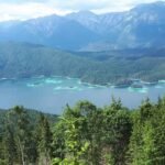
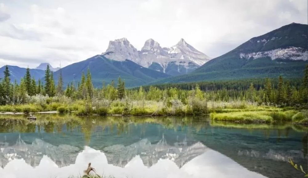
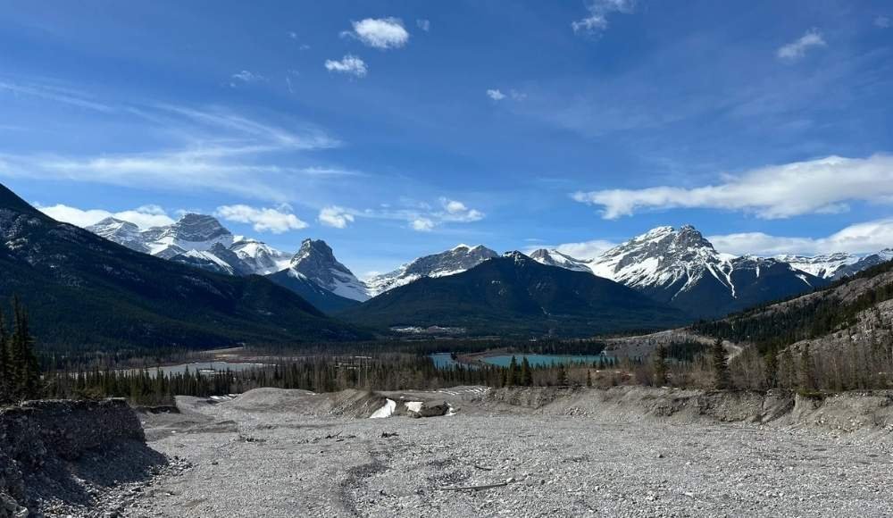
Canmore, just outside of Banff National Park, is one of the most underrated hiking towns in North America. This town is surrounded by peaks on every side. The town sits at the foot of Mount Rundle and the Three Sisters, with the Bow River curving through it and over 70 km of pathways linking neighbourhoods, parks, and trailheads. Step outside almost anywhere in town and you're within walking or driving distance of a trail — from flat riverside boardwalks to lung-busting scrambles up 2,400-metre summits.
Best of all, Canmore's trails are usually less crowded than Banff's, often cheaper to reach (no national park pass required for most), and arguably just as scenic. For a lot of hikers, Canmore is the smarter base for a Rocky Mountain trip — and the trails here can quietly take over your whole vacation if you let them.
This guide covers 15 of the best hiking trails in Canmore, sorted from easy to hard, so you can pick what fits your fitness, your time, and your travel style. Each one includes distance, elevation, difficulty, time estimate, and an honest take on what to expect. By the end, you'll know exactly which hike to do tomorrow morning.
Let's get into it.
A Few Things to Know Before You Hit the Trails
A few quick things to keep in mind before any hike in Canmore.
You'll need a Kananaskis Conservation Pass for many trails. Most of the popular hikes around Canmore (Grassi Lakes, Ha Ling Peak, East End of Rundle, Grotto Canyon, and others) require a Kananaskis Conservation Pass. It's $15 per vehicle per day or $90 for an annual pass, separate from a Banff National Park pass. Buy online at conservationpass.alberta.ca before you go.
Bring bear spray. Bears regularly walk through Canmore neighbourhoods and along most trails outside town. You can buy bear spray at Canadian Tire or Valhalla Pure Outfitters in Canmore. Learning how to use it takes about two minutes.
Mountain weather changes fast. Even on a sunny morning, pack a light waterproof jacket and a warm layer. Snow can fall above the tree line in any month.
Mountain fitness is different from gym fitness. Even strong gym-goers can find their first 800-metre climb humbling. Start with easier hikes and build up.
Set a turnaround time. For bigger hikes, decide before you start what time you'll head down — even if you haven't reached the summit. Getting caught in the dark in bear country is no joke.
Now, the trails.
Easy Hikes in Canmore (Great for Beginners and Families)
These are walks and gentle trails that work for almost any fitness level. Perfect for a quiet morning, an afternoon with kids, or a recovery day after a bigger hike.
1. Bow River Loop
Difficulty: Easy
Distance: 2.1 km
Elevation gain: 64 metres
Time: 20–50 minutes
Pass required: None
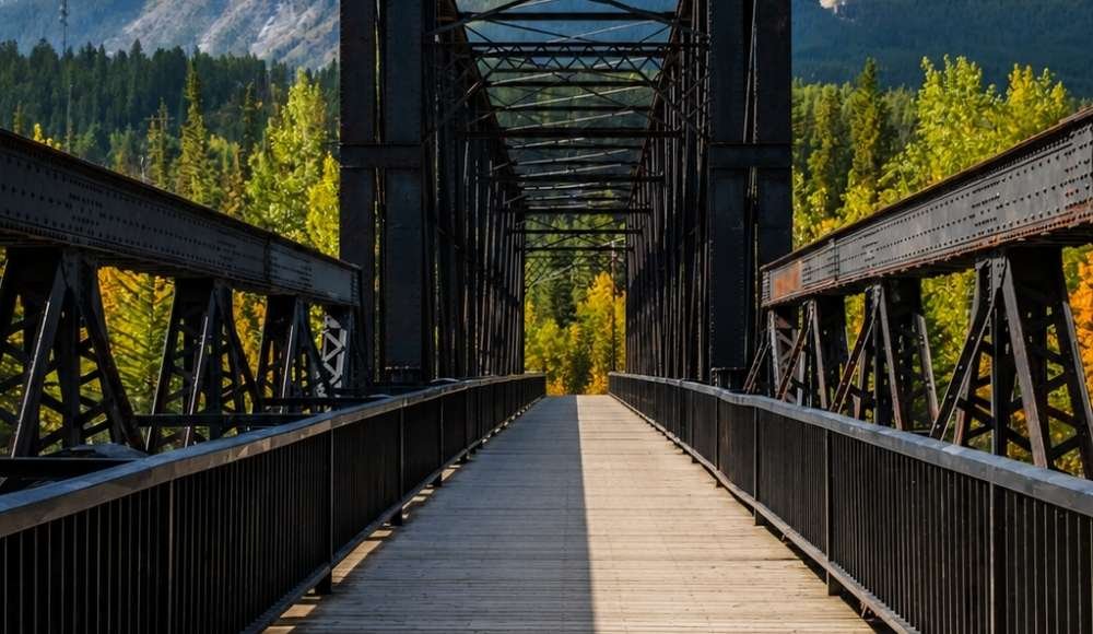
If you're staying in downtown Canmore and want a quick taste of the area's natural beauty, the Bow River Loop is the perfect starting point. The flat gravel path winds along both sides of the Bow River and crosses two pedestrian bridges — one at the end of 8th Avenue with sweeping views of the Three Sisters, and the historic Engine Bridge, a former railway bridge that recently made an appearance in the TV series The Last of Us.
It's the kind of walk you can do with a coffee in hand, push a stroller along, or use to clear your head between bigger adventures. Pair it with a stop at a downtown café before or after.
While you're in the area: Combine the loop with Policeman's Creek Boardwalk for a longer urban-nature stroll through downtown.
2. Policeman's Creek Boardwalk
Difficulty: Easy
Distance: 4.2 km return
Elevation gain: 84 metres
Time: 1–1.5 hr
Pass required: None
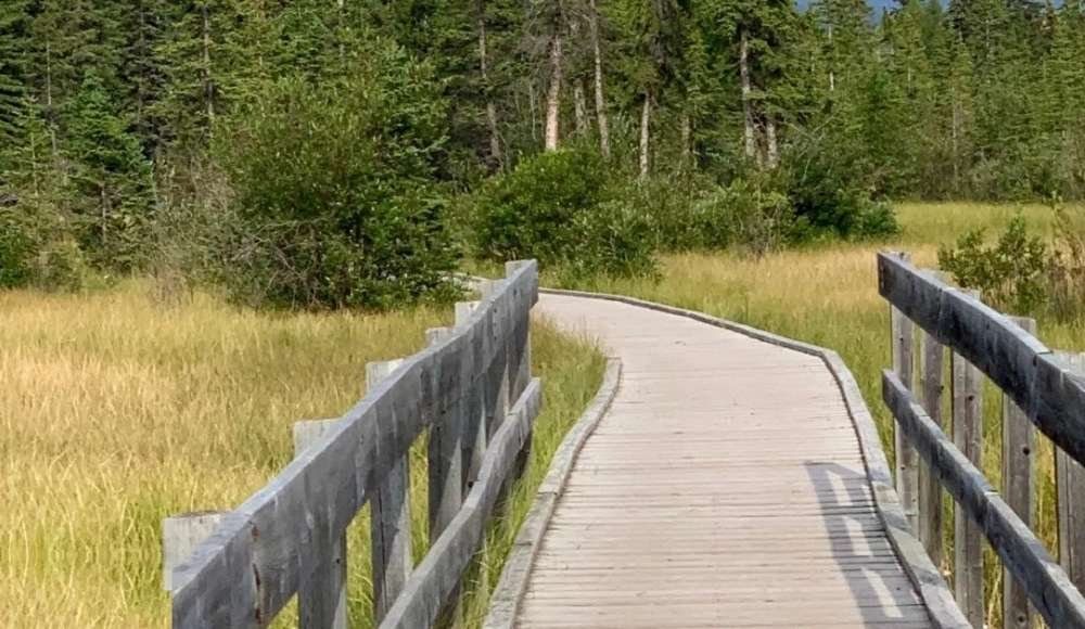
A raised wooden boardwalk runs through marshy wetlands along Policeman's Creek, a small offshoot of the Bow River. It's one of the most peaceful walks in downtown Canmore and an excellent spot for birding — you'll often see ducks, songbirds, and the occasional muskrat.
The most popular section runs from the Big Head sculpture on Main Street down to the Spring Creek neighbourhood. The walk is accessible year-round, and it's especially charming around the holidays when downtown Canmore lights up.
Ready to Explore Canmore?
From cozy mountain lodges to riverside hotels, find the perfect base for your Canmore hiking adventure. Rooms near the best trailheads book up fast in summer and fall — lock in your stay before peak season fills up.
Book Your Canmore Stay →3. Three Sisters Viewpoint
Difficulty: Easy
Distance: 1 km
Elevation gain: 22 metres
Time: 30–60 minutes
Pass required: None
The shortest "hike" on this list — but the reward is the iconic Three Sisters photo. Park at the off-leash dog park on Bow Valley Trail near the helipad, cross under the train tracks, and follow the short path to the viewpoint. Five minutes later, you're standing in front of one of the most photographed mountain views in the Canadian Rockies.
It's a top spot at sunrise or sunset for photographers. Combine with a longer walk along the Rundle Forebay Reservoir if you want to extend the outing.
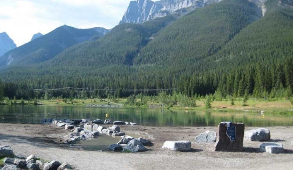
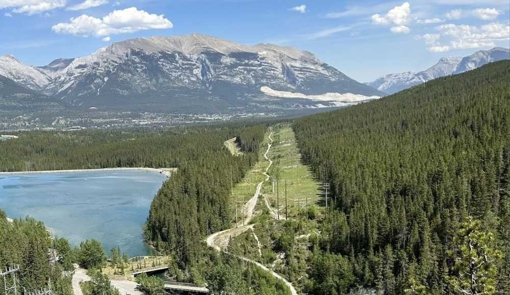
4. Quarry Lake
Difficulty: Easy
Distance: 3 km loop
Elevation gain: 52 metres
Time: 30 minutes – 1 hour
Pass required: No, but paid parking is in effect
Quarry Lake is a former mine site that's been revitalized into one of the most beloved local hangouts in Canmore. The lake itself is small and circled by a gentle gravel path that's perfect for an easy walk. In summer, it's a popular swimming spot, and the neighbouring off-leash dog park is one of the best in town.
Parking is paid (use the registration kiosk or pay by app), and it fills up fast on summer weekends. Arriving early or in the late afternoon is smart.
While you're in the area: From Quarry Lake, you can join the Highline Trail or the Powerline Trail that connects to the Rundle Forebay Reservoir for a much longer walk.
5. Upper Grassi Lakes
Difficulty: Easy to moderate
Distance: 3.5 km return
Elevation gain: 148 metres
Time: 1–2 hours
Pass required: Yes (Kananaskis Conservation Pass)
If you only have time for one easy-moderate hike in Canmore, make it Grassi Lakes. The trail climbs gently through forest before reaching two stunning emerald-green lakes fed by underground springs. The colour of the water in summer is genuinely surprising — almost tropical.
There are two trail options: an easy path that's family-friendly year-round, and a harder path with stairs and steeper sections that closes in winter due to ice. Both lead to the same lakes. Swimming isn't allowed (the lakes are a protected water source), but a picnic at the upper lake is one of the most rewarding ways to spend an hour in Canmore.
While you're in the area: Grassi Lakes is right at the start of Spray Lakes Road — easy to combine with a drive along the road to the Goat Pond viewpoint or a stop at the Canmore Nordic Centre.
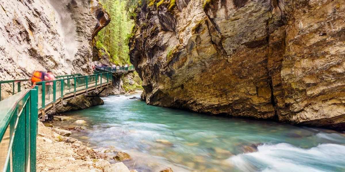
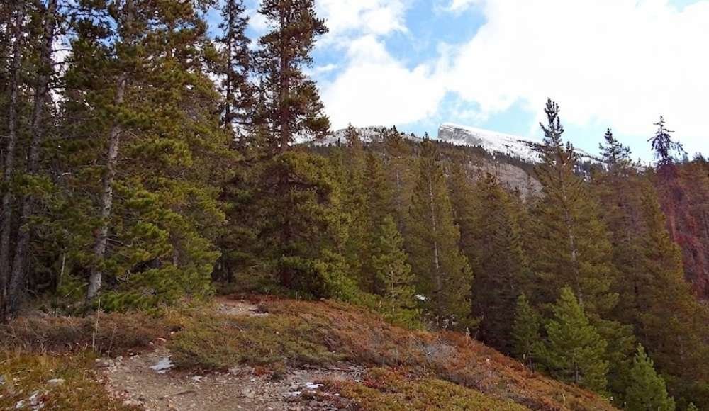
6. Grotto Canyon Trail
Difficulty: Easy
Distance: 7.4 km return
Elevation gain: 403 metres
Time: 2–3 hours
Pass required: Yes (Kananaskis Conservation Pass)
Grotto Canyon trail is a unique year-round hike that takes you through a narrow limestone slot canyon. In summer, the trail follows a dry creek bed flanked by towering rock walls — keep an eye out for ancient Indigenous rock art on the canyon walls. In winter, the creek freezes solid, and the canyon becomes one of the most popular ice walks in the Canadian Rockies, where you might even spot ice climbers scaling frozen waterfalls.
Microspikes are essential in winter — the ice can be treacherous without them. Doable any time of year, but visit in the shoulder seasons for the quietest experience.
Moderate Hikes in Canmore (For Hikers Ready for a Real Climb)
These hikes involve significant elevation gain and longer time on the trail. They're not for beginners, but most hikers in decent shape can handle them with proper preparation.
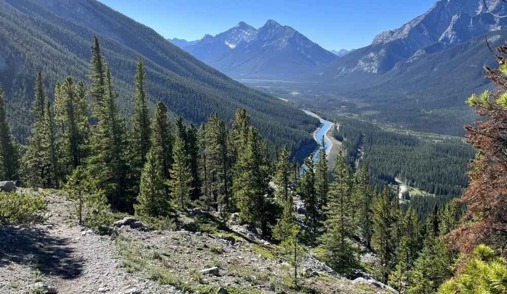
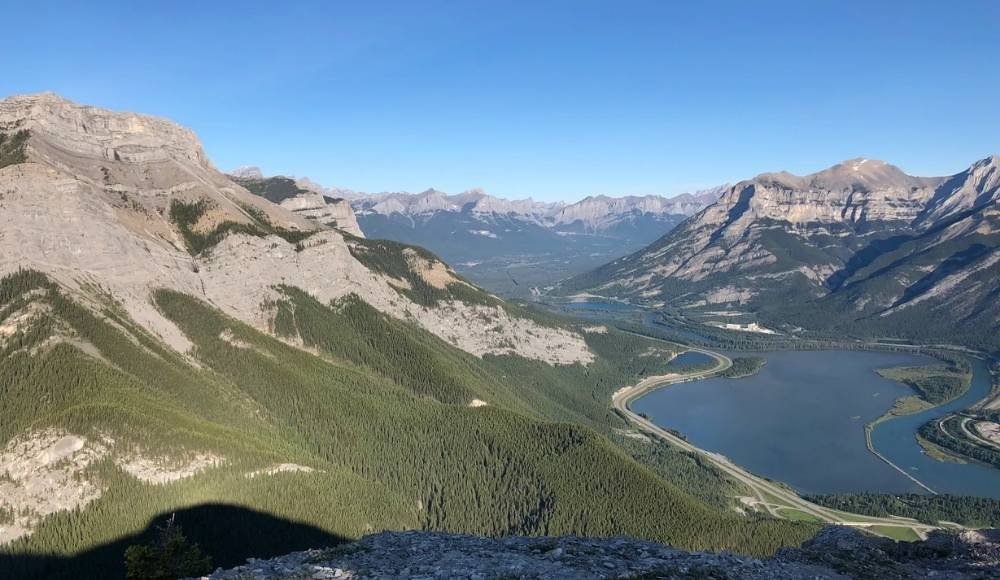
7. Ha Ling Peak
Difficulty: Moderate
Distance: 7.9 km return
Elevation gain: 793 metres
Time: 3–5 hours
Pass required: Yes (Kananaskis Conservation Pass)
The peak you see towering above downtown Canmore is Ha Ling Peak, and it's the most popular climb in town. Almost every local has done it. The trail was completely rebuilt in 2019 with new steps, handrails, and switchbacks, making the route safer and more accessible than it used to be.
The hike is genuinely tough — you'll gain nearly 800 metres of elevation in under 4 km — but the trail is well marked, and the summit views are spectacular. From the top, you'll see down into the Goat Valley and across the Spray Valley to Banff National Park beyond.
Best done early morning. Sunrise hikers reach the summit just as the first light hits the Bow Valley below.
While you're in the area: The trailhead is on Goat Creek Road off Spray Lakes Road, sharing parking with East End of Rundle. Many hikers actually combine the two on a long day.
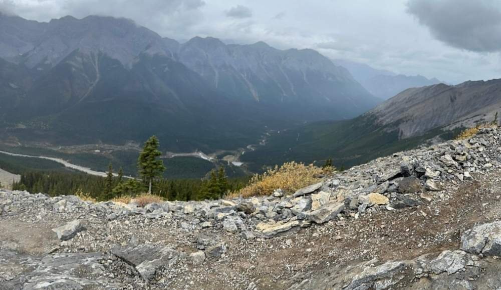
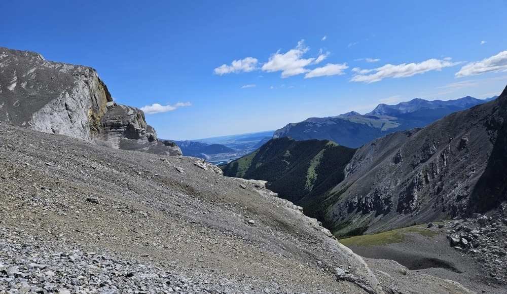
8. East End of Rundle (EEOR)
Difficulty: Moderate to difficult
Distance: 5.5 km return
Elevation gain: 826 metres
Time: 3–6 hours
Pass required: Yes (Kananaskis Conservation Pass)
Locals call it "Eeyore", but make no mistake — this hike is no soft donkey. The East End of Rundle delivers one of the best reward-to-effort ratios in Canmore: a relatively short trail with enormous elevation gain, ending in a panoramic view of the entire Bow Valley.
The final push to the true summit involves a short scramble up a cliff band, which scares off many hikers. You can stop at the lower viewpoint just below and still feel like you've earned the day. Both options are excellent.
Pack water, snacks, and a celebratory drink for the summit — there's a tradition of signing the summit registry up top.
9. Lady Macdonald Teahouse
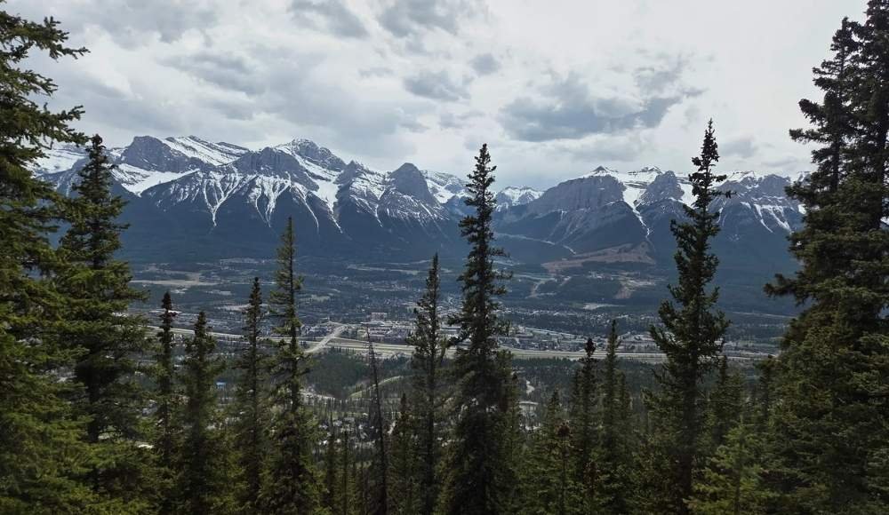
Difficulty: Moderate
Distance: 9.7 km return
Elevation gain: 1,200 metres
Time: 3–5 hours
Pass required: No (but check current trail status)
Mount Lady Macdonald rises directly above downtown Canmore, and the hike to its "teahouse" — actually the abandoned platform of a teahouse that was never built — is one of the most popular workouts among locals. The hike sits mostly in forest with occasional viewpoints, ending at a wide open platform that offers sweeping views over Canmore and toward the Three Sisters.
Important note: The trail has been subject to closures in recent years for safety upgrades. Always check the current Alberta Parks trail reports before going. The push from the teahouse to the true summit requires exposed scrambling on a narrow ridge — best left to experienced hikers.
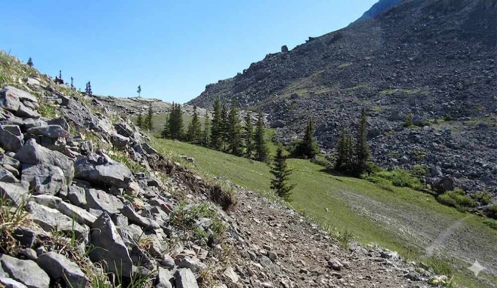
10. Wind Ridge
Difficulty: Moderate
Distance: 13.4 km return
Elevation gain: 928 metres
Time: 4–6 hours
Pass required: Yes (Kananaskis Conservation Pass)
A scenic ridge hike with massive views of Mount Lougheed, Wind Tower, and the back side of the Three Sisters. The trail starts gently in the forest before opening into alpine meadows and a steep, exposed ridge climb. There's a brief scramble section near the top that's easy to bypass if heights aren't your thing.
True to its name, bring a windproof jacket — the ridge gets gusty even on calm valley days. The trail is closed seasonally from December 1 to June 15 to protect wildlife, so plan around the open window.
11. Read's Tower Hiking Trail
Difficulty: Moderate
Distance: 10.5 km return
Elevation gain: 843 metres
Time: 3–5 hours
Pass required: Yes (Kananaskis Conservation Pass)
A quieter alternative to Ha Ling and EEOR. Read's Tower climbs steadily up Mount Sparrowhawk's western shoulder, ending with sweeping views over Spray Lakes Reservoir and the surrounding peaks. The trail is steep almost from the start, with a brutal scree section near the top that becomes a fast, fun "scree run" on the way down.
For hikers who want a real climb without the crowds of Ha Ling, this is the smart pick. Strong hikers can extend the day by continuing up Mount Sparrowhawk from Read's Tower.
Difficult Hikes and Scrambles in Canmore
These trails involve significant climbing, exposed terrain, and often some scrambling. They're suited to experienced hikers who are comfortable with their fitness and surroundings.
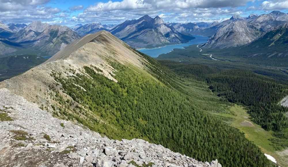
12. Tent Ridge Horseshoe Trail
Difficulty: Moderate to hard
Distance: 10.6 km loop
Elevation gain: 750 metres
Time: 3.5–6 hours
Pass required: Yes (Kananaskis Conservation Pass)
A genuine bucket-list hike for many Alberta hikers. Tent Ridge is a horseshoe-shaped ridge near Mount Engadine that delivers 360-degree views of the surrounding mountains, with wildflowers in summer and golden larches in fall making the experience even more spectacular.
The loop involves one short scramble section that's slightly exposed but manageable for most hikers. Doing the loop clockwise is recommended — most experienced hikers feel safer scrambling up than down. Plan around weather and ridge conditions, since exposed alpine terrain can be dangerous in storms.
This is the furthest hike on this list from Canmore (about an hour's drive south on Spray Lakes Road), but it's universally considered worth the trip.
Canmore or Banff? Which One Is Right for You?
Both sit at the doorstep of the Canadian Rockies, but they offer very different experiences. One is quieter, more local, and easier on the wallet — the other has the iconic name, the bigger crowds, and the postcard views. See how they stack up on hiking, cost, vibe, and what to do.
Read the Full Comparison →13. Windtower
Difficulty: Moderate to hard
Distance: 10.1 km return
Elevation gain: 919 metres
Time: 4–6 hours
Pass required: Yes (Kananaskis Conservation Pass)
A hike with a sense of progression — first you reach West Wind Pass (a perfectly fine stopping point for many hikers), then continue up another steep, lightly scrambled section to the actual Windtower summit. The view from the top stretches across Spray Lakes and back toward Canmore.
For hikers who want a flexible day, this is ideal: you can call it at West Wind Pass for a moderate hike, or push on to Windtower for a serious summit experience.
14. Heart Mountain Horseshoe
Difficulty: Difficult (easy scramble)
Distance: 10.8 km loop
Elevation gain: 942 metres
Time: 4–7 hours
Pass required: No (but trailhead parking can be limited)
A perfect "first scramble" for hikers ready to push past simple trails. Heart Mountain is shaped like — you guessed it — a heart, and it's clearly visible from Highway 1. The horseshoe loop takes you up one side, along a long, beautiful ridge with multiple sub-peaks, and back down the other side.
The scrambling here is genuinely fun, with excellent rock quality that makes the climbing feel secure rather than scary. It's one of the best transition hikes from regular hiking to mountain scrambling in the Canadian Rockies.
While you're in the area: Heart Mountain is right at Lac des Arcs, about 10 minutes east of Canmore. Easy to combine with a swim or picnic at the lake on a warm day.
15. Middle Sister
Difficulty: Difficult
Distance: 16.6 km return
Elevation gain: 1,489 metres
Time: 6–10 hours
Pass required: No (but extremely long day)
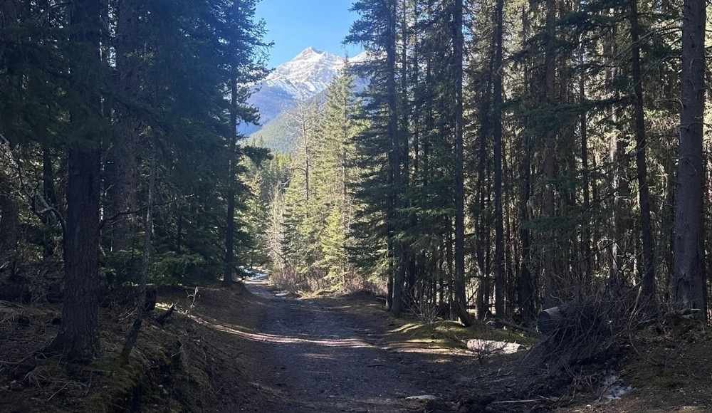
The most ambitious hike on this list — and the only one of the famous Three Sisters peaks that's accessible from Canmore by a non-technical route. Middle Sister starts at the end of Three Sisters Mountain Village and follows Stewart Creek up through forest, then enters a brutal scree slope for the final summit push.
This is a long, demanding day. The reward isn't a teahouse or panoramic platform — it's the personal achievement of standing on top of one of Canmore's most iconic peaks. For experienced hikers only, with very early starts and a careful eye on the weather.
How to Pick the Right Hike for You
With 15 options, here's how to narrow it down:
You're new to mountain hiking. Start with Grassi Lakes or Quarry Lake. Both are easy, beautiful, and won't crush your spirit.
You want a downtown stroll with a coffee. Bow River Loop and Policeman's Creek Boardwalk are made for this.
You want a real workout but want to be safe. Ha Ling Peak is the classic. Steep but well-trodden.
You want a "wow" view without the crowds. Read's Tower or Tent Ridge are quieter alternatives to the more famous hikes.
You want a true mountain summit. East End of Rundle, Windtower, or Middle Sister.
You want your first scramble. Heart Mountain Horseshoe is the perfect transition hike.
You're visiting in winter. Grotto Canyon for the ice walk, Three Sisters Viewpoint for photos, and the Policeman's Creek Boardwalk for an easy walk in the snow.
If you're staying for several days, mix it up. Do one easy day, one moderate day, one harder day. Your body (and mood) will thank you.
A Suggested 3-Day Hiking Itinerary Based in Canmore
If you've got a long weekend, this is one of the most rewarding hiking trips you can do in the Canadian Rockies.
Day 1 — Easy day: Walk the Bow River Loop in the morning, drive up to Grassi Lakes for a relaxed afternoon hike, finish with dinner in downtown Canmore.
Day 2 — Moderate day: Ha Ling Peak at sunrise, lunch in town, easy afternoon walk around Quarry Lake to recover.
Day 3 — Bucket-list day: Drive to Tent Ridge for the full loop, finish with a beer at a local Canmore brewery to celebrate.
By the end of three days, you'll have stood on a summit, walked a glacier-shaped ridge, and seen Canmore from every angle that matters. Most Banff visitors never get to do this.
And if you're combining your Canmore trip with Banff, check my top 12 hikes in Banff guide, which will walk through the best trails in the national park.
Practical Tips for Hiking in Canmore
A few last pieces of advice that will save you time and frustration.
Start early. Parking at popular trailheads (Ha Ling, EEOR, Grassi Lakes, Quarry Lake) fills up by 8–9 AM in summer. Get there before then for a stress-free start.
Buy passes online. Kananaskis Conservation Passes are easier to buy online than at the trailhead.
Download offline maps. Cell service drops off quickly outside town. AllTrails Pro and offline Google Maps are your friend.
Pack the 10 essentials. Water, food, headlamp, layers, first-aid kit, navigation, fire starter, sun protection, knife, emergency shelter, especially on the bigger hikes.
Use trekking poles. Steep descents on shale and scree are much easier with poles. Rent them at Valhalla Pure if you don't have your own.
Respect wildlife closures. Trails like Wind Ridge close seasonally to protect wildlife. Don't try to sneak in — fines are significant, and the closures matter.
Pack out everything. Canmore's trails are kept beautiful because people respect them. Even orange peels and apple cores take months to decompose. Take it all home.
Final Thoughts: Hiking Trails in Canmore, Alberta
After all the famous Banff trails and tourist-heavy Lake Louise hikes, many travellers eventually discover that Canmore is where the locals actually hike — and for good reason. The trails are just as scenic, the crowds are thinner, the parking is better, and the town itself feels more relaxed at the end of the day.
Whether you've got one easy morning or a full week of climbing, there's a Canmore trail with your name on it. Start small. Build up. Take your time. Stop for views. The mountains will reward every level of effort you put in.
For more first-timer guides, hidden gems, and honest local advice from across the province, keep exploring AlbertaTourist.com. We're here to help you discover the best of Alberta — including the trails most travellers never find.
Frequently Asked Questions
What is the best hike in Canmore for beginners?
Grassi Lakes is the most rewarding easy hike — beautiful emerald lakes at the top, gentle elevation, and well-marked trails. Quarry Lake and the Bow River Loop are even easier and perfect for families or recovery days.
Do you need a pass to hike in Canmore?
Many hikes around Canmore are in Kananaskis Country and require a Kananaskis Conservation Pass ($15/day or $90/year). Hikes that need it include Grassi Lakes, Ha Ling Peak, East End of Rundle, Wind Ridge, Grotto Canyon, Tent Ridge, and others. Hikes inside Canmore town limits (Bow River Loop, Policeman's Creek, Quarry Lake) don't require any pass.
What's the hardest hike in Canmore?
Middle Sister is the most demanding hike on this list — 17 km, over 1,500 metres of elevation, and a brutal scree push to the summit. East End of Rundle, Windtower, and Heart Mountain Horseshoe are also challenging but more popular.
Can you hike in Canmore in winter?
Yes, Grotto Canyon is one of the most popular winter hikes in Alberta thanks to its frozen waterfalls. Three Sisters Viewpoint, Policeman's Creek Boardwalk, and the Bow River Loop are easy year-round walks. Most summit hikes require winter mountaineering gear and experience.
How long is the Ha Ling Peak hike?
Ha Ling Peak is 7.9 km return with 790 metres of elevation gain. Most hikers take 3 to 5 hours round-trip. It's one of the most popular hikes in Canmore for both locals and visitors.
What's the best Canmore hike for fall larches?
Tent Ridge is the best larch hike near Canmore. The yellow larch trees turn brilliant gold for about two weeks in late September. Plan around peak larch season for unforgettable photos.
Is Canmore better for hiking than Banff?
Both are excellent, but Canmore offers more variety, smaller crowds, easier parking, and no national park pass requirement for most trails. Many local hikers consider Canmore the smarter base for a hiking-focused trip.
Do I need bear spray hiking in Canmore?
Yes. Bears live throughout the area and have been spotted in town and on every trail on this list. Carry bear spray on every hike, keep it accessible (not in your pack), and learn how to use it before you go. You can buy it at Canadian Tire or Valhalla Pure Outfitters in Canmore.