North Edmonton is where a large share of the city actually lives. It is not Edmonton's traditional tourist area, but it offers a different side of the city.
There is no strip of historic storefronts like Old Strathcona, no cluster of arenas and galleries like downtown. What you get instead is river valley parks, a strong food scene built around immigrant communities, family recreation centres, plenty of shopping, and fast access to the highways out of town.
That mix makes it a good choice for some travellers, while others may prefer a more central part of Edmonton. I live near Castle Downs in the northwest, and the thing I notice most is how little time I spend fighting traffic.
I can reach a major shopping centre, a river valley park and the Anthony Henday ring road without ever driving through the core. I have lived in two different parts of the north side over the years and have never wanted to move to another quadrant of the city.
This guide covers the best places to visit, where to eat and where to stay in North Edmonton. For the wider picture, start with the ultimate Edmonton travel guide.
Where Is North Edmonton?
North Edmonton is not an official district with fixed borders. Most people use it loosely for everything north of downtown and the river valley: Blatchford and Griesbach in the middle, Castle Downs and Northgate to the northwest, and Londonderry, Clareview, Hermitage and Beverly to the northeast.
For visitors, a few roads matter more than the neighbourhood names:
Road
Why it matters to visitors
97 Street
The main north-south spine. Runs from downtown straight up through the north side and continues toward CFB Edmonton.
137 Avenue
The main east-west commercial strip. Most of the shopping, hotels and restaurants sit on or near it.
Yellowhead Trail (Highway 16)
Cuts across the south edge of the area. Your route west toward Jasper or east toward Elk Island.
Anthony Henday Drive
The ring road along the north edge. Lets you cross the city without touching downtown.
St. Albert Trail
Runs northwest out of the city into St. Albert.
Manning Drive
The northeast route toward Fort Saskatchewan and the industrial Heartland.
The practical takeaway: if your trip includes St. Albert, Fort Saskatchewan or Elk Island National Park, staying here saves you real driving. If your trip is mostly downtown and Old Strathcona, it does not.
Is North Edmonton Worth Visiting?
North Edmonton is not a major tourist destination on its own, but it can be a convenient place to explore and a good base for the right type of visitor.
It suits travellers with a car, families looking for parks, pools and outdoor recreation, people visiting friends and relatives here, anyone heading out of the city on day trips, and anyone who eats well on a budget.
It may not be the best choice if you want to walk to major attractions or want an evening out beyond your hotel lobby. Those visitors should look at the Downtown Edmonton guide instead, or the Edmonton areas guide to compare five parts of the city.
Best Things to Do in North Edmonton
Alberta Aviation Museum
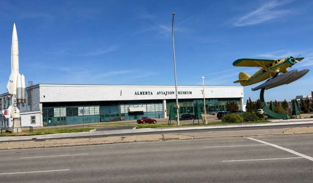
The Alberta Aviation Museum is one of the most interesting attractions in North Edmonton, and the building is half the reason to go. The museum sits in Hangar 14 on the site of the former Edmonton City Centre Airport, now the Blatchford redevelopment.
The hangar is one of the last surviving "double-double" wooden hangars built for the British Commonwealth Air Training Plan during the Second World War, and standing inside it gives you a sense of scale that photos do not.
The collection runs to more than 30 aircraft, from bush planes to military and jet-era machines, with displays on Edmonton's role as the gateway to the North.
Give yourself about an hour and a half, or two if you read every panel or get talking with the volunteers. It works well for older kids and anyone interested in history or machinery, and younger children may run out of patience faster. Check the museum's website for current hours and admission.
Rundle Park
Rundle is the best all-round park on the north side and the one I would send a visitor to first. It sits in the river valley in the northeast, off 118 Avenue, and there is plenty of space even when the park is busy.
In warmer months, you get paved multi-use trails that connect straight into the wider river valley network, an 18-hole disc golf course that is one of the busiest in the city, a short public golf course, beach volleyball, tennis courts, playgrounds and picnic sites, six of which can be booked.
A pedestrian bridge links the park to Gold Bar Park across the river, which makes a good longer walk or ride. The ACT Aquatic and Recreation Centre sits inside the park with an indoor pool and gym, so a wet afternoon does not end the visit.
In winter, the park runs the IceWay, a lit skating trail of roughly two kilometres through the trees, plus a shinny area and toboggan hills. Skating on city ice surfaces is free, and rentals are available on site in season. Check the City of Edmonton's ice surface page first, because a warm spell can close it.
Hermitage Park
Hermitage is quieter than Rundle. It sits further northeast along the river, with natural-surface trails, two large ponds, a big off-leash dog area and a lot of birdlife. American white pelicans turn up here, which surprises people.
The southern pond is stocked with rainbow and brown trout and is free to fish with a valid Alberta licence. Canoes, kayaks and paddleboards are allowed; motors are not. There are picnic tables throughout, and in winter the open ground is used for cross-country skiing.
Hermitage Park is best for visitors who enjoy a quieter outdoor experience. It is a good place to spend an hour or two if you are staying nearby, walking a dog, or looking for somewhere calm to eat lunch outside.
Castle Downs Park
Castle Downs is a community recreation hub rather than a sight. It has one of the largest playgrounds in the city, a free drop-in spray park, a skate park, ball diamonds, sports fields including a cricket pitch, and an outdoor rink and skating oval in winter. The Castle Downs Recreation Centre on site holds an arena and a YMCA.
If you are in the northwest with young kids, this is where you take them for an afternoon. It is mainly worth visiting for families with young children.
Griesbach
Griesbach is worth exploring if you enjoy walking through an attractive Edmonton neighbourhood. It was built on the site of the former CFB Griesbach army base, which Canada Lands Company acquired in 2003 and redeveloped over the following fifteen years.
The result does not look like the rest of north Edmonton. It is laid out around a central park, four small lakes that double as stormwater ponds, walking paths and a community garden, with front porches, back lanes and mature trees kept from the base. Street names and memorials keep the military history visible.
Griesbach is my old neighbourhood, so I am biased. What I would tell a visitor is that it is the one part of north Edmonton where walking is genuinely the point. The paths connect, the lakes break up the sightlines, and you are never far from a bench.
Treat it as a thirty to forty minute stroll with a coffee, not an attraction. There are no formal attractions or visitor facilities, which is part of why I recommend simply enjoying it as a walk.
Parks and Outdoor Activities in North Edmonton
If you only have time for one outdoor stop, here is how I would choose between them.
Young kids: Castle Downs Park. Playground, spray park and washrooms in one place.
Walking or cycling: Rundle Park, then across the footbridge into Gold Bar. The paved trails link straight into Edmonton's river valley network, the largest urban park system in Canada.
Winter: the Rundle IceWay for skating and tobogganing, or Castle Downs for the outdoor rink.
A quiet afternoon, dogs, or fishing: Hermitage Park.
Rundle is the one I keep going back to, in every season. Hermitage I have been to and enjoyed, but it offers a quieter and more relaxed experience, and I would not send someone across the city for it.
Check conditions before you drive out. Trails flood, ice melts, and spray parks shut down. The City of Edmonton posts current status for parks and ice surfaces.
Shopping in North Edmonton
North Edmonton is convenient for shopping without being a major shopping destination. If you are staying on the north side, you will find most of what you need within a short drive, usually with free parking.
The main shopping areas include:
97 Street and 137 Avenue. Northgate Centre is an enclosed mall with more than 70 stores and services, along with many medical offices. North Town Centre sits across the intersection, with big-box stores and a T&T Supermarket for Asian groceries.
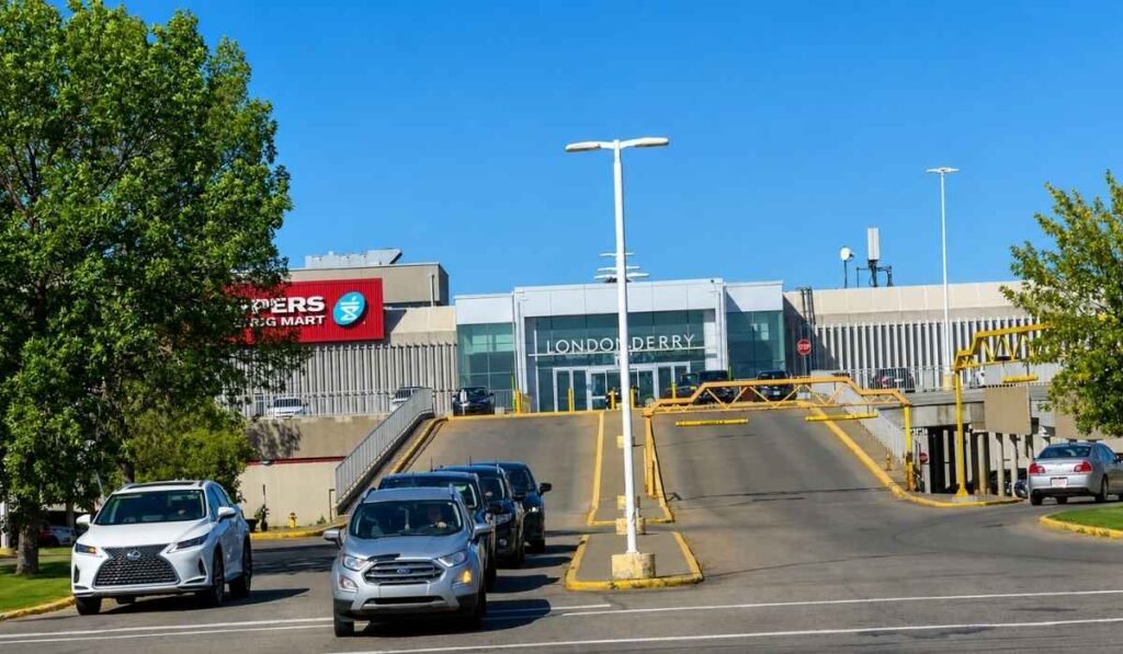
66 Street and 137 Avenue. Londonderry Mall is the largest enclosed mall in the area. It has been recently renovated and includes Simons, Winners, H&M, a grocery store, a library branch and a Service Canada office.
Kingsway area. Kingsway Mall is close to the Alberta Aviation Museum and is a convenient place to shop or grab something to eat before or after visiting the museum. It offers a larger selection of stores and restaurants than most neighbourhood shopping centres.
Northeast Edmonton and St. Albert Trail. Manning Town Centre, Clareview and the shopping areas along St. Albert Trail cover much of the big-box shopping in and around North Edmonton.
Londonderry and Northgate are where I do most of my own shopping, which is probably the most honest measure of them: they are practical places where I can easily find what I need for everyday life. Kingsway Mall is a useful option when I am closer to the Alberta Aviation Museum or the Kingsway area.
Where to Eat in North Edmonton
One of the things I enjoy most about North Edmonton is its diverse food scene. Decades of immigration have filled 97 Street, 137 Avenue, 118 Avenue and the northeast with family-run restaurants that serve excellent food in locations that visitors might easily overlook. Prices are low, portions are large, and most places are family-friendly.
Some starting points:
Middle Eastern. Jerusalem Shawarma on 137 Avenue is one of the busiest shawarma spots in the city. Alhuda Pita Bakery and Abu Nawras, both on 97 Street, do fresh pita, manakish, falafel and grilled plates. Ali Baba Turkish Grill further north on 97 Street is the pick for kebab platters.
Filipino. Edmonton has a large Filipino community and the north side is its centre of gravity. Manila Grill Express on 140 Avenue and Kuya Allan's Lechon Pinoy on 97 Street both do the classics. The Filipino food counters at Northgate Centre are also worth considering for a quick and affordable meal.
Vietnamese. The 118 Avenue corridor, known locally as the Avenue of Nations, is the place to look. Dang Good near 133 Street is a long-standing favourite with an unusually good vegan menu alongside the regular one.
Indian and South Asian. Savoy's South Indian Kitchen in Clareview covers dosa and biryani. Spicebros in Griesbach does Indian street food and stays open late, which is rare on this side of the city.
Coffee and dessert. Mokha Coffee House and Parama Cafe, near Griesbach and 137 Avenue, are Middle Eastern-style cafés that stay open into the night.
If you want something familiar, when I go out for a proper sit-down dinner on the north side, it is usually Earls Kitchen + Bar on 50 Street near 137 Avenue, or the Keg Steakhouse at Skyview on the west end of 137 Avenue. Neither is a local discovery. But both are close to the north-side hotels, both take reservations, and both work when you are travelling with people who want a predictable meal and a table they can sit at for two hours. The Keg is the pricier of the two.
Hours change often at the independent restaurants, and some close on their own schedule rather than a posted one. Call or check before you drive out. For a wider list across the city, see the Edmonton restaurants guide.
Where to Stay in North Edmonton
Most north-side hotels sit near 137 Avenue or along the Yellowhead. Their locations are convenient for travellers driving in and out of the city rather than visitors who want to walk to attractions.
Fairfield by Marriott Inn & Suites Edmonton North, on Griesbach Parade. The best family choice, with a pool and waterslide, beside the 137 Avenue restaurants and shops.
Holiday Inn Express & Suites Edmonton North, at 50 Street and 137 Avenue. Handy if your plans point northeast toward Fort Saskatchewan or Elk Island.
Chateau Nova Yellowhead, on Yellowhead Trail. Good if you are driving west afterward toward Jasper.
Rosslyn Inn & Suites, at 97 Street and 137 Avenue. Older and plainer, but cheap and central.
Rates change constantly, so check pricing directly. Parking is usually free, which is a real difference from downtown.
Staying in North Edmonton involves a few trade-offs. You get easier driving, cheaper rooms and a faster exit toward St. Albert, Fort Saskatchewan and Elk Island National Park.
Getting Around North Edmonton
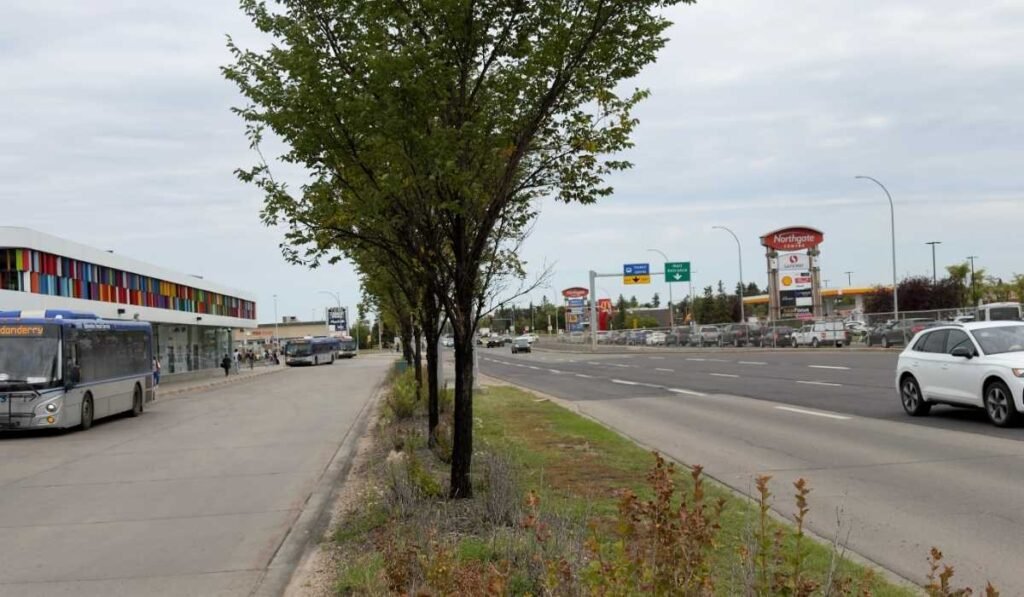
Northgate Centre and Edmonton Transit buses at Northgate Transit Centre on the left.
By car
Having a car makes exploring North Edmonton much easier. Distances are long, and the attractions are spread across roughly fifteen kilometres. Use the roads in the table above, and note that Yellowhead Trail carries heavy truck traffic sometimes, and has been under construction in sections for years.
Parking is free at nearly every park, mall and hotel on the north side.
By public transit
Transit works, but not everywhere equally.
The Capital Line LRT runs from Clareview in the northeast through Belvedere and Coliseum, into downtown and south to Century Park. If you are staying near Clareview, that is a genuine car-free option for reaching downtown. The Metro Line runs northwest from downtown to NAIT/Blatchford Market station, which puts you close to the Alberta Aviation Museum.
Everything else is buses, routed through transit centres at Northgate, Castle Downs, Eaux Claires and Clareview. Service is generally better along the main corridors than in residential areas between them. Getting from a north-side hotel to a north-side park by bus is slower than it looks on the map.
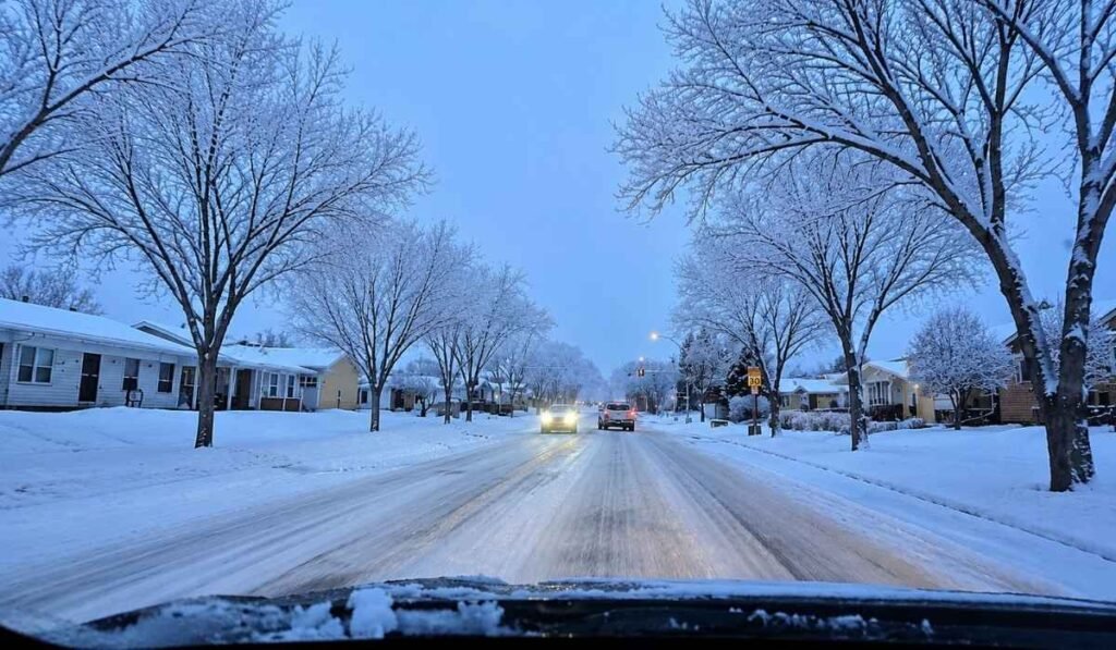
A snowy residential street in North Edmonton during winter. Side streets can remain covered with snow for extended periods during cold weather.
Edmonton winters are long and cold, and locals do not spend them hiding indoors. We plan around the day rather than the season. A minus five day with sun is a good day to be outside. A minus twenty-eight day with wind is a day for a museum and a pool.
Winter options on the north side:
Skating the Rundle Park IceWay, then warming up at a fire pit along the trail
Tobogganing at Rundle or on the hill at Castle Downs
Indoor swimming at the ACT Aquatic and Recreation Centre or the Castle Downs YMCA
The Alberta Aviation Museum, which is heated but is still a hangar, so wear a jacket
Cross-country skiing at Hermitage Park
Driving in North Edmonton during winter requires a little extra preparation. Clear the entire windshield before setting off; leave extra following distance because some side streets can stay covered with packed snow for weeks. Plug in the block heater overnight during deep cold temperatures if your vehicle has one.
Visiting North Edmonton in Summer
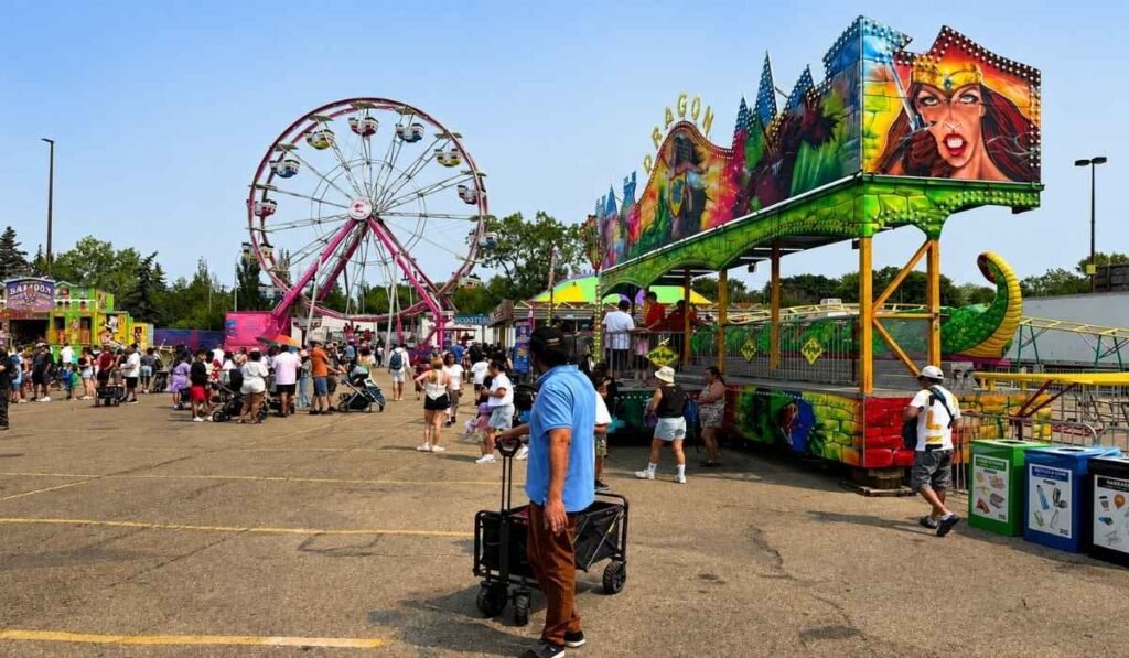
K-Days brings carnival rides, food, entertainment and large crowds to Edmonton each summer.
Summer is my favourite time to explore North Edmonton. The days are long, with daylight lasting well past 10 p.m.
This is when I think North Edmonton's parks are at their best. Rundle and Hermitage are great for walking and spending time outdoors, spray parks are open, the disc golf course is busy, and the river valley trail network is ideal for cycling.
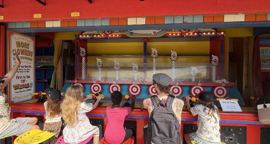
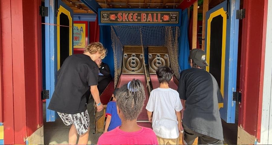
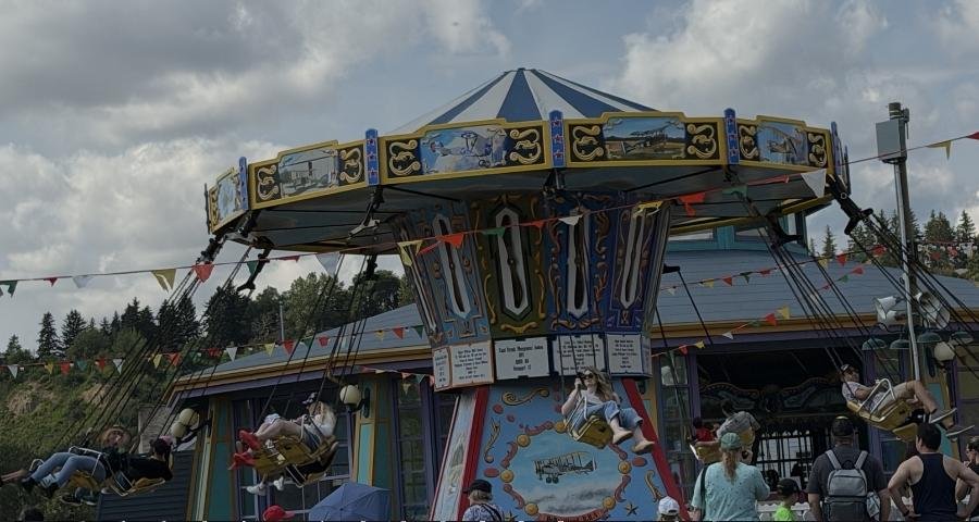
Summer also brings one of Edmonton's biggest annual summer festivals to North Edmonton. K-Days, held at the Edmonton EXPO Centre and surrounding grounds, brings midway rides, food, entertainment and other events to the area each July. If you are visiting during the festival, I recommend checking the current schedule and planning your visit ahead.
Is North Edmonton a Good Place to Stay?
Stay here if:
You have a car
You are visiting family or friends on the north side
You are travelling with kids and want space, pools and parks
You want easier parking and lower room rates
Your trip includes St. Albert, Fort Saskatchewan or Elk Island
You would rather be in a quiet residential area than a busy core
Stay somewhere else if:
You want to walk to attractions
You want restaurants, bars or live music near your hotel at night
You plan to spend most of your time downtown or in Old Strathcona
You are not renting a car
Frequently Asked Questions
Is North Edmonton a good place to stay?
It is a good base if you have a car, are visiting family, or are travelling with children. It may not be the best base if you want to walk to attractions or spend your evenings out. Rooms are generally cheaper, and parking is easier than downtown.
What are the best things to do in North Edmonton?
The Alberta Aviation Museum, Rundle Park, and Castle Downs Park if you have children.
Do you need a car in North Edmonton?
For most visitors, yes. The LRT reaches Clareview and NAIT/Blatchford and buses cover the main corridors, but the parks and restaurants are spread out and slow to reach without one.
What are the best parks in North Edmonton?
Rundle Park for range and trails, Hermitage Park for quiet, wildlife and fishing, and Castle Downs Park for young families.
What is North Edmonton known for?
Residential neighbourhoods, river valley parks in the northeast, diverse and inexpensive restaurants, shopping along 137 Avenue, and quick highway access to St. Albert, Fort Saskatchewan and Elk Island.
Is North Edmonton safe for visitors?
Yes, generally. North Edmonton is a practical and generally safe area for visitors, particularly around major hotels, shopping centres, and residential neighbourhoods. As in any large city, use common sense: keep valuables out of sight in your vehicle, use well-lit areas at night, and stay aware of your surroundings.
Final Thoughts
North Edmonton may not be the first part of Edmonton that visitors think about, but it offers a more local side of the city. This is where many Edmontonians live, shop, eat and spend time outdoors.
For visitors, its strengths are its parks, diverse restaurants, family recreation, convenient shopping and easy access to major roads. I have lived in different parts of North Edmonton over the years, and one of the things I appreciate most is how easy it is to get around without having to drive through the city centre.
North Edmonton is a particularly good choice for visitors with a car, families, and people visiting friends or relatives on the north side. If you want a highly walkable area with major attractions, nightlife and restaurants outside your hotel, Downtown Edmonton or Old Strathcona may be a better fit.
But if you want to experience a different and more residential side of Edmonton, North Edmonton is well worth exploring.
The first sound I heard at Jurassic Forest was not a dinosaur. It was mosquitoes.
They found me in the parking lot and stayed with me for most of the walk. I am telling you that first because if I had known, I would have packed differently. Now you know. The rest of the day was better than I expected. I walked a wooden boardwalk through real old forest, and every so often something enormous started moving in the trees beside me and roaring.
Here is the first thing I want to clear up. Jurassic Forest is not in Edmonton, even though nearly everyone searches for it that way. I drove out to Gibbons, Alberta, about 30 minutes north of the city on Highway 28. It is one of the easiest day trips from Edmonton I have done, and I did not plan it much at all. I went today, and this is what I would tell a friend who asked me about it.
What Is Jurassic Forest?
I want to set your expectations properly, because I had the wrong idea going in.
Jurassic Forest is an outdoor dinosaur park. It is not a museum with fossils behind glass, and it is not an amusement park with rides. The main thing you do there is walk.
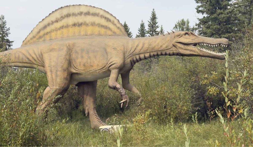
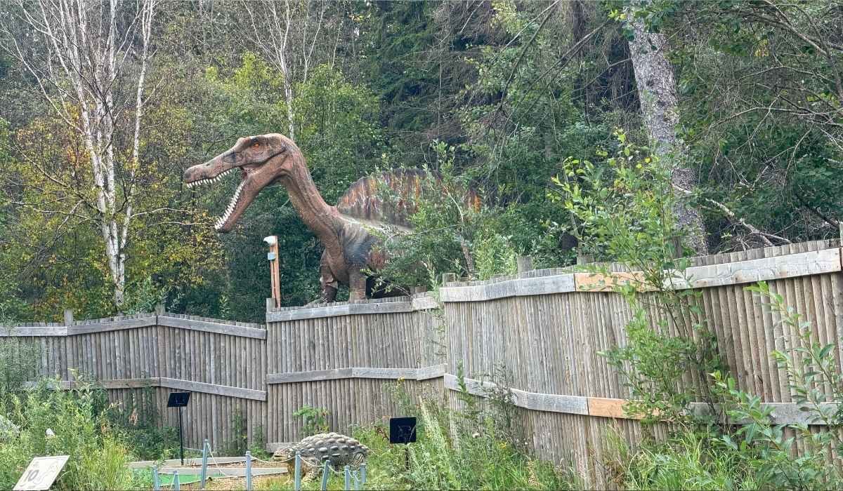
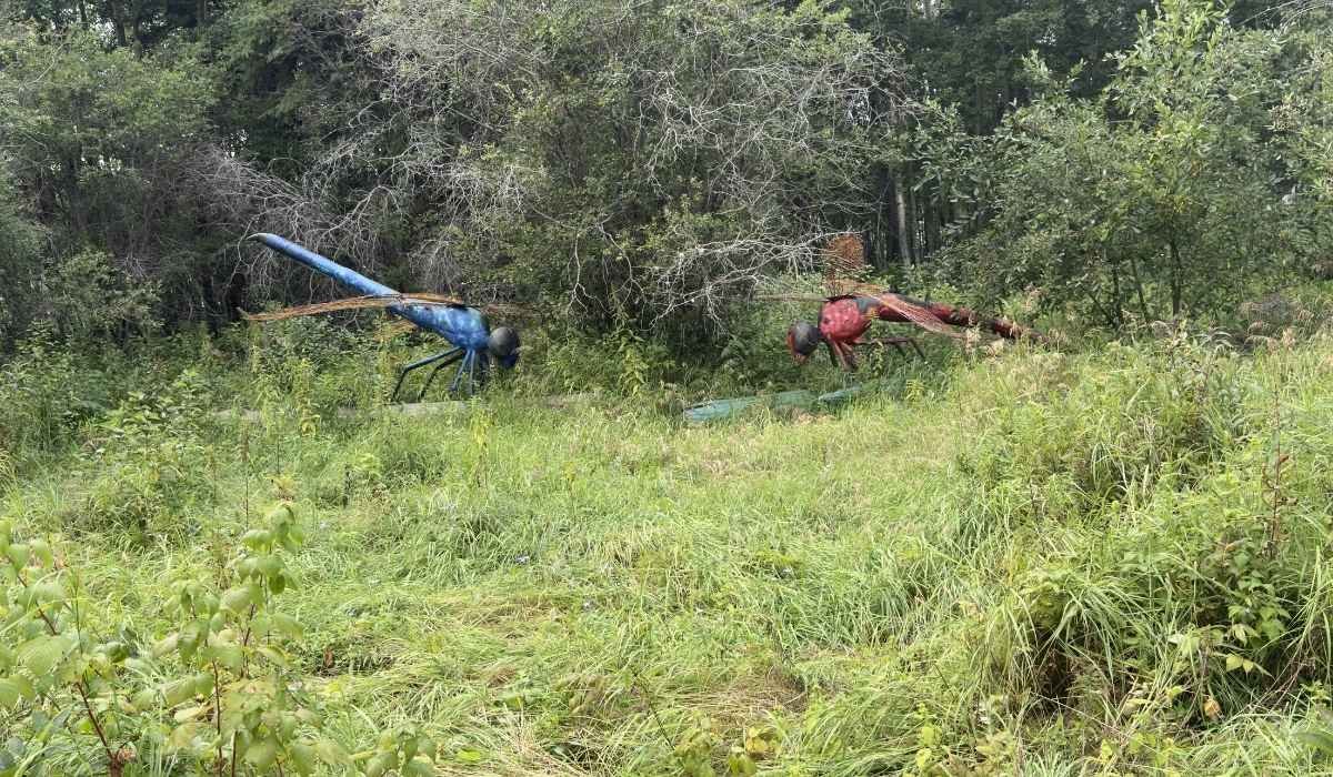
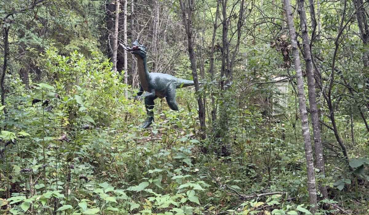
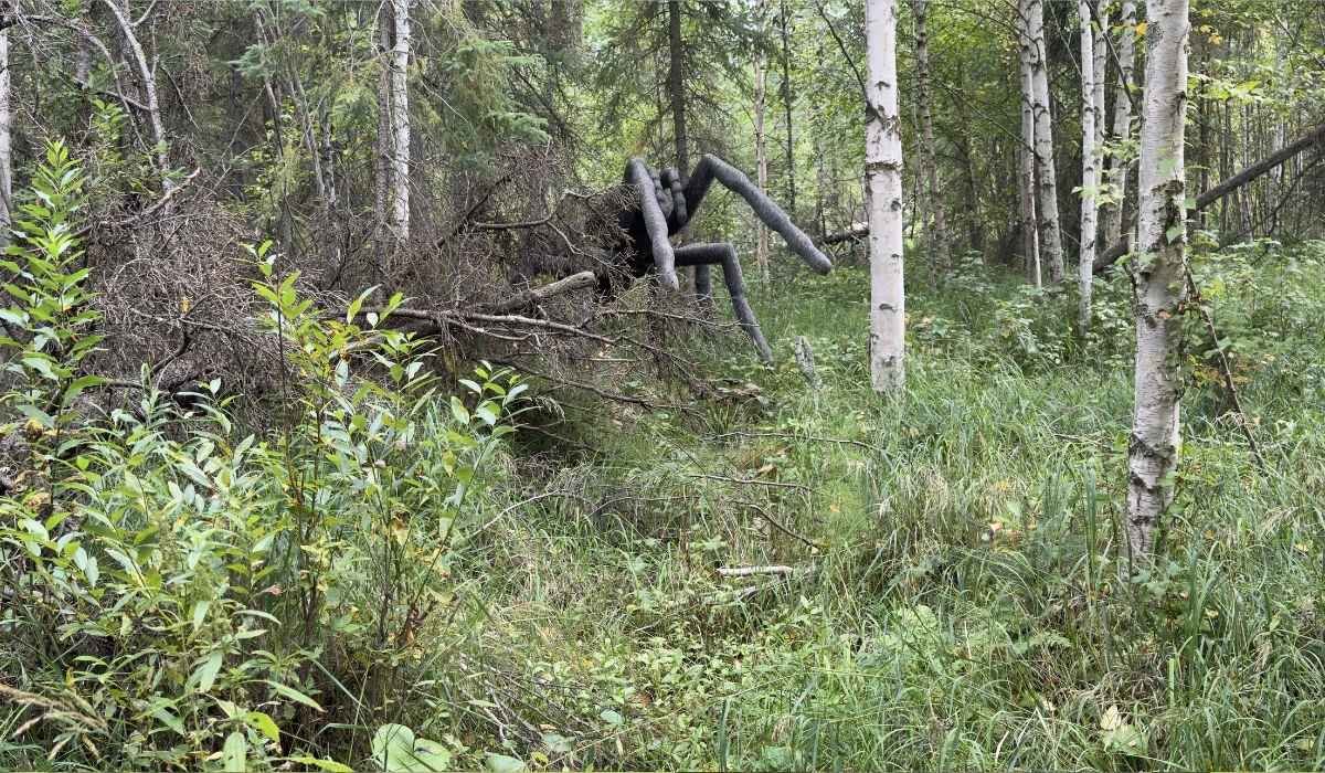
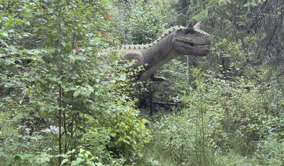
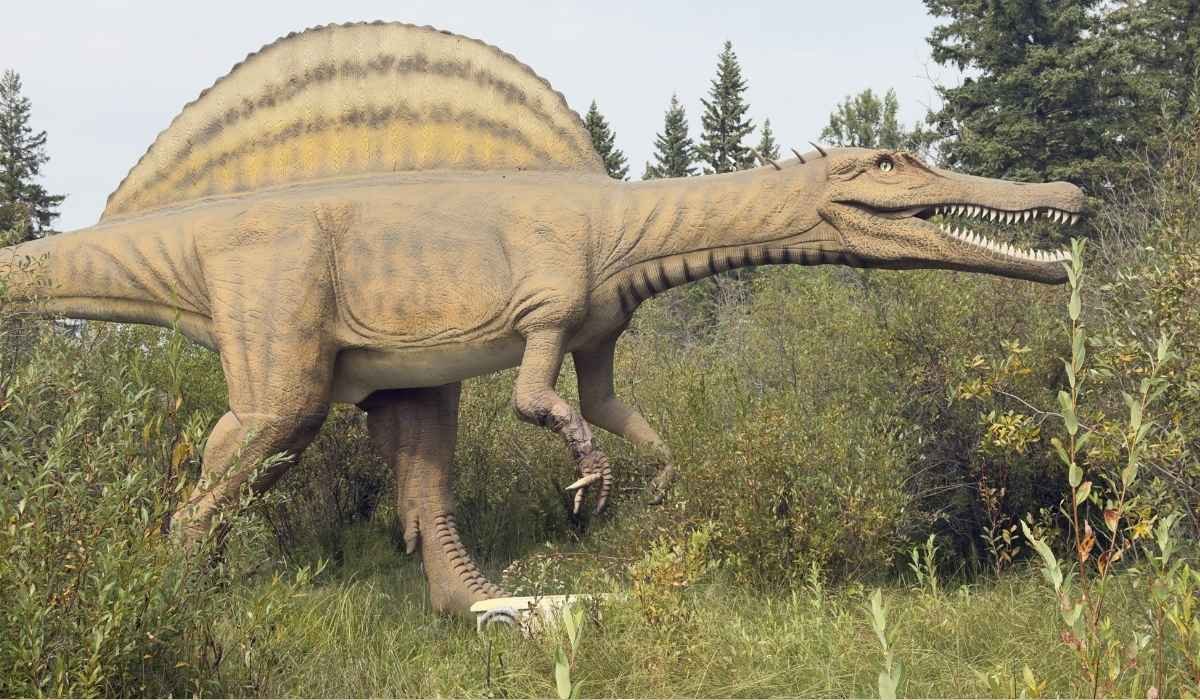
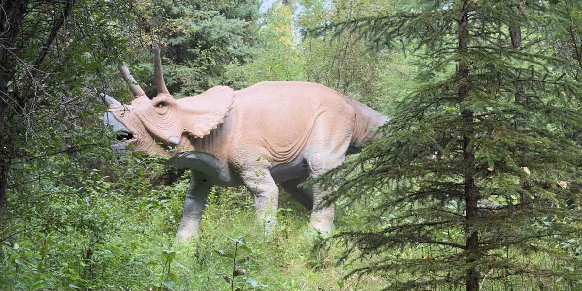
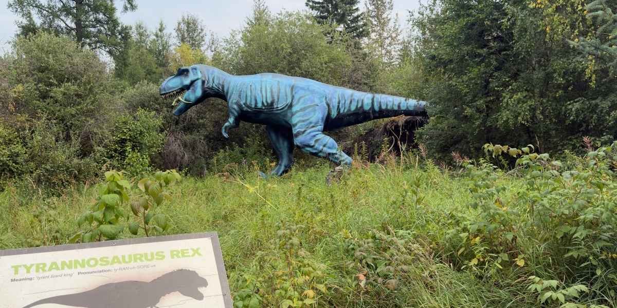
The park has more than 40 life-size animatronic dinosaurs spread along a 2 km boardwalk trail through old forest. Motion sensors set them off as you come near, so they move and make noise when you round a corner.
That is what makes it work, and I did not understand it until I was standing on the trail. The forest is thick and shaded, so I usually heard a dinosaur before I saw it. I was not looking at a statue in an open field. I was walking a path, and the path kept interrupting me.
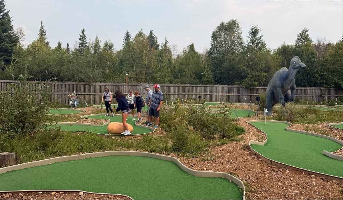
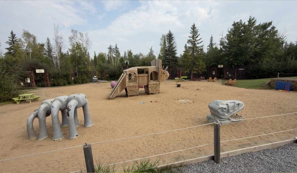
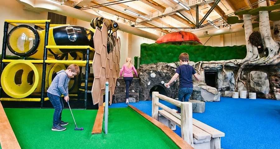
There is more than the trail. There is also an 18-hole dinosaur mini golf course called Journey to Extinction, an outdoor play area called the Active Learning Park where kids can brush for bones in sand, and two food spots, the Tar Pit Café and the Cretaceous Concession.
My Visit to Jurassic Forest
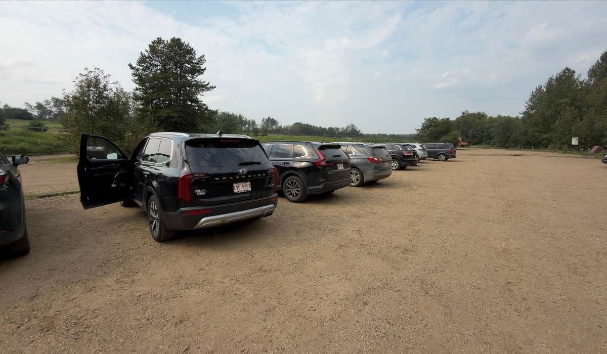
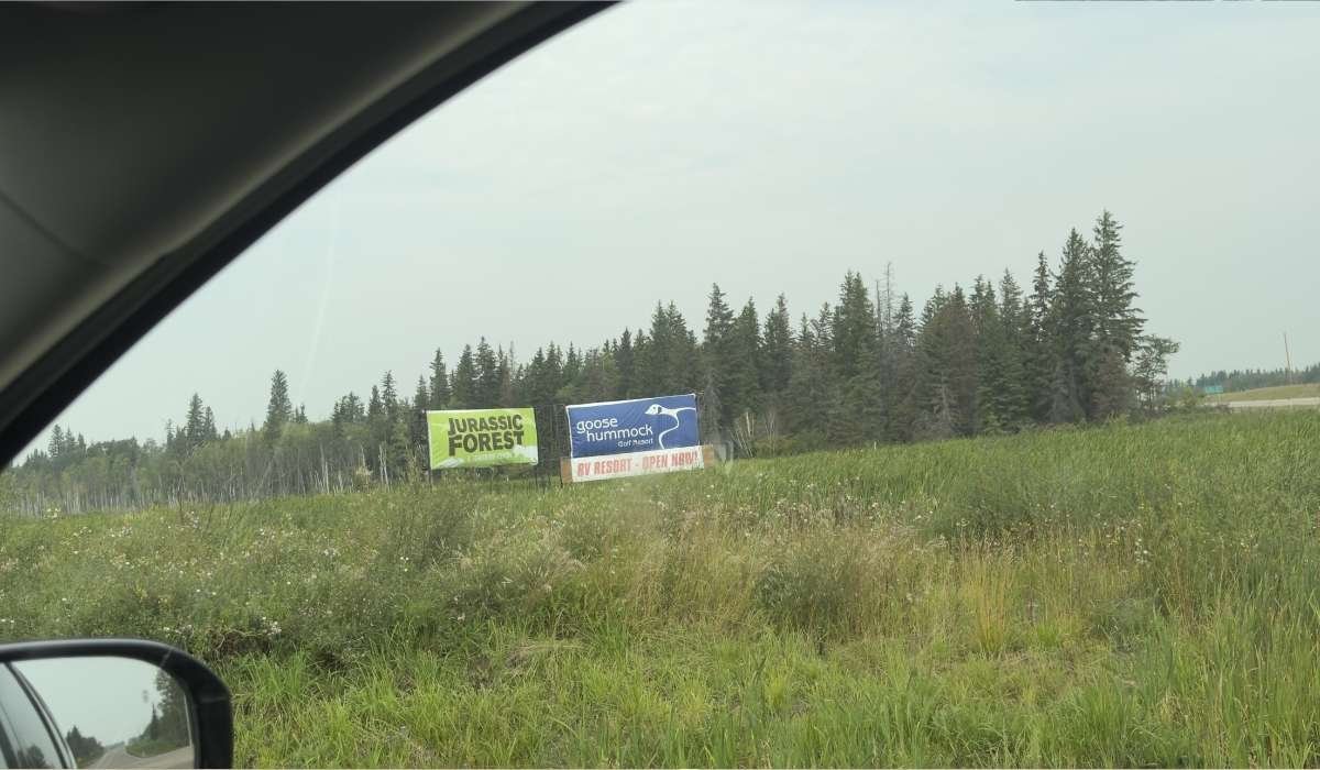
Getting there was simple. The drive north out of Edmonton is flat farmland and grain bins, and then I turned onto a township road and the trees closed in around me. Parking is free and sits right at the entrance. There was plenty of room when I pulled in.
The mosquitoes started at the car. I am not blaming the park for this. It is an old forest with wet ground in late August, and mosquitoes are simply part of that in this corner of Alberta. I just did not have repellent with me, and I paid for it all afternoon.
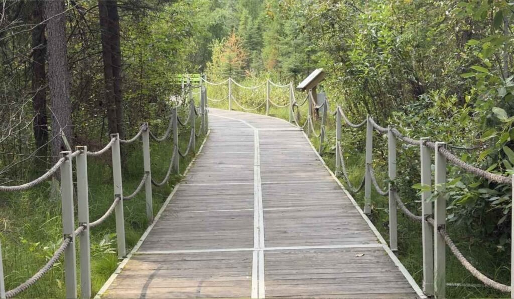
Once I stepped onto the boardwalk, the forest seemed to take over. The entire trail is a raised wooden boardwalk, so I never had to worry about mud, and the walk was easy. Sunlight filtered through the trees in patches, and the trail was quiet between the displays. Then, without warning, a sensor would pick up my movement, and a full-size dinosaur would suddenly start moving just a few metres away.
That is also where I learned how my kids felt about the whole idea. My toddler was a little afraid, and my baby was scared outright and refused to stand on the trail at all. We ended up carrying the little one for most of the walk.
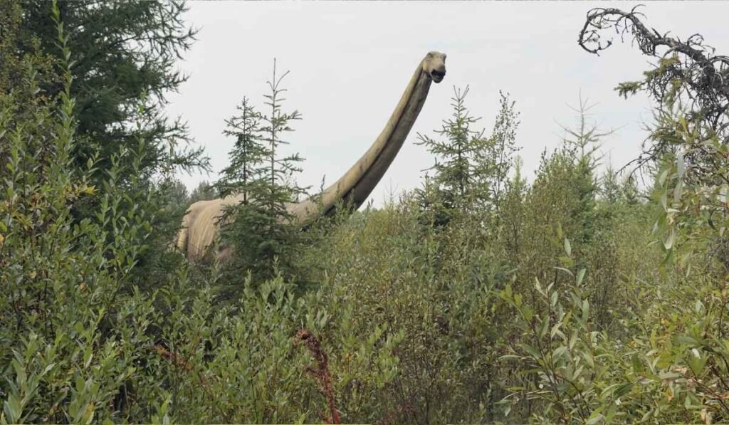
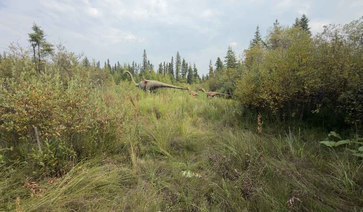
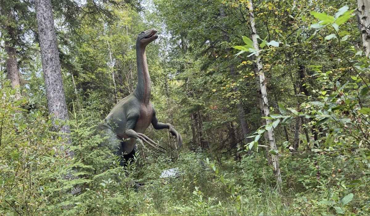
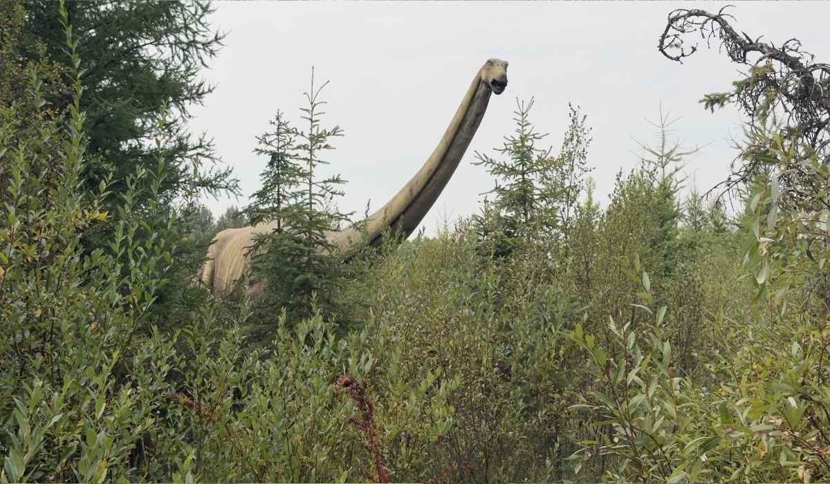
The scale is what surprised me most. Photos online don't really capture how large these dinosaurs feel. From the trail, the long-necked dinosaurs looked like they belonged among the trees around them, while the meat-eaters were positioned low and close to the boardwalk, making them feel surprisingly near.
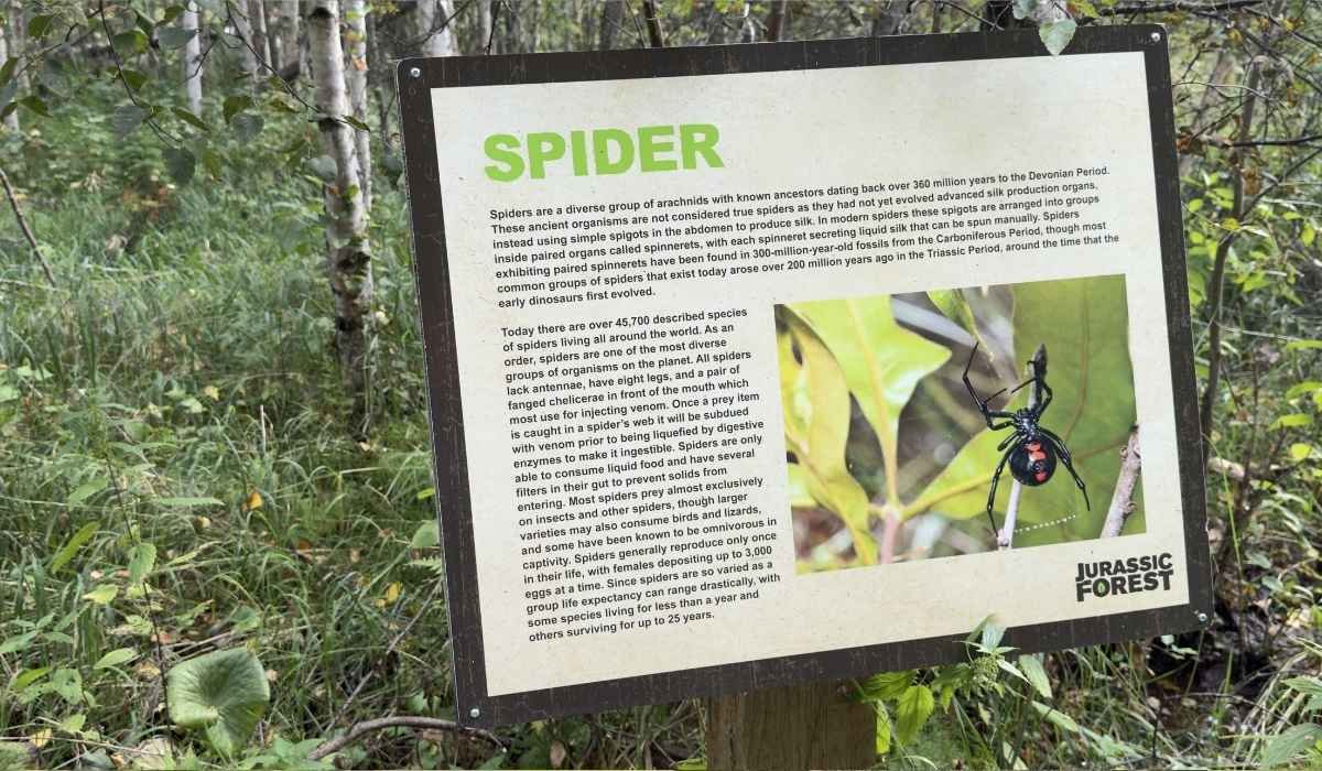
I found information boards along the route. Some are about the dinosaurs, and others explain the forest I was standing in, including the wetland sections the boardwalk crosses. I wanted to read more of them than I did, but I could not because of the bugs and a nervous baby in my arms.
My walk took about 15 minutes, and I was moving faster than I meant to. If you have repellent on and you can stand still without being eaten, you will take much longer than I did, and you should.
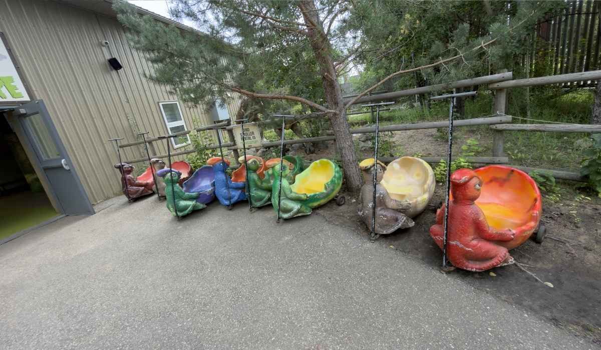
Three things I noticed that I think will help you. The boardwalk is smooth and wide, and I watched people push strollers along it without any struggle.
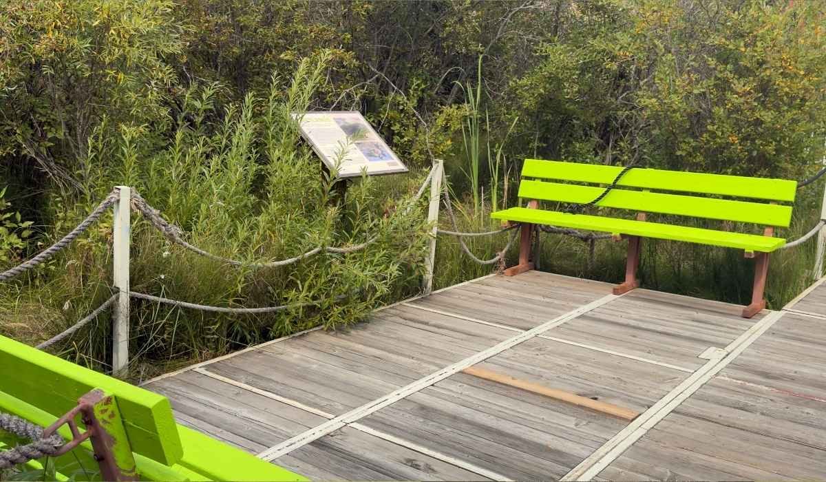
There are benches spaced out along the trail, often right beside an information board with a view into the trees, so you can sit whenever you want instead of pushing through to the end. And the sensors do not all fire at the same moment for every group, so if a dinosaur looks still, wait a second before you walk past it.
What You'll See at Jurassic Forest
The wooden boardwalk winds through the forest and past the dinosaur displays.
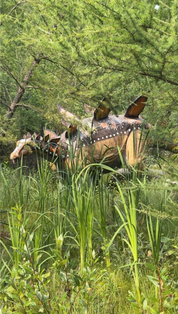
The trail is the main event. You will pass a mix of plant eaters and predators. Species you can expect to encounter include Albertosaurus, Tyrannosaurus rex, Triceratops and Stegosaurus, plus the very large long-necked dinosaurs that are impossible to miss.
I would not go in with a checklist of species. I got more out of letting the trail surprise me and reading the boards for the ones I liked.
Here is what else I found worth knowing about.
Discovery Trails
The boardwalk loop is 2 km in total, the dinosaurs are motion-activated, and it is all included with general admission. The park also offers printable scavenger hunt sheets in two age levels, one for ages 4 to 7 and one for ages 8 to 12. If you are visiting with older children, the scavenger hunt can be an easy way to keep them engaged throughout the walk. It is a free way to keep them interested for the whole walk.
Journey to Extinction Mini Golf
An outdoor 18-hole course with dinosaur-themed obstacles. It is an add-on rather than part of general admission. I saw the price posted as $8 per person on the admissions board at the gate when I visited, and you can play it on its own without paying full park admission.
Active Learning Park
A dinosaur-themed outdoor playground with climbing and slides, plus a sand pit where kids can brush for bones. I noticed families with younger kids spending extra time here.
Food Options
The Tar Pit Café serves coffee, tea and baked goods, including gluten-free options, and there is also the Cretaceous Concession. You can bring your own food and snacks in, though barbecues, stoves and cooking equipment are not allowed.
How Long Do You Need at Jurassic Forest?
I can tell you the trail goes quickly if you let it. Ours took roughly 15 minutes, but that pace was set by mosquitoes and a scared baby, not by interest. At a normal pace, stopping at the boards and letting each dinosaur finish its cycle, I would give it closer to an hour.
If you add everything else, the time climbs. Mini golf, the play park and a stop at the café can push a visit to two or three hours without much effort. Families with small kids may stay longer, especially if they spend time in the playground, mostly because the playground is hard to leave.
The things that will stretch your visit:
Actually reading the information boards
Waiting for each dinosaur to finish moving
Photography, because the forest light is good
Kids who want to see every display twice
Mini golf and the play area
One handy detail: you get a stamp when you arrive, and re-entry is allowed, so you can go back out to your vehicle for a jacket or a cooler and come straight back in.
Is Jurassic Forest Good for Families?
Yes, and I think the boardwalk is the reason why.
The park lists the Discovery Trails as stroller-friendly and suitable for most mobility levels. Every pathway is a wooden boardwalk; the park says it is fully wheelchair accessible, and there are accessible washrooms on site. I do not see that often at an outdoor attraction, and it means a nap in the stroller does not end your day.
A few things I would want a friend to know before taking their kids:
A few things I would want a friend to know before taking their kids. The biggest one is fear. My toddler was a little afraid and was hurrying me up to finish the trail quickly so she could get out of there, and my baby was scared enough to refuse to stand on the trail for pictures, so we carried the little one through.
The dinosaur displays are loud, and they move suddenly, and that is exactly the point that scared my kids more. Older kids love that. Very small ones may not.
If your child gets nervous easily, walk the first few metres and watch how they react before you commit to the whole loop.
It is fully outdoors. Once you're on the trail, there is nowhere indoors to escape if the weather turns, so check the forecast and dress for the conditions you’re likely to encounter.
If you are visiting with small children, the bugs may be harder for them to ignore than they were for me. Repellent on your kids matters more than repellent on you. I learned that lesson the hard way on my own arms.
Pets are not allowed anywhere in the park, so leave the dog at home rather than in the car.
Jurassic Forest for Adults
I went as an adult, and I enjoyed it, so I do not want to leave you thinking this is only a kids' attraction.
If you like photography, the mix of forest light and enormous dinosaur displays gives you plenty of interesting subjects to photograph. And if you have an interest in paleontology, seeing a full-size Albertosaurus in an Alberta forest feels very different from seeing one in a book.
It also works as a change of pace. If you have already worked through the best tourist attractions in Edmonton and you want something outdoors and a bit unusual, this fits. I think grandparents would do fine here too. The surface is flat and even, and those benches along the trail mean you can rest as often as you need.
Where Is Jurassic Forest?
Jurassic Forest sits near Gibbons, Alberta, north of Edmonton and slightly to the east. The address is 23210 Township Rd 564 #2, Gibbons, AB T0A 1N5.
The town of Gibbons is a few minutes away and has fuel and groceries if you want to stock up before or after. The attraction is in Sturgeon County, and the drive is mostly straightforward farmland highway, and the drive is straight farmland highway the whole way.
Calling it "Jurassic Forest Edmonton" is a habit more than a fact. It is close enough to the city for an easy afternoon, but you are leaving Edmonton to get there.
How to Get to Jurassic Forest from Edmonton
Drive. The park says it is roughly 30 minutes north of Edmonton on Highway 28 north, and there is plenty of on-site parking, including space for school buses. Parking is free, so there is no lot fee to add on top of your tickets.
Coming from north Edmonton, that 30-minute estimate held up for me. If you are starting from the south side or Sherwood Park, give yourself extra time just to cross the city first.
The last turn takes you onto a rural township road. Just type "Jurassic Forest" into Google Maps by name rather than entering the street address. Then watch for the sign once you leave the highway.
There is no practical public transit out there, and the site is rural, so plan on driving.
When Is the Best Time to Visit Jurassic Forest?
Jurassic Forest runs seasonally from May through October, and it stays open in rain, shine or smoke unless conditions are unsafe. Hours are 9:00 am to 7:00 pm daily with last admission at 6:00 pm, though they can shorten later in the fall, so confirm before a September or October trip.
What I would tell you about timing:
Mid to late summer is peak mosquito season in a wet forest like this one. That is the single thing I would change about my own visit. Do not treat repellent as optional.
September and early October should give you cooler temperatures, and a late-season visit may also mean fewer mosquitoes than I experienced in late August.
The canopy keeps the trail cooler than open ground on a hot day, which I appreciated. That is a real advantage in July and August.
Weekends and holidays can be busier, so booking online is a good idea to skip the line, though you can still buy at the gate.
What to Bring
Short and practical, based on what I wished I had:
Insect repellent. The one thing I would not leave home without again.
Comfortable walking shoes. The boardwalk is flat, but you are on your feet.
A light jacket or long sleeves. More bug protection, and useful in the shade.
Water bottle. Easier than having to buy drinks on site.
Sunscreen and a hat. The open areas near the entrance and mini golf have no cover.
Rain gear. The park stays open in wet weather.
Camera or phone. The size of these displays is worth capturing.
The park's own suggestion list is close to mine: repellent, sunscreen, a water bottle, a hat and a jacket.
Jurassic Forest Tickets, Hours and Practical Information
The prices below are what I saw posted on the admissions board at the gate on the day I visited, and the rest comes from the park's own visitor pages. Admission, add-on pricing and hours can change, so check jurassicforest.com for current information before you drive out.
Location: 23210 Township Rd 564 #2, Gibbons, AB T0A 1N5
Season: May through October
Hours: Daily 9:00 am to 7:00 pm, last admission 6:00 pm
Admission: Adult (18+) $18, Youth (13 to 17) $15, Senior (55+) $15, Child (3 to 12) $12, Family of Four $60, children 2 and under free
Add-ons: Dino Wagon $6, Mini Golf $8, both priced per person on top of admission
Parking: Free on site, with room for school buses
Accessibility: All pathways are wooden boardwalk; the park states they are fully wheelchair accessible, and accessible washrooms are available
Food: Tar Pit Café and Cretaceous Concession on site; outside food and snacks allowed, no cooking equipment
Booking: Online booking recommended to skip the line, gate tickets available, and online day passes can be used on any day of the season
Rules to know: No pets, no smoking or vaping, no bikes or scooters, stay on the boardwalk, and do not touch the displays or motion sensors
Season memberships are available if you think you will go back more than once.
🏨
Looking for a Place to Stay?
Staying overnight in Edmonton? Find a hotel that puts you within easy reach of Jurassic Forest.
For me, yes, and I would tell a friend to go. I would say go if you have kids roughly between 3 and 12, if you like dinosaurs, or if you want a short outdoor trip from Edmonton that does not eat a whole day in the car.
The boardwalk setting is the best part of it. Walking through real forest and running into a moving Albertosaurus felt different from looking at a skeleton behind glass, and the flat trail makes it work for people who usually get left out of outdoor attractions.
I will be honest about the other side. If you only do the trail, it is a smaller experience than the ticket price suggests, because the walk can be over quickly. If you want to make more of a day of it, add mini golf, the play park and a slower walk along the trail instead of treating it as a quick stop.
You might prefer somewhere else if you want real fossils and museum-grade science. In that case, the Royal Tyrrell Museum in Drumheller is the better drive, or the Royal Alberta Museum in Edmonton for an indoor day. I would also skip it if bugs ruin your mood and you will not spray, because on a warm late-summer afternoon in that forest, they will find you the way they found me.
I am glad I went. I would go back in late September with repellent in my pocket, and I would give myself the time to read every board I walked past today.
Jurassic Forest Photos
Click on each image to expand.
Final Thoughts on Jurassic Forest
Jurassic Forest is one of those Edmonton-area attractions that is easy to enjoy at your own pace. The trail takes you through a natural forest setting, with life-sized dinosaurs appearing among the trees and vegetation along the way. It feels less like walking through a traditional exhibit and more like discovering dinosaurs in their natural environment.
I especially enjoyed the combination of the forest trail, dinosaur displays, and quiet outdoor setting. The boardwalk, resting areas, and educational signs also make it an easy experience for families and visitors who want to take their time.
If you're looking for a fun outdoor attraction near Edmonton that combines dinosaurs, nature, and a little adventure, Jurassic Forest is well worth adding to your Edmonton itinerary.
Frequently Asked Questions
Where is Jurassic Forest located?
It is near Gibbons, Alberta, north of Edmonton. The address is 23210 Township Rd 564 #2, Gibbons, AB T0A 1N5. It is not inside Edmonton city limits, though it is close enough to feel like it.
How far is Jurassic Forest from Edmonton?
It is about 30 minutes north of Edmonton on Highway 28 north, and that matched my drive from the north side. Starting from south Edmonton, allow extra time to cross the city.
How much does Jurassic Forest cost?
The board at the gate on the day I visited listed $18 for adults 18 and over, $15 for youth 13 to 17, $15 for seniors 55 and over, $12 for children 3 to 12, and $60 for a family of four. Children 2 and under get in free. Mini golf is $8, and the Dino Wagon is $6 on top of admission, and parking is free. Confirm current pricing on the official site before you go.
How long does it take to visit Jurassic Forest?
My walk took about 15 minutes, but I was hurrying away from mosquitoes. Give the trail closer to an hour at a normal pace, and expect two to three hours once you add mini golf, the play park and food.
Is Jurassic Forest good for young children?
Yes. The trail is stroller-friendly. The one thing I would watch for is noise, since the animatronics move suddenly and roar; it makes my children scared. Yours may be scared too.
What should I wear to Jurassic Forest?
Comfortable walking shoes, clothes for the day's forecast, and long sleeves if the bugs are out. It is fully outdoors, and the park stays open in rain, shine or smoke unless conditions are unsafe.
Is Jurassic Forest open year-round?
No. It runs seasonally from May through October. Fall hours can be shorter than summer hours, so check before a late-season visit.
Downtown Edmonton is the heart of Alberta's capital city, stretching between the North Saskatchewan River valley and the city's central neighbourhoods. It brings together some of Edmonton's best-known attractions, cultural venues, restaurants, shops and entertainment districts, making it a convenient place to start exploring the city.
From the museums and galleries around Churchill Square to the restaurants and historic buildings along 104 Street and the sports and entertainment of the ICE District, downtown offers plenty to see and do within a relatively compact area. The river valley is also close by, giving you an easy way to combine city sightseeing with trails, parks and scenic views.
This Downtown Edmonton Guide covers the area's top attractions, neighbourhoods, places to eat and stay, nightlife, transportation, parking, seasonal tips and suggested itineraries to help you plan your visit.
Downtown Edmonton at a Glance
Where it is
Central Edmonton, north of the North Saskatchewan River valley.
Best for
First-time visitors, concert and game trips, museum days, festival season, business travel with free time
Main attractions
Royal Alberta Museum, Art Gallery of Alberta, Churchill Square, ICE District, 104 Street, Legislature grounds, river valley access
Time needed
Half a day for highlights, one full day to do it properly
Walkability
High. Flat, gridded, with an indoor pedway linking many buildings and three LRT stations
Public transit
Capital, Metro and Valley Line LRT, plus most major bus routes
Nearby areas
Old Strathcona and Whyte Avenue, 124 Street, Chinatown, the river valley parks
Best time to visit
July for festivals, September for weather without crowds, winter for hockey and skating
Where Is Downtown Edmonton?
Downtown Edmonton sits in the central part of the city, immediately north of the North Saskatchewan River valley. For visitors, “Downtown Edmonton” generally refers to the central urban core around Jasper Avenue, 104 Street, Churchill Square and the ICE District, extending west toward the Government Centre area.
The downtown area is relatively compact, but it has several distinct districts worth knowing. Churchill Square and the Arts District are home to major museums, galleries and cultural venues. 104 Street and the Warehouse District are known for restaurants, cafés, historic buildings and the Downtown Farmers' Market. The ICE District is Edmonton's major sports and entertainment area, centred on Rogers Place.
One of downtown's biggest advantages is its proximity to the North Saskatchewan River valley. The 100 Street Funicular connects the downtown core with the river valley, where you can find walking trails, parks and viewpoints.
Why Visit Downtown Edmonton?
Downtown Edmonton is one of the easiest places to experience several sides of the city in a single visit. The area brings together major cultural attractions, restaurants, entertainment venues and public spaces, making it a convenient starting point for exploring Edmonton.
Culture is a major draw, with museums, galleries, theatres and other attractions concentrated around the downtown core. The ICE District adds a lively sports and entertainment scene, especially during Edmonton Oilers games, concerts and major events.
Downtown also has a good mix of restaurants, cafés and bars, particularly around 104 Street, Jasper Avenue and the ICE District. During the warmer months, festivals and outdoor events bring even more activity to the area.
Another advantage is the North Saskatchewan River valley, which sits just south of downtown and offers trails, parks and scenic views. With the LRT, pedestrian connections and nearby attractions, you can explore much of downtown without needing a car.
For first-time visitors, downtown is a practical place to begin discovering Edmonton.
Downtown Edmonton Areas to Know
Downtown is not one uniform place. These pockets each feel different.
Area
Best known for
Churchill Square & Arts District
Museums, galleries and festivals
104 Street & Warehouse District
Restaurants, cafés and historic buildings
ICE District
Rogers Place, sports and concerts
Jasper Avenue
Hotels, restaurants and central-city access
Government Centre
Legislature and river valley access
The rhythms differ. The Jasper Avenue office core is busiest at weekday lunch. ICE District runs on the event calendar. Churchill Square and 104 Street are at their best on summer weekends.
Best Things to Do in Downtown Edmonton
Downtown Edmonton has a mix of museums, galleries, public spaces, entertainment venues and river valley experiences. You can explore the city's culture during the day, catch a game or concert in the evening, or simply walk between some of the area's most interesting districts.
1. Royal Alberta Museum
Discover Alberta's natural and human history through exhibits covering wildlife, Indigenous cultures, dinosaurs and the province's past. It's one of the city's best indoor attractions at the Royal Alberta Museum, especially on a cold or rainy day.
2. Art Gallery of Alberta
Located near Churchill Square, the Art Gallery of Alberta features Canadian and international art in a striking modern building. It's a good choice for visitors interested in art, architecture and culture.
3. Churchill Square
This central public square is one of downtown's main gathering places and hosts festivals, concerts and seasonal events. It's also surrounded by several of Edmonton's major cultural attractions.
4. Explore 104 Street
Walk along 104 Street to see historic warehouse buildings, cafés, restaurants and independent businesses. The area is especially lively during the Downtown Farmers' Market.
5. Visit the ICE District
The ICE District is downtown's major sports and entertainment hub, centred around Rogers Place. Check the schedule for an Edmonton Oilers game, concert or other major event during your visit.
6. Ride the 100 Street Funicular
Take the funicular down from downtown toward the North Saskatchewan River valley. It's an easy way to reach river valley trails and enjoy views of the city.
7. Explore the River Valley
Just south of downtown, Edmonton's river valley offers walking and cycling trails, parks and scenic viewpoints. It's a chance to experience the city's natural side without leaving the central area.
8. See a Show
The Citadel Theatre and Winspear Centre make downtown an important destination for theatre, music and live performances. Check what's playing during your visit.
Where to Stay in Downtown Edmonton
Staying downtown makes sense if you are attending an event at Rogers Place, doing a museum-focused trip, or would rather walk than drive. It makes less sense if your plans revolve around West Edmonton Mall or an early flight.
There are three useful clusters. ICE District puts you minutes from Rogers Place, which matters on a game night. Churchill Square and Jasper Avenue are the best all-round position for museums and pedway access to the LRT. The river valley edge, near 100 Street south of Jasper Avenue, gives you valley views and the funicular on your doorstep.
Downtown has everything from luxury hotels to mid-range and suite-style properties. Rates can increase around Oilers games, concerts and major conventions, so check the event calendar if your dates are flexible.
Where to Eat in Downtown Edmonton
Downtown Edmonton has a diverse dining scene, from casual cafés and quick bites to upscale restaurants, international cuisine and lively spots for a night out.
104 Street and the Warehouse District are popular choices for restaurants, cafés and casual dining, with a mix of independent businesses and more polished dining options. Jasper Avenue has another concentration of restaurants and bars, making it convenient for a meal before exploring downtown or heading to an evening event.
Around the ICE District, you'll find restaurants, pubs and casual spots that are especially convenient before or after an Edmonton Oilers game or concert at Rogers Place. The Arts District also has several places to eat close to museums, galleries, theatres and Churchill Square.
Whether you're looking for a quick coffee, a relaxed lunch, international flavours or a restaurant for a special evening, you won't have to go far to find something downtown.
Downtown Edmonton Nightlife
Nightlife concentrates in three areas: 104 Street, the Jasper Avenue corridor near 109 Street, and ICE District.
Event nights change everything. When the Oilers are home or a big concert is on, bars near Rogers Place fill hours beforehand and stay busy afterward. When nothing is scheduled, the same blocks can be quiet midweek.
Beyond bars, the evening scene leans toward performance: the Winspear for symphony and touring music, the Citadel for theatre, and late dining rather than late clubbing. If you want a dense strip of pubs and live bands, Whyte Avenue across the river is the better bet, and the LRT gets you there.
How to Get Around Downtown Edmonton
Walking. Downtown is walkable. It is flat, the grid is logical, and most attractions sit 15 to 20 minutes apart at most. Churchill Square to 104 Street or to Rogers Place is about ten minutes. The indoor pedway connects many towers, hotels and three LRT stations, though signage is poor and hours vary because segments run through private buildings.
LRT. Genuinely useful for visitors. The Capital and Metro lines share an underground tunnel through the core, stopping at Corona, Bay/Enterprise Square, Central, Churchill, MacEwan and Government Centre. The Valley Line runs at street level and stops at 102 Street.
Fares are flat at $3.00 tapping an Arc card or a contactless bank card, $3.75 cash on buses, with no cash on the LRT. One fare covers 90 minutes including transfers, and daily fare capping replaced day passes. Children 12 and under ride free with a paying rider. Fares and payment options can change, so check the current ETS information before your trip.
Driving. A car is not necessary if you are staying downtown, and ongoing Valley Line West LRT construction has closed and reconfigured streets across the core. Park once and walk.
From the airport.Edmonton International Airport is about 30 km south, a 30 to 45 minute drive. There is no LRT to the airport. By transit, take Route 747 from Door 8 to Century Park Transit Centre on a separate fare, then the Capital Line north. Budget an hour door to door.
Cycling. Downtown has a growing protected bike lane network, shifted in places during construction. The payoff is the river valley trail system below the bank, and the funicular takes bikes.
Parking in Downtown Edmonton
Downtown has street parking and several parkades, including options near Churchill Square and the ICE District. Event-day parking can be more expensive and busier around Rogers Place, so check posted signs before leaving your car. If you're spending the day downtown, parking once and walking is often the easiest option.
Parkades suit longer stays, including City Hall, the Milner Library and the ICE District parkade, which connects into the pedway.
On event days, on-street rates near Rogers Place switch to higher event pricing when a large crowd is expected, and the streets around 104 Avenue congest before and after. Rates and rules change, so read the signage. Because the attractions cluster so tightly, the simplest approach is to park once near Churchill Square and cover the rest on foot.
Downtown Edmonton in Winter
Edmonton winters are long and genuinely cold, and downtown is built with that in mind more than most Canadian cores.
The pedway system is the first thing to understand. Enclosed walkways and tunnels link many office towers, hotels, the shopping centre and three LRT stations, so you can cross much of downtown without going outside. Pull up the city's pedway map before relying on it, since signage is limited and some segments close outside business hours.
Indoor attractions carry the season: the Royal Alberta Museum, the Art Gallery of Alberta, the Milner Library, the Winspear and the Citadel. The farmers' market moves inside City Hall from mid-October to mid-May. Skating is free at the City Hall rink on Churchill Square, with free skate rentals during select hours and weekend programming through January and February.
Hockey season is one of the reasons winter can be a great time to visit. An Oilers game is the most reliably lively thing happening downtown between November and April.
Daylight is short, with sunset before 4:30 p.m. around the solstice, so plan outdoor walking for early afternoon. Dress in layers with a windproof shell, wear boots with real grip, and cover your ears. Sidewalks near construction get icy and detoured, and cold slows transit, so build in extra time.
Events and Festivals
Downtown Edmonton comes alive throughout the year with festivals, concerts, sporting events and community celebrations. Churchill Square is one of the city's main gathering places, hosting outdoor festivals, performances and seasonal events, particularly during the warmer months.
Summer is the busiest season for downtown events, with recurring celebrations such as the Edmonton International Street Performers Festival, Taste of Edmonton, The Works Art & Design Festival and Cariwest Caribbean Arts Festival bringing performances, food, art and entertainment to the city centre.
The ICE District provides year-round entertainment, with Edmonton Oilers games, concerts and other major events at Rogers Place. If you're visiting during hockey season, checking the Rogers Place schedule can help you plan an evening around a game or concert.
Downtown also hosts seasonal markets, holiday activities and smaller cultural events throughout the year. Event schedules change from season to season, so check official event websites before your visit to see what's happening during your dates.
Is Downtown Edmonton Safe?
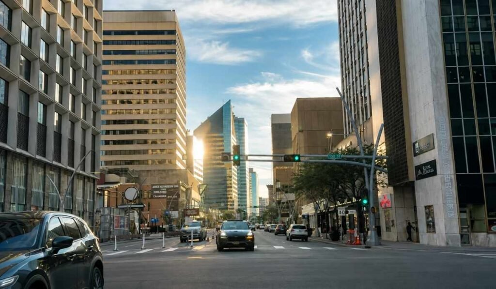
Downtown Edmonton along 100 Street, with high-rise buildings lining the city centre.
Downtown Edmonton is safe for most visitors most of the time, though how comfortable it feels varies by block and time of day.
Visitors are rarely targeted. What you are more likely to notice is visible homelessness and street disorder in parts of the core and around some transit stations, particularly late at night.
Normal urban precautions cover the rest. Stay aware of your surroundings, keep valuables out of sight and leave nothing visible in a parked car, use well-lit and busier streets after dark, and take a rideshare rather than a long late walk alone.
Best Time to Visit Downtown Edmonton
The best time to visit Downtown Edmonton depends on what you want to do and how much you want to spend.
Summer (late June to August) is the busiest season and the best time for outdoor sightseeing. Long daylight hours, outdoor patios, festivals and the Downtown Farmers' Market make the city centre especially lively. This is also when hotel rates tend to be highest.
Fall (September to October) is a quieter alternative, with comfortable early-fall temperatures, fewer crowds and colourful foliage in the nearby river valley. Hotel rates may also be lower than during the summer peak.
Winter (November to March) is cold, but downtown remains active with Edmonton Oilers games, concerts, skating and indoor attractions. It's a good time to experience Edmonton's winter atmosphere, provided you're prepared for freezing temperatures and snow.
Spring (April to May) is generally quieter and can offer lower accommodation rates. However, weather can be unpredictable, with lingering snow and muddy conditions in the river valley. By late spring, outdoor activities and downtown events begin picking up again.
For most first-time visitors, summer and early fall offer the easiest combination of pleasant weather, long days and things to do.
How Many Days Do You Need?
A few hours covers Churchill Square, one major indoor attraction, and either a walk down 104 Street or a funicular ride to the river valley lookout.
One day is enough for downtown itself: a museum in the morning, the square and gallery in the afternoon, 104 Street and ICE District on foot, the valley before dinner, and an evening event.
Two days lets you slow down and add nearby areas, most naturally Old Strathcona and Whyte Avenue across the river, or the Muttart Conservatory in the valley.
Downtown Edmonton Itineraries
Half-day
Start at Churchill Square, spend two hours at the Royal Alberta Museum a block away, eat lunch on 104 Street, then walk south to the Fairmont and take the funicular down to the river valley lookout. About four hours without rushing.
One day
Morning: coffee on 104 Street, then the Royal Alberta Museum at opening. On a summer Saturday, do the farmers' market first.
Lunch: Churchill Square, or back toward 104 Street and Rice Howard Way.
Afternoon: Visit the Art Gallery of Alberta or another nearby cultural attraction. If it's closed on your visit, use the Legislature or another downtown attraction as an alternative.
Late afternoon: the funicular down to the lookout and part of the Louise McKinney trail.
Evening: dinner in the core, then a show at the Citadel or Winspear, or an Oilers game if the schedule cooperates.
Two days
Day one follows the plan above. On day two, cross the river. In summer, the High Level Bridge Streetcar runs from downtown's Jasper Plaza terminus to Whyte Avenue, which makes the trip an attraction in itself. Spend the morning in Old Strathcona, stop at the Muttart Conservatory in the valley on the way back, and finish with dinner downtown.
Places Near Downtown Edmonton
Close enough to combine with a downtown visit, but separate destinations.
Old Strathcona and Whyte Avenue sit across the river on the south side, 10 to 15 minutes by car. Independent shops, vintage stores, live music, a Saturday farmers' market and the Fringe grounds in August. The seasonal High Level Bridge Streetcar connects the two areas from roughly the May long weekend to Thanksgiving.
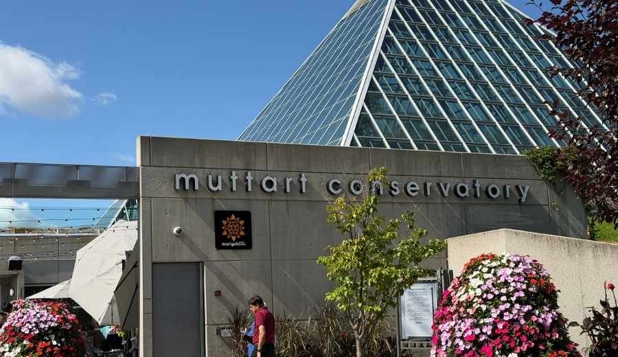
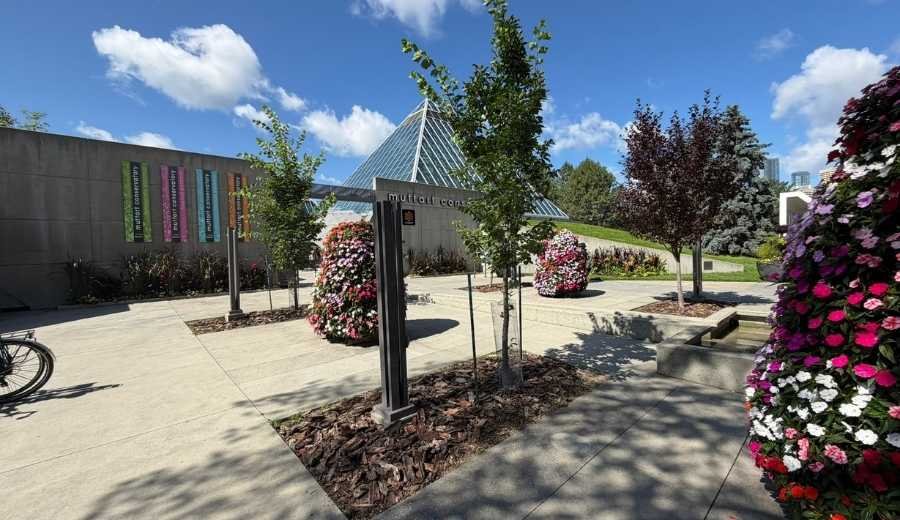
Muttart Conservatory, four glass pyramids in the river valley in Cloverdale, is visible from downtown and a short drive or Valley Line trip away. Plan around two hours for all four pyramids.
The Edmonton River Valley connects directly to downtown by funicular and stairways, with Louise McKinney Riverfront Park closest.
124 Street, about 20 minutes on foot west of downtown, has galleries, design shops and one of the city's better restaurant strips.
What Isn't Actually Downtown Edmonton?
Travel lists often group Edmonton attractions together as "downtown" when they sit in very different parts of the city, which leads to wasted time. To be clear:
Old Strathcona is across the river on the south side, not downtown.
Whyte Avenue is the main street of Old Strathcona, also south of the river.
Muttart Conservatory is close, but sits in the river valley in Cloverdale on the other side of the water.
West Edmonton Mall is in the far west end, 20 to 30 minutes away by car.
Fort Edmonton Park is in the river valley in the southwest, well outside the core.
124 Street and Wîhkwêntôwin are just west of downtown, part of central Edmonton rather than the core.
All are worth visiting. Just budget separate travel time rather than assuming you can walk there from a downtown hotel.
Frequently Asked Questions
Is Downtown Edmonton worth visiting? Yes, particularly for museums, live events and river valley access, all within walking distance of each other.
What is Downtown Edmonton known for? Rogers Place and ICE District, Churchill Square and its summer festivals, the Arts District museums and theatres, the warehouse blocks on 104 Street, and the river valley below.
Is Downtown Edmonton walkable? Yes. It is flat and gridded, with most attractions 15 to 20 minutes apart, plus an indoor pedway linking three LRT stations. LRT construction creates some detours.
Where should I stay in Downtown Edmonton? ICE District for events at Rogers Place, Churchill Square or Jasper Avenue for museums and pedway access, the river valley edge for views.
Is Downtown Edmonton safe for tourists? Generally yes, with normal urban precautions. Visitors are rarely targeted, though you may notice street disorder in parts of the core and near some transit stations at night.
How do I get downtown from the airport? About 30 km, or a 30 to 45 minute drive. There is no direct LRT. By transit, take Route 747 to Century Park, then the Capital Line north, roughly an hour door to door.
What attractions are near Downtown Edmonton? Old Strathcona and Whyte Avenue across the river, the Muttart Conservatory, the 124 Street strip, and the river valley park system.
Final Thoughts
Downtown Edmonton rewards visitors who know what it is: a compact, walkable district with a strong museum and gallery cluster, an NHL arena at its centre, a square that hosts festivals and events throughout the summer, and a river valley you can reach ten minutes after leaving your hotel.
Give it a full day rather than a rushed couple of hours, and go past the obvious stops. Walk the 104 Street warehouse blocks. Take the funicular down and stand on the lookout.
Use this Downtown Edmonton Guide as your starting point, then dig into the detail with our guides below.
Edmonton is bigger than most first-time visitors expect. The city covers more than 700 square kilometres, making it larger in area than Toronto, Montreal or Vancouver. The North Saskatchewan River Valley cuts through Edmonton, and the city stretches across a large area, making some neighbourhoods feel surprisingly far apart.
That is why it helps to think about Edmonton areas before you think about individual attractions. Where you base yourself changes almost everything about your trip:
How far you are from the attractions you actually came to see
Whether you can walk to restaurants at night or need to drive
How much shopping is within easy reach
How quickly you can get into the river valley
Whether transit works for you, or whether you need a car
The general feel of your mornings and evenings
Edmonton is a driving city for most visitors. Distances are real, and winter weather can slow things down. A 15-minute trip in July can take 30 minutes in January. Getting the location right the first time saves you a lot of backtracking.
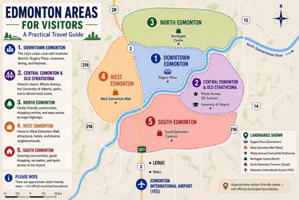
Map of Edmonton’s five visitor-friendly areas and their approximate locations.
To keep things simple, this guide breaks the city into five broad areas: Downtown, Central Edmonton and Old Strathcona, North Edmonton, West Edmonton and South Edmonton. These are visitor-friendly groupings rather than official city boundaries; locals use them loosely, and you will hear other names too. They are just the clearest way to understand the different areas of the city before you book anything. If you want the wider picture first, our ultimate Edmonton travel guide covers seasons, history and trip length.
Downtown Edmonton
Rogers Place and high-rise buildings in Downtown Edmonton.
Downtown sits on the north bank of the river, roughly between 97 Street and 109 Street, with Jasper Avenue running through it as one of its main streets. Almost everything else in the city is described in relation to it, so it is worth understanding even if you decide to stay somewhere else.
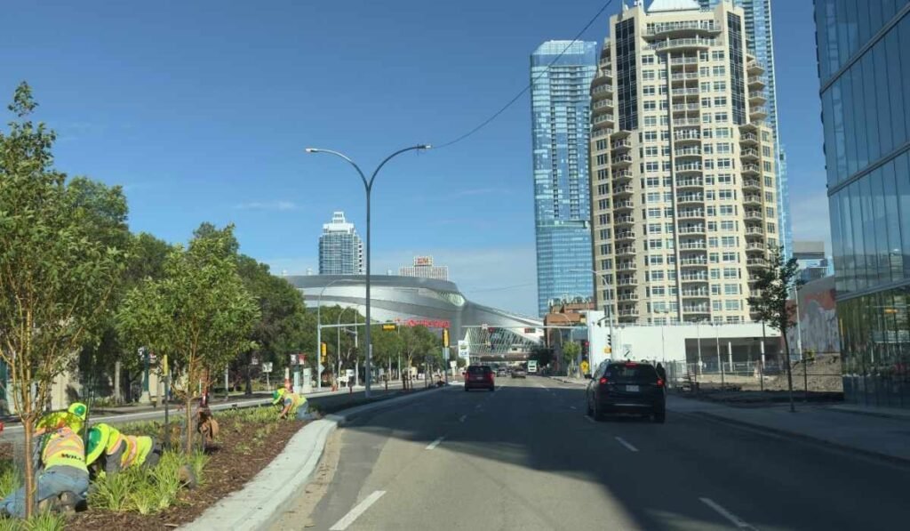
This is the most compact part of Edmonton and the easiest to explore on foot. It is also the part of the city that has changed the most in the last decade. The ICE District, built around Rogers Place arena, added hotels, towers, restaurants and a public plaza to what used to be a quiet stretch of downtown. When the Oilers are playing, or a concert is on, the area fills up quickly.
The other downtown anchors are close together. Churchill Square hosts festivals through the summer and sits beside the Art Gallery of Alberta, the Stanley A. Milner Library and the Citadel Theatre. The Royal Alberta Museum is one of Western Canada's major museums and is easily worth half a day if you take your time.
The Edmonton Convention Centre sits along the riverbank overlooking the valley, and the Alberta Legislature grounds sit at the southwest edge of downtown, with free public gardens and a wading pool that turns into a skating rink in winter. If museums are a priority for your trip, our roundup of the best museums in Edmonton covers what is worth your time across the city.
Downtown Edmonton along 100 Street, with high-rise buildings lining the city centre.
River valley access is one of the underrated things about staying downtown. You can be on a trail in Louise McKinney Riverfront Park or Victoria Park within 10 or 15 minutes of leaving a downtown hotel, which is not true of most city centres. Several of the free things to do in Edmonton are in or near this area.
Downtown also has the strongest transit connections in the city. The Capital, Metro and Valley Line LRT routes all pass through here, which matters if you are travelling without a car.
Downtown suits you if you are visiting Edmonton for the first time, coming for an event at Rogers Place or the Convention Centre, travelling for business, or you simply want restaurants and bars within walking distance of your room. It is less ideal if you are travelling with young kids who need space and easy parking, since most downtown hotels charge for parking.
One practical note for 2026: Valley Line West LRT construction is affecting 102 Avenue downtown, with lane closures in place through the construction season. Give yourself extra driving time in the core.
Old Strathcona along 83 Avenue, one of Edmonton's most lively areas.
Central Edmonton is the ring of older, denser neighbourhoods around downtown, on both sides of the river. It gets its own section because the feel is genuinely different: fewer towers, more main streets, and more of the day-to-day life of the city.
The best-known part is Old Strathcona, on the south side of the river. This was a separate town until 1912, and the brick storefronts along Whyte Avenue (82 Avenue) still show it. Whyte is where you go for independent shops, record stores, pubs, coffee, live music and late-night food.
The Old Strathcona Farmers' Market runs on Saturdays year-round and is a good place to start a morning. In August, the Edmonton International Fringe Theatre Festival takes over the whole district. It is the largest and oldest fringe festival in North America, and the streets change completely for about ten days. Our festivals and events section tracks what is on through the year.
Just north and west of Whyte is Garneau, a leafy older neighbourhood beside the University of Alberta campus. The student population keeps the area lively, with plenty of cafés, restaurants and shops serving the university community. Walk north from campus, and you reach the High Level Bridge, which carries you back to downtown on foot.
In summer, the High Level Bridge Streetcar runs across it, a restored streetcar with a genuinely good view of the valley, and one of the more memorable things you can do in the city for a few dollars.
The Old Strathcona Farmers' Market in Edmonton.
On the north side of the river, Wîhkwêntôwin, the neighbourhood many people still call Oliver, was officially renamed in 2025 and sits immediately west of downtown. It is one of Edmonton's most densely populated areas, with good restaurants along 104 Street and Jasper Avenue and quick access to Victoria Park. A little further west, 124 Street has galleries, patios and a summer farmers' market.
Central Edmonton also has the best river valley access of any area. The Muttart Conservatory and its four glass pyramids sit in Cloverdale, just across the water from downtown, and the trail network connects most of these neighbourhoods to each other.
Central Edmonton suits you if you would rather stay in a neighbourhood than a hotel district. You want to walk to breakfast, browse shops in the afternoon and eat somewhere local at night. Accommodation here leans toward smaller hotels and short-term rentals rather than large chains, so book earlier than you would downtown, especially during Fringe in August.
Explore Central Edmonton & Old Strathcona →
North Edmonton
Northgate Centre and Edmonton Transit buses in North Edmonton.
North Edmonton covers a wide band of the city above downtown, stretching from the Yellowhead Trail up to Anthony Henday Drive and out to both the northwest and northeast corners. Most visitors group all of it together, and that is how we treat it here.
The character is mostly residential. A large share of Edmontonians live here, in a mix of 1960s and 70s neighbourhoods and much newer developments. Castle Downs and the Northgate area sit in the central and northwest parts of North Edmonton. Clareview and Londonderry are further east.
Griesbach, built on a former military base, is one of the newer communities and is noticeably different in layout from the older grid around it.
You will not find a dense cluster of headline attractions up here, and it is worth being honest about that. What you will find is everyday convenience: large grocery stores, big-box shopping along 137 Avenue, chain restaurants, recreation centres, arenas and some of the city's better neighbourhood parks.
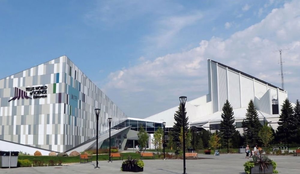
Hermitage Park and Rundle Park in the northeast both sit along the river valley, with paved trails, picnic areas and open space that rarely feels crowded. The TELUS World of Science in Coronation Park, northwest of downtown, is the main family attraction in this part of the city.
Skyview Centre along 137 Street in North Edmonton.
Getting around is straightforward if you have a car. Anthony Henday Drive rings the north side of the city, so you can reach the west end or cross to the south without going through the core.
The Capital Line LRT runs north to Clareview, and Edmonton Transit Service connects most of these neighbourhoods, though service is less frequent than in the centre. Our Edmonton Transit Service guide explains how fares and Arc cards work.
North Edmonton suits you if you are visiting family, you want a hotel with free surface parking rather than a downtown parkade, or you are heading somewhere north of the city: St. Albert, Fort Saskatchewan or the drive toward Elk Island National Park in the northeast.
Be realistic about the trade-off. If your plan is to walk to downtown attractions, restaurants and nightlife, North Edmonton will mean driving or a transit trip every single day. Choose it for a reason, not by default.
Explore North Edmonton →
West Edmonton
Yellowhead Trail and 170 Street in West Edmonton.
For many visitors, West Edmonton is synonymous with one attraction: West Edmonton Mall.
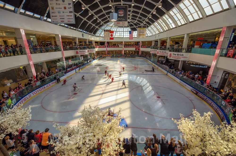
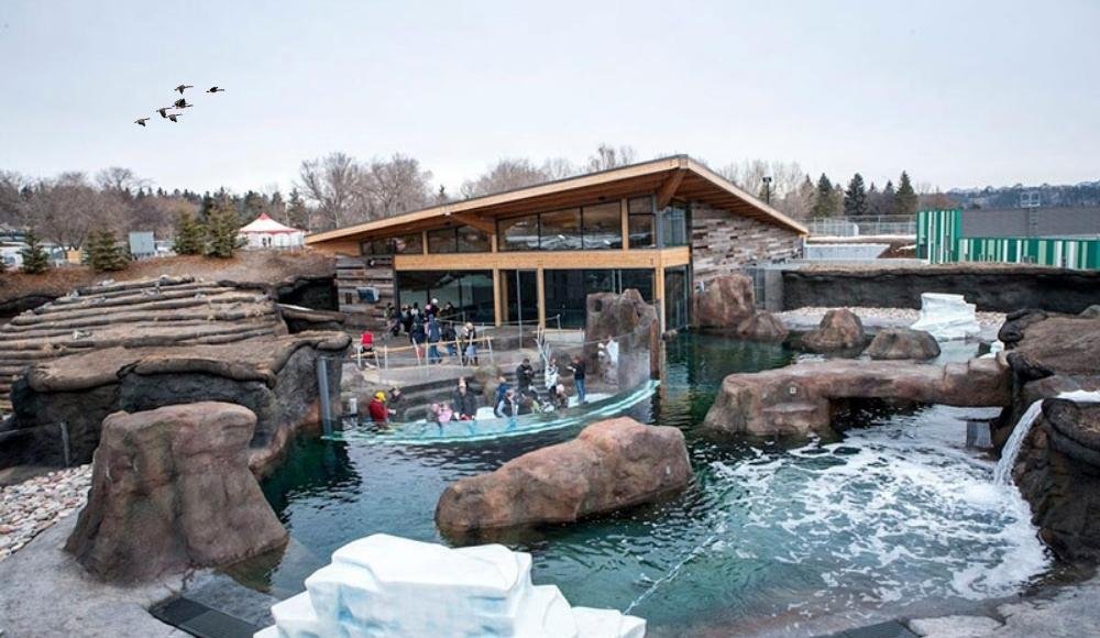
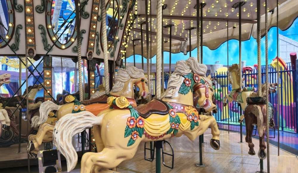
West Edmonton Mall opened in 1981 and is one of North America's largest shopping and entertainment complexes, with more than 800 stores and services. Calling it a mall undersells what it actually is: there is an indoor amusement park (Galaxyland), an indoor waterpark with a wave pool and slides, an ice rink, a sea lion habitat, a mini-golf course, two hotels attached to the property and more than 100 places to eat.
Families regularly build entire trips around it, particularly in winter when the weather makes outdoor plans unreliable. Our complete West Edmonton Mall guide covers tickets, timing and how to plan a day there without burning out.
The mall sits near 170 Street and 87 Avenue, and the surrounding area has developed around it. There is a large cluster of hotels within a few minutes' drive, at a wider range of prices than you will find downtown, and most of them have free parking, a real consideration if you are travelling by car. We keep an updated list of hotels near West Edmonton Mall if you are comparing options.
West Edmonton Mall, one of Edmonton's best-known shopping and entertainment destinations.
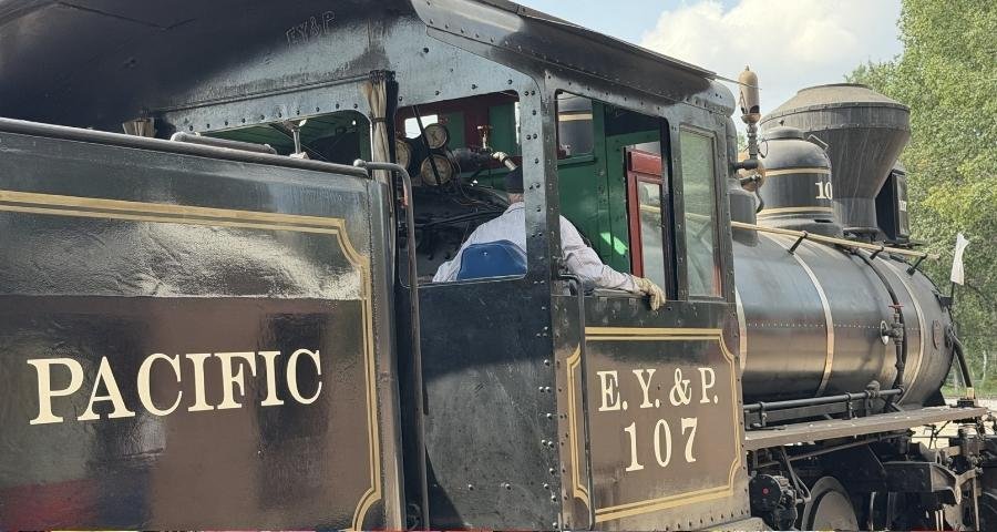
There is more out here than the mall, though. The Edmonton Valley Zoo sits in the river valley on the west side and is a manageable size for young children. Fort Edmonton Park, Canada's largest living history museum, is in the valley near Whitemud Drive, with costumed interpreters, four historical eras, a steam train and a midway.
Whitemud Park and the Terwillegar trail system are close by for walking and cycling. Beyond that, west Edmonton is made up of established neighbourhoods like Jasper Place, Meadowlark and Callingwood, and newer ones out toward Lewis Farms.
Road access is good. Whitemud Drive runs east-west across the south end of the area, Stony Plain Road heads into the core, and Anthony Henday Drive gets you around the city quickly. If you are continuing west toward Jasper, starting from here saves you crossing the whole city.
West Edmonton suits you if you are travelling with kids, you plan to spend more than a day at the mall, you want a hotel with easy parking, or shopping is a real part of your trip. More options are listed in our shopping and malls section.
One heads-up: Valley Line West LRT construction along 87 Avenue continues through 2026, with lane reductions between 161 Street and Anthony Henday Drive. When the line opens in 2028, it will connect the mall directly to downtown, but for now, budget extra driving time.
Explore West Edmonton →
South Edmonton
83 Street near Bonnie Doon, one of the key areas of Edmonton’s south side.
South Edmonton is the largest and most varied of the five areas, covering everything below the river from Terwillegar in the west across to Mill Woods in the east, and south to the city limits near Ellerslie and Heritage Valley.
It contains two different kinds of neighbourhood. There are established communities built from the 1960s through the 1980s (Mill Woods, Riverbend, Millbourne) and then a large band of newer development that has filled in over the past 20 years: Windermere, Summerside, Heritage Valley, Ellerslie, Terwillegar Towne.
The newer areas have wide roads, recent construction and shopping centres nearby. The older ones have mature trees and more established neighbourhoods.
The defining feature for visitors is retail. South Edmonton Common, near 23 Avenue and Gateway Boulevard, is one of the largest open-air shopping developments in North America, with big-box stores, restaurants and cinemas spread across a very large site. Southgate Centre, further north near 51 Avenue, is an enclosed mall connected directly to the LRT.
Mill Woods in the southeast is more established, while Windermere in the southwest is newer and quieter. Together, these areas have a wide range of shopping options and restaurants, including some of Edmonton's best South Asian, Filipino, and Vietnamese food in and around Mill Woods.
The river valley curves along the northern edge of the area, and the ravine systems reach further south than people expect. Whitemud Creek and the Terwillegar Park trails are genuinely good walking, and Snow Valley operates as a small ski and tube hill right inside the city limits in winter.
South Edmonton also has a large selection of newer hotels, particularly in the Gateway Boulevard and Ellerslie corridors, and it is one of the most convenient areas of Edmonton for reaching Edmonton International Airport, which sits about 30 km south near Leduc.
If you have an early flight, staying south saves you a long drive. The Valley Line LRT connects Mill Woods to downtown, and Route 747 links the airport to Century Park station.
South Edmonton suits you if you have a car, you want newer accommodation, you are doing serious shopping, you are visiting family, or you are flying out early. Compare options across the city in our where to stay section.
The one thing to watch: this area is enormous. A hotel in Windermere and a hotel in Mill Woods are both "south Edmonton" and roughly 25 minutes apart. Before booking, check the actual address against wherever you plan to spend your days.
Explore South Edmonton →
Which Area of Edmonton Is Best for Your Trip?
There is no single best area to stay in Edmonton. It depends entirely on what you came for and whether you are driving. This table compares the five areas of Edmonton at a glance.
Area
Best For
General Character
Downtown Edmonton
First-time visitors, events at Rogers Place, business travel, nightlife
Older, denser main streets on both sides of the river
North Edmonton
Visiting family, parking, heading north of the city
Mostly residential and spread out
West Edmonton
Families, shopping, West Edmonton Mall stays
Shopping and attraction focused, car friendly
South Edmonton
Shopping, newer hotels, early flights, longer stays
Very large and varied, driving essential
A few honest points that the table cannot capture:
Without a car, downtown or Old Strathcona are the practical choices. The LRT and bus network work well in the core and get thinner as you move outward.
With a car, the calculation flips. Parking is free and plentiful in the outer areas and costs money downtown.
Winter changes things. Between November and March, an indoor-heavy plan built around West Edmonton Mall, museums or the Muttart makes more sense than a walking-based itinerary.
Two nights in different areas is not a bad idea on longer trips: a couple of nights central, then a couple near the mall, for example.
Edmonton Areas at a Glance
Downtown: Central attractions, arena events, hotels and nightlife within walking distance.
Central Edmonton & Old Strathcona: Whyte Avenue, restaurants, cafés, arts, festivals and river valley access.
North Edmonton: Residential communities, everyday shopping, parks, and a base for trips north of the city.
West Edmonton: West Edmonton Mall, family attractions, and hotels with easy parking.
South Edmonton: The biggest shopping districts, newer hotels, and the closest area to the airport.
Frequently Asked Questions About Edmonton Areas
What are the main areas of Edmonton?
For visitors, Edmonton can be grouped into five main areas: Downtown, Central Edmonton & Old Strathcona, North Edmonton, West Edmonton, and South Edmonton. Each has a different mix of attractions, restaurants, hotels, and things to do.
Is Edmonton divided into quadrants?
Yes. Edmonton uses a street-address system with quadrant designations, with NW being the most common. However, the five-area approach in this guide is easier for visitors planning their trip.
What is the best area to stay in Edmonton for a first visit?
Downtown is a good choice for first-time visitors because it is close to major attractions, Rogers Place, the river valley, restaurants, and public transit. Old Strathcona is another great option for a livelier neighbourhood atmosphere.
Do you need a car in Edmonton?
You can get around without a car if you stay in Downtown or Old Strathcona. For exploring attractions across the city, however, having a car is more convenient.
How far is West Edmonton Mall from downtown?
West Edmonton Mall is about 15 km from downtown, usually taking around 20–30 minutes by car, depending on traffic and weather.
Which area of Edmonton is best for families?
West Edmonton is a popular choice for families because of West Edmonton Mall, Galaxyland, the World Waterpark, Fort Edmonton Park, and the Edmonton Valley Zoo.
Which area is closest to Edmonton International Airport?
South Edmonton is one of the most convenient areas for reaching Edmonton International Airport. Staying around Gateway Boulevard or Ellerslie can be useful for early flights.
Which area of Edmonton is best for nightlife?
Old Strathcona is one of the best areas for nightlife, with pubs, restaurants, live music and entertainment around Whyte Avenue. Downtown is another good option, especially around 104 Street and Rogers Place.
Conclusion on Edmonton Areas
Edmonton makes far more sense once you stop looking at it as one large city and start looking at it area by area. The distances stop being a surprise, the hotel choices start to mean something, and it becomes obvious why a stay near West Edmonton Mall feels nothing like a stay on Whyte Avenue.
Use these five Edmonton areas as your starting framework, pick the one that matches the trip you actually want, and then dig into the detail. Each area has its own full guide:
Most museums ask you to look at history through glass. Fort Edmonton Park asks you to walk down the middle of it, on wooden sidewalks, past shopfronts that look the way they did more than a hundred years ago.
I visited Fort Edmonton Park for a family day out, which turned out to be the right way to see it. We walked more than we expected, we got tired in places, and we found out the hard way which parts are worth planning around.
Inside one ticket, you can ride a steam train, walk through four different eras of the city, and lose half an hour to a midway game. The trick is knowing the order to do it in.
This guide covers what to see, how long you actually need, what tickets cost, and how to get there.
What Is Fort Edmonton Park?
Fort Edmonton Park is a living history museum in the river valley, run by the City of Edmonton and the largest of its kind in Canada. It works nothing like the other museums in Edmonton.
Instead of display cases, it is laid out as full-size historical settings you walk through in order: a fur trade fort, then three streets set in 1885, 1905, and 1920. An indoor Indigenous Peoples Experience covers thousands of years of history here before and after that timeline begins. The buildings are staffed by costumed interpreters who stay in the role of someone living in that period.
Why it matters to Edmonton is simple. Much of the city's early architecture is gone. This is where a lot of it still stands, either as original buildings moved here or as careful reconstructions.
My Visit to Fort Edmonton Park
The first thing I noticed is how big it is. This is not a two-hour attraction, and the walking distances between areas are real.
We started at the front entry and walked the historical streets rather than taking the train down first. By the time we reached the 1846 Fort at the far end, our legs were weak. The fort sits at the back, and walking there uses more energy than you expect.
What saved us was the horse-drawn wagon on 1885 Street. It passed the fort and carried on through the settlement era past Ottewell Farm, and sitting down for it was as much a rest as a ride.
We left the Midway for the way back, after the streets were done, and that was the right order. The games are addicting, and I would not have wanted to walk the streets afterwards.
Our last ride was the 1919 Baldwin steam train. It circles the park on its own track around the outside, unlike the streetcar, which runs along the historical streets themselves. Finishing on the train, sitting down and watching the park go past, was a good way to end.
This is mostly an outdoor site, so the weather you get is the visit you get.
Fort Edmonton Park Map
Things to Do at Fort Edmonton Park
What to expect in each area during the summer season, and roughly how long to give it.
Area
Good for
Suggested time
Indigenous Peoples Experience
All ages, indoor break
45–60 min
1846 Fort
History fans, kids
45–60 min
1885 Street
Everyone
45–75 min
1905 Street
Everyone
45–75 min
1920 Street
Families, food stops
60–90 min
Midway
Kids and teens
45–90 min
Train and streetcar
All ages
20–40 min total
Indigenous Peoples Experience
An indoor, interactive exhibit built with input from Treaty 6 First Nations and the Métis Nation of Alberta, covering the history and culture of Indigenous Peoples here well before the fur trade. It is the most modern space in the park and a good quiet break on a hot day. A market inside sells hand-crafted goods.
1846 Fort
A reconstruction of the Hudson's Bay Company trading post that gave the park its name. Inside the palisade gates are the trading room, workshops, living quarters, and the Chief Factor's house. Kids like it because the buildings are small and easy to explore, and adults get more from the interpreters. It sits at the far end of the site.
1885 Street
Edmonton as a small settlement finding its feet after the fort era, and the most rural of the three streets. Along it are Kelly's Saloon, Lauder's Bakery, Ottewell Farm and its animals, and McDougall's General Store, which sells pioneer goods and ride tickets. The horse-drawn wagon runs here.
1905 Street
By 1905, Alberta was a province, and Edmonton was growing fast. This street shows that, with larger buildings and a busier main-street feel. The Masonic Hall operates as a food hall, a practical lunch stop halfway through the park. The change from 1885 to 1905 is the clearest jump here.
1920 Street
The largest and busiest street, closest to a recognizable modern city. It has the Capitol Theatre, Hotel Selkirk, Johnson's Cafe, Bill's Confectionery, and Tom Thumb Mini Golf. Families spend the most time here, partly for the food and partly because there is more to do than walk.
The Midway and Exhibition
The fairground area. Admission covers unlimited rides and games, and it is the part of the ticket I rate highest.
Kids and teenagers will push for this section, and it works as a reward for getting through the streets first. Fair warning: the games are addicting, and you will spend longer here than you plan. The Treasure Trove candy store is here too.
Train and Streetcar Rides
Two different experiences, both worth doing. The 1919 Baldwin steam train runs on about four kilometres of track from the front entry station to a platform at the back near the 1846 Fort. The streetcar line is roughly one kilometre, with stops on 1905 and 1920 Streets, running along the streets rather than around.
Both are included and work as transport. The streetcar takes no strollers, walkers, or wheelchairs; the steam train is wheelchair-equipped.
Wagon, Pony, and Carriage Rides
The horse-drawn wagon at Kelly's Saloon on 1885 Street. This is the wagon starting point and last stop.
The one thing not covered by your ticket, and it caught me out. Pony rides for children 10 and under and horse-drawn wagon rides both cost $8 per person; children 2 and under are free on the wagon. The wagon runs along 1885 Street past Ottewell Farm. Buy tickets online or at McDougall's General Store.
The midway costs nothing extra, so it is easy to assume the wagon does too. I would still pay it: arriving there with tired legs, sitting down behind a pair of horses was worth $8.
A private vis-à-vis carriage ride, about 20 minutes, covers a wider part of the park on selected dates. The park also keeps horses, ponies, donkeys, goats, pigs, sheep, chickens, and turkeys, and asks you not to feed them.
One safety note from my visit: I went to rub a horse from behind and was corrected straight away. Approach from the front and rub the forehead. Standing behind a horse puts you where it can kick.
Capitol Theatre and Events
The Capitol Theatre runs programming through the season. There is also an escape game, weekend brunch at Johnson's Cafe, and summer stays at Hotel Selkirk. Check the calendar before booking.
Food and Shops
Food is spread across the site:
Front entry: café and gift shop
1885 Street: Kelly's Saloon, Lauder's Bakery, McDougall's General Store
Johnson's Cafe in Hotel Selkirk is the only sit-down option. The I.A.M Collective and the Indigenous Market sell hand-crafted Indigenous goods.
What I Liked About Fort Edmonton Park
The strongest thing here is the structure. Moving from 1846 to 1920 gives the visit a shape a normal museum cannot match. You feel the city changing under your feet.
I also liked that most extras are included. Unlimited midway rides and games, the train, and the streetcars are covered by admission. The horse-drawn wagon is the exception.
Variety is the other strength: an indoor exhibit, four historical areas, a fairground, mini golf, farm animals, live theatre, and places to eat. Having three different ways to ride around it matters more than it sounds, because it lets you keep going once the walking catches up with you. The river-valley setting helps, too, since the city noise mostly disappears.
Is Fort Edmonton Park Worth Visiting?
Yes, for most people, as long as you give it enough time and go in the summer.
You will probably enjoy it if you are:
A family with kids roughly 4 to 12, who get the most from the interpreters, animals, and rides
Someone interested in Edmonton or Western Canadian history
A visitor with a couple of days in the city, working through an Edmonton itinerary
A local who last went on a school trip
You may want to skip it if:
You have only a couple of hours, or you are out with toddlers. The Edmonton Valley Zoo is an easier day at that age
Mobility is a concern. The site is large, only partly accessible, and several historic buildings are hard or impossible to enter with a wheelchair
You are visiting in fall or winter and expect the full park. Only the Indigenous Peoples Experience stays open then
One more honest note: the price is not small for a family, and rain would take a lot away from the day.
How Long Do You Need at Fort Edmonton Park?
The park's own advice is at least four hours, and that is fair.
2 to 3 hours. The Indigenous Peoples Experience, the train, and one or two streets. You will skip most buildings.
Half a day, 4 hours. All four historical areas at a decent pace, the train, a streetcar, and a meal.
Most of a day, 5 to 7 hours. What I would recommend: time to go inside buildings, talk to interpreters, eat properly, and let kids loose on the Midway.
Best Time to Visit Fort Edmonton Park
Season matters here more than at almost any other Edmonton attraction.
Summer is when the full park operates: 10:00 AM to 5:00 PM, Wednesday through Sunday plus holiday Mondays, closed Mondays and Tuesdays. Last admission is an hour before closing. Watch the tail end of the season: in 2026 the Wednesday-to-Sunday schedule runs to early September, then the final stretch is Saturdays and Sundays only, September 12 to 20.
Fall and winter are limited. The general park closes, and select exhibits such as the Indigenous Peoples Experience stay open on reduced schedules. Ticketed events still run through the off-season, including winter wagon rides, Indigenous storytelling, and seasonal evening events, but do not arrive in November expecting to walk 1905 Street.
Aim for a weekday in July or August, or one of those September weekends once crowds thin. If you are planning around Alberta as a whole, the same months work. Arrive close to opening, since the main lot fills by afternoon.
Fort Edmonton Park Tickets and Admission
Buy online in advance. The gate sells tickets too, with cash, debit, Visa, or Mastercard, but capacity can limit that on busy days.
The rates posted at the gate for 2026, with 10% off all summer. GST is added on top.
Ticket
Posted
With 10% off
Adult
$31.00
about $27.90
Child
$24.75
about $22.28
Senior
$24.75
about $22.28
Family pass (2 adults, up to 4 children)
$112.00
about $100.80
Children 2 and under are free but still need a ticket. The family pass only beats separate tickets once you have three or more children.
Admission includes unlimited midway rides and games, the train, and the streetcars. Pony and wagon rides are $8 per person on top.
It is not a cheap day out, so if the budget is tight, check out the free things to do in Edmonton article. Prices change between seasons, so check the official site. Tickets are non-refundable but can usually be exchanged for another date, Leisure Access Passes are accepted in summer, free admission is extended to Indigenous Peoples, and group discounts exist. A membership pays for itself in two or three visits.
How to Get to Fort Edmonton Park
The park is at 7000 143 Street NW, Edmonton, down in the river valley on the south side.
Driving. Take Fox Drive to Fort Edmonton Park Road and follow it in. Parking is free, but the main lot fills by afternoon. An overflow lot sits near the administration building.
Public transit. No regular bus drops you at the gate. Get to the South Campus/Fort Edmonton Park Transit Centre by LRT or bus, then book an On Demand Transit trip. Check fares on the City of Edmonton site.
Cycling. The park connects to the river valley trail system, and it is too far to walk from anywhere.
Tips for Visiting Fort Edmonton Park
Check the calendar first. The park is closed Mondays and Tuesdays, and the season is shorter than people assume.
Arrive within the first hour of opening. Easier parking, quieter streets, more attention from interpreters.
Wear shoes you can walk in all day. You will cover several kilometres on gravel, boardwalk, and grass.
Take the steam train down to the fort first. We walked instead and paid for it. Riding down and walking back saves your legs for the streets.
Save the Midway for the end. The historical streets are harder to face after the games.
Dress for changing weather. A hat, sunscreen, and a layer for wind or rain all earn their place.
Download the park app. Buildings occasionally close for maintenance, and the app shows what is open.
Plan your food stop around the map. Sit-down dining is on 1920 Street and the food hall on 1905 Street, so eating at the wrong moment means walking back.
Talk to the interpreters. A direct question is the difference between looking at old buildings and learning something.
Budget $8 each for the wagon ride, and bring a stroller for small kids. The wagon doubles as a sit-down break near the far end of the park. Stroller rentals are not available, and strollers are not allowed on the streetcar.
Fort Edmonton Park vs. Other Edmonton Attractions
The Royal Alberta Museum gives you the province's story indoors in a couple of hours, in any weather. Muttart Conservatory is a focused, ninety-minute visit. West Edmonton Mall is an all-weather day of shopping and rides with no historical angle at all.
Of the main attractions in Edmonton, this is the only one where the draw is a place rather than a collection: you are not looking at Edmonton's history, you are inside a version of it. It also depends far more on the season, which is the main thing to weigh when you pick a date.
Frequently Asked Questions
Is Fort Edmonton Park worth visiting?
Yes, if you go in summer and give it at least four hours. First-timers and lifelong Edmontonians both get something out of it.
How long should I spend at Fort Edmonton Park?
Four hours is the practical minimum; five to seven is better, especially with kids.
What can you do at Fort Edmonton Park?
Explore four historical areas and the Indigenous Peoples Experience, ride a steam train and streetcars, go on midway rides and games, play mini golf, see farm animals, eat at period restaurants, and shop.
Are wagon rides included in the admission?
No, they are $8 per person, as are pony rides. Midway rides and games, the steam train, and the streetcars are included.
Is Fort Edmonton Park good for families?
Very good. Children roughly 4 to 12 get the most out of it, and admission covers the rides and transport that would normally cost extra.
What is the difference between the train and the streetcar in Fort Edmonton Park?
The steam train loops around the park on its own track between the front entry and the 1846 Fort. The streetcar runs along 1905 and 1920 Streets. Both are included and show you different parts of the site.
Is Fort Edmonton Park indoors or outdoors?
Mostly outdoors. Many buildings are open to enter, and the Indigenous Peoples Experience is indoors, but the walking happens outside.
Can you visit Fort Edmonton Park in winter?
Only in a limited way. The general park closes and select exhibits stay open on reduced schedules. Ticketed seasonal events do run.
Where is Fort Edmonton Park located?
At 7000 143 Street NW, in Edmonton's river valley on the south side, reached from Fox Drive.
Final Verdict
Fort Edmonton Park earns the time it asks for. A plan, comfortable shoes, and a free afternoon make the difference between a decent day and a good one. Pace yourself, and use the rides.
I would recommend it most to families with school-age kids, to anyone curious about how Edmonton grew from a trading post into a city, and to visitors who have done the obvious stops. I would not squeeze it into a spare couple of hours, and I would check the forecast first.
Ask an Edmontonian to name the buildings that define their city, and the four glass pyramids in the river valley come up almost every time. The Muttart Conservatory has been part of Edmonton's skyline for decades, and it remains one of the city's most rewarding places to spend a couple of hours.
Even after living in Edmonton for years, walking into the Muttart Conservatory still feels like stepping into something new. You step out of a prairie winter or a windy spring day, and within a few minutes you are standing under palm leaves in air so warm and humid that it can fog your glasses.
That contrast is the whole magic of the place. It is one of the best indoor attractions Edmonton has, and it earns a spot on any Edmonton itinerary, summer or winter.
This guide covers what each pyramid is like, how to get there, tickets, accessibility, photography, food nearby, and the practical tips that make a visit go smoothly.
About this guide: During my visit to Muttart Conservatory, I spent about two hours exploring all four pyramids without feeling rushed. Every photo in this guide was taken during my visit. What follows combines that first-hand experience with practical advice to help you plan your own trip.
Quick Facts
Location: 9626 96A Street, Edmonton, in the North Saskatchewan River Valley
The 4 glass pyramids: Tropical, Temperate, Arid, and a rotating Feature pyramid
Open every day of the year except December 25
On-site parking: On-site.
Typical visit: 1 to 2 hours
What is Muttart Conservatory?
The Muttart Conservatory is Edmonton's botanical garden, housed inside four glass pyramids on the south bank of the North Saskatchewan River.
Three pyramids each recreate a different climate zone, and the fourth changes its entire display several times a year. Together they hold hundreds of plant species, cared for year-round by City of Edmonton horticulture staff.
History
The Muttart Conservatory opened in 1976 and was named after the Muttart Foundation, which helped fund its construction. After a major renovation between 2018 and 2021, it reopened with improved accessibility, a new restaurant, and refreshed displays while preserving its four iconic glass pyramids. Today, it's one of Edmonton's best-known landmarks, with generations of locals returning for everything from family outings to wedding and graduation photos.
Architecture
Designed by renowned Edmonton architect Peter Hemingway, the conservatory features four separate glass pyramids, each with its own climate-controlled environment. This innovative design allows visitors to experience tropical, temperate, arid, and seasonal displays in one visit, while the illuminated pyramids have become one of Edmonton's most recognizable sights, especially after dark.
The four glass pyramids
Two large pyramids and two smaller ones sit around a central indoor courtyard, with a fifth, much smaller pyramid above it as a skylight. Each display pyramid has its own temperature, humidity, and lighting, so walking between them feels like crossing continents in ten steps.
Why it's unique in Canada
Plenty of Canadian cities have conservatories. None look like this. The pyramid architecture, the river valley setting, and the rotating Feature pyramid make the Muttart one of a kind, and it is one of the few botanical attractions in Canada that is genuinely better in winter, when the contrast with the cold outside is strongest.
Where is Muttart Conservatory?
The Muttart sits at 9626 96A Street, directly across the river from downtown Edmonton, in Cloverdale, a quiet river valley neighbourhood beside Gallagher Park, home of the Edmonton Folk Music Festival every August.
Driving
From downtown, it is about a five-minute drive across the river; from West Edmonton Mall or the south side, plan for 15 to 25 minutes. Once you are in the river valley, the pyramids are impossible to miss.
Transit
The Valley Line LRT has its own Muttart stop, a short walk from the entrance, and two bus stops serve the area. If you are staying downtown without a car, the LRT is the simplest option.
Parking
Parking is available on site, and the lot is conveniently located right beside the conservatory. During my visit, visitors were required to register their vehicle's licence plate inside the building to receive complimentary parking, so don't forget to do this before you start exploring.
The lot can fill up on weekend afternoons and during popular Feature Pyramid shows, so arriving earlier in the day is a good idea.
Walking and cycling
The Muttart connects directly to Edmonton's river valley trail system. In summer, walking or biking from downtown across the Low Level Bridge is a genuinely nice trip. For directions, search "Muttart Conservatory" on Google Maps.
Getting There
Details
Address
9626 96A Street, Edmonton, AB
Neighbourhood
Cloverdale, in the river valley
Driving from downtown
About 5 minutes
LRT
Valley Line, Muttart stop
Parking
On-site parking is available
Walking
Connected to river valley trails
The Four Pyramids
The pyramids are the reason you come. Here is what to expect in each one.
Tropical Pyramid
Click on an image to expand.
This is the big one, and it was my favourite. Walking in felt like stepping into another country: warm, heavy, humid air, winding paths, and greenery thick enough to make you forget you are still in Edmonton. It smells green in there, like soil and leaves and growing things, and it fogs camera lenses and glasses instantly.
Inside are palms, banana plants, orchids, and plants you normally only see in produce aisles, including a papaya tree that sometimes carries real fruit. A waterfall anchors the space, and the sound of moving water follows you around the path.
The tropical pyramid is at its best in January and February. Standing in jungle humidity while snow slides down the glass above you is a strange and wonderful experience, and the single best argument for visiting in winter.
Photography here is rewarding but tricky: give your lens a few minutes to warm up, or everything will be fog. Who will enjoy it: everyone, especially anyone stuck in an Edmonton winter.
Temperate Pyramid
Click on an image to expand.
The temperate pyramid feels the most familiar to Canadians, holding plants from climates like ours and slightly milder ones across Australia, Asia, and North America. The air is comfortable, neither hot nor humid, a nice place to slow down after the tropical pyramid.
It also has a lovely pond, which became one of our favourite spots. Watching the colourful koi swim beneath the reflections of the glass overhead was surprisingly relaxing, and it is exactly the kind of thing you miss if you rush through.
This pyramid changes with the seasons more than the others. Spring brings blossoms, autumn brings colour changes, and the gardeners rotate displays through the year. Repeat visitors often say this is the pyramid that rewards coming back.
It is also the calmest of the four. There are benches throughout the conservatory, and this is the pyramid where you will most want to use one, with a few quiet minutes among the trees. Who will enjoy it: garden lovers, seniors, and anyone who wants a peaceful corner.
Arid Biomes Pyramid
Click on an image to expand.
The arid pyramid flips the script: dry air, warm light, and an entire landscape of cacti, succulents, and desert plants from Africa, the Americas, and Australia. Some of the cacti are enormous, far bigger than anything you can grow on a windowsill, and the shapes and textures are fantastic to look at up close.
The light in this pyramid is beautiful, especially on sunny afternoons when shadows from the glass panels fall across the sand and stone. It tends to photograph better than you expect.
One practical note: the arid pyramid has some steps and uneven sections, so it is the least accessible of the four. There is still plenty to see from the main path. Who will enjoy it: photographers, kids who think cacti are cool (most kids), and anyone curious about desert plants.
Feature Pyramid
Click on an image to expand.
The feature pyramid is the wild card. Its entire display changes several times a year, built around a theme or season. Past shows have covered everything from prehistoric plants to harvest scenes and holiday displays.
During my visit, the Feature Pyramid had a themed seasonal display that completely transformed the space. One of the things I like most about the Muttart is that this pyramid changes throughout the year, giving returning visitors a different experience each time.
The feature pyramid is the reason locals buy annual memberships and come back every couple of months. Check the official website to see what is on before you go.
Did You Know? A fifth, smaller pyramid sits above the central courtyard. It works as a skylight, flooding the space between the four display pyramids with natural light.
What Surprised Me Most
What surprised me most wasn't the plants—it was how peaceful the Muttart Conservatory felt. Even with other visitors around, everyone seemed to slow down and enjoy the surroundings. Each pyramid had its own personality, making every transition feel like a new adventure rather than another greenhouse.
I also didn't expect to take so many photos. The changing light through the glass, colourful plant life, koi pond, and unique architecture kept giving me new scenes to capture. My daughter especially enjoyed the fish, flowers, and different environments, and before we knew it, two hours had flown by.
The Muttart offers more than beautiful gardens. Thoughtful amenities like Café Bloom, the gift shop, and seasonal Feature Pyramid displays make it easy to spend a relaxed afternoon here.
Best Time to Visit
The honest answer: there is no bad time, but some times are clearly better.
By season, winter is the sleeper pick. The tropical pyramid feels like a vacation when it is minus twenty outside, and the pyramids look beautiful in snow. Spring and fall bring the best temperate pyramid displays. Summer works too, paired with river valley walks, but July in Edmonton has a lot of competition.
By weekday, Monday through Thursday mornings are the quietest. Weekends are busiest, especially Saturday and Sunday afternoons and any weekend during a popular feature show.
Morning versus afternoon: mornings win for quiet and for photography without crowds. Afternoons win for light in the arid pyramid.
Rainy days are perfect. The Muttart is one of the best attractions in Edmonton, and a grey, wet day outside makes the pyramids feel even more like a refuge.
One more thing: Wednesday evenings are adults-only at the Muttart, which locals use for date nights. If you are planning an evening visit with kids, pick a different night and check current evening hours on the official website first.
When
Crowd Level
Best For
Weekday mornings
Low
Quiet visits, photography
Weekday afternoons
Low to medium
Flexible visits
Weekend mornings
Medium
Families beating the rush
Weekend afternoons
High
Expect crowds during feature shows
Winter days
Varies
The tropical-pyramid-in-a-blizzard experience
Wednesday evenings
Low
Adults-only visits and date nights
How Long Does It Take?
Visitor Type
Recommended Time
Best For
Quick Visit
45–60 minutes
Seeing all four pyramids at a relaxed pace.
Most Visitors
1.5–2 hours
Exploring every pyramid, reading displays, and taking photos.
Photography Enthusiasts
2–3 hours
Waiting for good lighting, letting lenses adjust to humidity, and capturing different angles.
Families
2+ hours
Exploring at a child's pace, visiting the Feature Pyramid, and stopping at Café Bloom or the gift shop.
Local tip: The Muttart Conservatory isn't a full-day attraction. Pair it with the Royal Alberta Museum, the Edmonton River Valley, or the Alberta Legislature Grounds to create a memorable half-day or full-day Edmonton itinerary.
Tickets
You can purchase tickets online or inside the facility. Ticket prices are reasonable, roughly in line with a museum visit, and kids under two are free. Family rates are available, and the feature pyramid shows are included with general admission.
Prices change from time to time, so check the official City of Edmonton Muttart Conservatory page for current rates rather than trusting numbers in any article. You can buy tickets online with a timed entry or at the door. Walk-ups are welcome, but booking online is smart on weekends and during popular shows.
If you live in the Edmonton area, look at the annual membership. It pays for itself in a few visits, and the rotating feature pyramid gives members a different experience each time. Combo discounts exist with other city attractions, so ask if you already hold a zoo or attractions pass.
Budget Tip The LRT stops at the door and parking is free if you drive. So getting there costs little. Watch the city's website and social channels for occasional special admission days too.
Facility Hours
The Muttart is open year-round, every day except December 25. Doors open mid-morning, and on Wednesdays and Thursdays the conservatory stays open into the evening, which is when it is at its most atmospheric: the pyramids glow, and the crowds thin out. Wednesday evenings are reserved for adults only. Last admission is 30 minutes before closing.
Exact opening and closing times shift occasionally with seasons and events, so confirm current hours on the official City of Edmonton website before you go, especially for an evening visit.
Hours at a Glance
Details
Open
Every day of the year except December 25
Evenings
Extended hours on Wednesday and Thursday
Wednesday evenings
Adults only
Last admission
30 minutes before closing
Exact times
Check the official website before visiting
Accessibility
The Muttart Conservatory is one of Edmonton's more accessible attractions. The entrance, central courtyard, and the Tropical, Temperate, and Feature pyramids are wheelchair-friendly, with wide, mostly level paths throughout. Accessible washrooms are located near the lobby.
The Arid Pyramid is the only exception. It includes a few steps and uneven sections, so it is only partially accessible, although much of the display can still be viewed from the main path. Strollers can access the rest of the conservatory without difficulty, making it a good choice for families with young children.
Benches are available throughout the conservatory for anyone who wants to take a break, and the single-level layout makes it easy to move between the pyramids. If you have specific accessibility questions, call 311.
If you have specific accessibility questions, call 311 in Edmonton or check the accessibility section of the official page before your visit.
Photography Tips
The Muttart is one of the most photogenic indoor spaces in Alberta, and it will punish you if you are not prepared for the humidity. I went in planning to take a handful of photos and left with far more than I expected. The sunlight through the glass creates light and shadow patterns all through the building, and it makes shooting here more enjoyable than most indoor attractions.
Best pyramid: tropical for lush, dense frames; arid for clean shapes, texture, and dramatic light.
Lens fog is the big enemy. Your gear comes in cold and hits warm, wet air. Let your camera or phone sit for five to ten minutes in the tropical pyramid before shooting, and keep a microfibre cloth in your pocket.
Best lighting: late morning to mid-afternoon on sunny days, when light through the glass panels creates strong shadow patterns, especially in the arid pyramid.
Camera settings: bump your ISO rather than using flash. Flash flattens the plants and bothers other visitors. A wide aperture helps isolate single blooms like orchids.
Phone photography: portrait mode on orchids and cacti works surprisingly well. Wipe your lens often; humidity smears build up fast.
Shoot up. The pyramid geometry overhead, with leaves against the glass grid, makes some of the best frames in the building.
Outside, the trails toward the river give you the pyramids-plus-skyline shot. Blue hour, when the pyramids glow from inside, is the money shot.
Be respectful: stay on paths, never move or touch plants for a photo, and give other visitors space. Tripods can be awkward on busy days; if a professional shoot is your goal, contact the Muttart about their photo policies first.
Photography Tip If winter photography is your thing, visit during or right after a snowfall. Snow sliding down the glass above the tropical canopy is a shot most people never think to look up for.
Tips Before You Visit
Dress in layers. You will move between a jungle, a desert, and a mild zone, and a heavy winter coat becomes a burden fast.
Use the coat hooks or carry a light bag so your hands are free.
Book online for weekend visits and popular feature shows; walk up on quiet weekdays.
Check what the feature pyramid is showing before you go. It changes several times a year and shapes the whole visit.
Go on a weekday morning if you want the place close to yourself.
Give your camera time to defog in the tropical pyramid before judging your shots.
Wear glasses? Expect them to fog on entry. It passes in a minute.
Start with the tropical pyramid and save the feature pyramid for last.
Build in time to just sit. The courtyard and temperate pyramid benches are half the experience.
Bring a water bottle; the tropical pyramid is genuinely warm.
Kids' energy burns fast in the humidity, so plan a snack stop at Cafe Bloom.
The gift shop sells live plants. In winter, ask them to wrap plants for the trip to the car, because tropical plants and minus twenty do not mix.
Pair your visit with a river valley walk in summer or the Royal Alberta Museum in winter.
Remember Wednesday evenings are adults-only, and confirm evening hours online before planning a night visit.
Visiting at Christmas time? The Muttart is open every day except December 25, and the holiday feature shows are popular, so book ahead.
Locals: price out a membership if you think you will come twice or more in a year.
Family Tip The Muttart runs drop-in programs for preschoolers on weekday mornings, and the feature shows are often built with kids in mind. Regular admission covers the programs, so a toddler morning here is one of the best-value activities in Edmonton.
Who Should Visit?
Families: yes, strongly. I visited with my daughter, and the mix of flowers, koi, and changing environments held her interest the whole way through. Wide paths and kid-focused feature shows help too. If you're travelling with children, don't miss my guide to Family Attractions in Edmonton for Kids.
Couples: yes. The Wednesday adults-only evenings exist for a reason, and Cafe Bloom's dinner events make it a proper date.
Photographers: yes, with the fog warnings above taken seriously.
Garden lovers: obviously. Plan extra time to read every label.
Tourists: yes. It is one of the few attractions that shows you something you cannot see in most other Canadian cities.
Locals: yes, especially with a membership, since the feature pyramid resets the experience a few times each year.
Kids: the tropical waterfall, giant cacti, and themed shows do the work for you.
Seniors: comfortable, mostly flat, plenty of seating, and quiet on weekday mornings.
Who might find it underwhelming: anyone expecting acres of outdoor gardens. The Muttart is compact and indoors, which is its strength in winter and its limit in summer.
Nearby Attractions
The Muttart sits in the middle of Edmonton's best sightseeing corridor, so if you are building a list of things to do in Edmonton, it pairs easily with several of them in a single day.
Café Bloom (on site): The most convenient option for coffee, snacks, lunch, and seasonal dinner events.
Little Brick (Riverdale): A charming café in a historic house, perfect for brunch or coffee after your visit.
Old Strathcona / Whyte Avenue: Just 5–10 minutes away, with everything from casual cafés to upscale restaurants.
Downtown Edmonton: A wide selection of restaurants, including the historic Hotel Macdonald for a special meal with river valley views.
Hours and menus can change, so check the restaurant's website before your visit, especially for Café Bloom's seasonal dinner events.
Frequently Asked Questions
How long do you need at the Muttart Conservatory?
Most people spend 1 to 2 hours. A quick walk-through takes 45 minutes; photographers and families should plan for two hours or more.
Is the Muttart Conservatory worth visiting?
Yes, especially in winter, when the tropical pyramid feels like a two-hour vacation. It is compact, so expect a rich 90 minutes rather than a full day.
Is the Muttart Conservatory open in winter?
Yes. It is open every day of the year except December 25, and winter is arguably the best season to visit.
How much does it cost?
Prices are similar to a museum admission, with discounts for kids, and children under two are free. Check the official City of Edmonton website for current rates, since they change periodically.
Do I need to book tickets in advance?
Not usually. Walk-ups are welcome. Booking a timed entry online is smart for weekends, holidays, and popular feature pyramid shows.
Is parking free at the Muttart Conservatory?
Yes, but the lot can fill up on weekend afternoons, and the LRT is a good alternative.
Can you get there by LRT?
Yes. The Valley Line LRT has a Muttart stop, a short walk from the entrance.
Is the Muttart Conservatory good for kids?
Very. Paths are stroller-friendly, feature shows are often kid-themed, and weekday preschool drop-in programs run in the mornings.
Is it wheelchair accessible?
Mostly, yes. The entrance, courtyard, and three of the four pyramids are accessible. The Arid pyramid has steps and is only partially accessible.
What are the four pyramids at the Muttart?
Tropical, Temperate, Arid, and the Feature pyramid, which changes its entire display several times a year.
Can you take photos inside Muttart Conservatory?
Yes, and it is a photographer's favourite. Expect lens fog in the tropical pyramid, skip the flash, and contact the Muttart first if you are planning a professional or wedding shoot.
Is there food at the Muttart Conservatory?
Yes. Cafe Bloom operates on site, serving lunch and hosting special dinner events in the colder months.
Are dogs allowed?
No, only service animals. Pets stay home for this one.
How old is the Muttart Conservatory?
It opened in 1976 and was fully renovated between 2018 and 2021.
Is the Muttart busy?
Weekday mornings are quiet. Weekend afternoons and popular feature shows draw crowds. Wednesday evenings are adults-only and generally calm.
Can you see the Muttart pyramids without paying?
From outside, yes. The nearby river valley trails offer free views, but the plants are all inside the paid area.
Final Verdict on Muttart Conservatory
The Muttart Conservatory may sound simple on paper—four glass pyramids filled with plants—but after exploring it, I left with a completely different impression.
From the warm, fragrant eucalyptus trees in the Tropical Pyramid to the cooler alpine displays and ever-changing seasonal exhibits, every pyramid offers a different perspective on the world's remarkable plant life. It's easy to see why the Muttart has become one of Edmonton's most recognizable landmarks.
I recommend visiting if you're travelling with children, enjoy photography, appreciate nature, or simply want a peaceful escape from the city's pace. It's especially rewarding during the colder months, when stepping from an Alberta winter into a lush tropical environment feels almost surreal. If you're hoping for a sprawling outdoor botanical garden, this may not be the right attraction, but if you enjoy discovering unique places at a relaxed pace, the Muttart Conservatory is well worth your time.
One thing I tell visitors is that you do not need to spend much money to enjoy Edmonton. Some of my favourite days here have cost nothing at all. A walk through the river valley, an afternoon on Whyte Avenue, or an evening watching the Legislature grounds light up in winter can be just as memorable as any paid attraction.
Edmonton has one of the largest stretches of urban parkland in North America, a free downtown funicular, a museum you can visit at midnight, and a library that surprises almost everyone who walks in. Most of these places sit close together, so you can see several in a single day without a car.
This guide covers the 10 best free things to do in Edmonton, based on my own visits over the past years. For each one, I explain why it is worth your time, when to go, and the small details that first-time visitors usually miss.
Whether you're looking for free attractions in Edmonton, free activities in Edmonton, or simply want to explore the city without spending much money, these local favourites deliver excellent value.
Quick Comparison: Free Things to Do in Edmonton
If you're wondering which free attractions in Edmonton are worth your time, this quick comparison will help you choose the right ones for your trip.
All ten attractions and activities are completely free to enjoy. Parking is free at most locations too, and I point out the exceptions throughout the guide.
1. Alberta Legislature Building
The Legislature building is one of the first places I take friends who are visiting Edmonton for the first time. The building itself is over a hundred years old, with a sandstone dome you can see from across the river valley, and the grounds around it are some of the best-kept public spaces in the city.
Why It Made My List
Free guided tours run year-round inside the building, and they are genuinely good. The guides know their history and take you through the rotunda, the marble staircases, and the chamber where Alberta's laws are passed. I have done the tour three times over the years, usually with out-of-town family, and I still notice something new each visit.
Outside is where the Legislature really earns its spot, though. In summer, the wading pools and fountains on the south grounds turn into an unofficial splash park.
On a hot July afternoon, you will see hundreds of kids running through the water while parents relax on the grass. It is one of the few places in any Canadian capital where you can wade in a fountain in front of the seat of government, and nobody minds.
When I Go
Summer weekday afternoons are ideal if you want the fountains without heavy crowds. In December, the grounds are covered in thousands of Christmas lights, and I would honestly rank the light display among the best free things to do in Edmonton in winter. Dress warm and walk the full loop around the building.
Tips From My Visits
Tours are free, but check the schedule online before you go, since times change on weekends and holidays.
The pedway under the grounds connects to the Federal Building, which has a free interpretive centre and clean washrooms.
Street parking nearby is metered on weekdays, but the Grandin/Government Centre LRT station is right there, so transit is the easier option.
Bring towels in summer if you have kids. They will end up in the water whether you planned it or not.
Nearby, you can walk down into the Edmonton River Valley, where hundreds of kilometres of trails connect many of the city's parks and viewpoints. Or head east along the top of the bank toward the funicular, which is next on this list.
2. 100 Street Funicular
Edmonton built a free outdoor funicular in 2017, and I still think most visitors do not know it exists. It is a glass elevator on rails that carries you down the steep river valley bank from downtown to the trails below, and it costs nothing to ride.
I will be honest: I am not great with heights, and the glass walls made me hesitate the first time. But the ride is short, smooth, and over in about a minute, and the view on the way down is worth the sweaty palms. If I can do it, anyone can.
The View Is the Real Attraction
At the bottom of the funicular, a long staircase and lookout platform called the Frederick G. Todd Lookout extends out over the valley.
From there you get a clear view of the North Saskatchewan River, the Walterdale Bridge with its big white arches, and the treed slopes on both sides. In late September, when the aspens turn yellow, this is one of the best free views in the city.
How I Recommend Doing It
Ride the funicular down, walk to the lookout, then follow the stairs and paths down to the river if you have energy. You can walk along the water toward the Walterdale Bridge and loop back up. The funicular runs daily and is fully accessible, which makes it a good option for strollers and wheelchairs that could never handle the old wooden stairs.
A few practical notes from my trips:
It occasionally closes for maintenance, especially in freezing rain. Check the City of Edmonton site if it is a special trip.
Early mornings are quiet. Summer evenings get busy with joggers and photographers.
The top station is at 100 Street and Macdonald Drive, a short walk from the Hotel Macdonald, which is worth seeing from the outside on its own.
Pair this stop with the Legislature and Victoria Promenade for an easy half-day walking route along the top of the valley.
3. Churchill Square
Churchill Square is Edmonton's main downtown gathering space, sitting between City Hall, the art gallery, and the Winspear Centre. On an ordinary weekday, it is a wide open plaza where office workers eat lunch. During festival season, it becomes the busiest free entertainment venue in the city.
What Happens Here
Edmonton calls itself a festival city, and Churchill Square is where that reputation gets earned. Through the summer, the square hosts a rotating lineup of free events: Canada Day celebrations, food truck gatherings, cultural festivals, and outdoor concerts. I have wandered through the square on a random Saturday and stumbled into live music more times than I can count.
City Hall, on the north side, is open to the public and free to walk through. The pyramid-shaped glass roof looks great from inside, and in winter the fountain out front becomes a small free skating rink. If you have skates, it is a classic Edmonton experience. If you do not, watching from the steps with a coffee works too.
My Honest Take
On a quiet day with no events, Churchill Square itself will not hold your attention for long. The trick is to treat it as a hub. Check the city's event calendar before you visit, and combine the square with the Milner Library next door and the Neon Sign Museum a few blocks away. Together they make a solid free downtown afternoon.
Many of Edmonton's biggest summer festivals take place in and around Churchill Square, making it one of the best times of year to visit.
Best time to visit: July and August, when something is happening almost every weekend. Arrive by LRT since Churchill Station opens directly onto the square, and downtown parking near the square is rarely free.
4. Stanley A. Milner Library
If you think a library is a strange thing to put on a list of Edmonton attractions, you have not seen the Stanley A. Milner Library. The downtown branch reopened in 2020 after a full rebuild, and the angular metal exterior alone stops people on the sidewalk. Locals either love the design or hate it, but nobody ignores it.
Inside is where it wins everyone over. When people ask me about free activities in Edmonton on a rainy day, the Milner Library is usually my first recommendation.
What You Get for Free
A huge children's area with an indoor play structure that my kids treated like a full attraction on its own when they were younger
A simulation lab and gaming areas with equipment you can actually use
A makerspace with 3D printers and recording studios (some services need a free library card)
Quiet reading floors with big windows looking over Churchill Square
Clean washrooms and comfortable seating, which matter more than people admit when touring a downtown
I have spent whole winter afternoons here with the kids, and it did not cost a dollar. Non-residents can walk in and use most of the public spaces freely.
Planning Your Visit
Weekday mornings are calm. Weekends bring more families, and the children's floor gets loud by early afternoon. The library sits right on Churchill Square, so it pairs naturally with a downtown walking day.
If you are visiting Edmonton in January or February, put this at the top of your indoor list along with the pedway system that connects much of downtown so you can walk between buildings without going outside.
5. Neon Sign Museum
The Neon Sign Museum is the most unusual free attraction in Edmonton, and my personal favourite to show visitors after dark. It is not a building. It is a collection of restored vintage neon signs mounted on the outside walls along 104 Street downtown, glowing over the sidewalk every night of the year.
Why It Works
Each sign came from a real Edmonton business, some going back to the 1940s and 50s. There are signs from old pawn shops, diners, cleaners, and theatres, all repaired and lit up again.
Walking under them feels like stepping into an old photograph of the city. Because it is an outdoor wall display, it never closes, never charges admission, and never has a lineup.
I usually swing past when I am downtown in the evening anyway. It takes twenty minutes to see everything, which is exactly why it is so easy to recommend. It asks nothing of you and still gives you something you will not see in another Canadian city at this scale.
Getting the Most Out of It
Go after sunset. The signs are on during the day, but they mean nothing without the glow. In winter, that can be as early as 4:30 pm, which is one small perk of Edmonton's short days.
Bring a camera or a phone with night mode. This is one of the best free photo spots in the city, and I share specific camera tips later in this guide.
The museum wall is on 104 Street just north of 104 Avenue, near Rogers Place. If there is an Oilers game that night, the whole area is buzzing; if not, it is a quiet, slightly gritty block, so evening visitors may prefer going as a pair.
Combine it with the weekend downtown farmers market area on 104 Street in summer, when the street has the most life.
6. Whyte Avenue
Whyte Avenue is one of the most enjoyable free attractions in Edmonton because the experience comes from walking, exploring, and soaking up the atmosphere rather than buying anything. It is a whole neighbourhood experience that costs nothing unless you decide to spend.
The strip runs through Old Strathcona on the south side of the river, lined with century-old brick buildings, independent shops, record stores, buskers, and some of the best people watching in Alberta.
A Local's View of the Strip
I have walked Whyte Avenue in every season since 2011, and it never feels the same twice. Saturday afternoons in summer are the peak: patios full, street performers out, and the Old Strathcona Farmers Market running in the old bus barn just off the avenue.
The market is free to enter and worth an hour even if you buy nothing, though the fresh bread usually breaks my willpower.
The architecture is half the appeal. Old Strathcona was its own town before joining Edmonton, and the buildings show it. Look up above the modern storefronts, and you will see dates from the early 1900s carved into the brick.
Free Things to Do on Whyte
Browse the used bookstores and record shops. Nobody rushes you.
Walk the murals and back alleys between 103 and 105 Street, which have become an open-air gallery.
Catch free street performances during summer festival weekends, especially during the Fringe Festival in August, when the whole district turns into a stage. Outdoor Fringe performances are free to watch, with tips appreciated.
End Steel Park and the rail museum area at the south edge give you a quieter break from the crowds.
When to Come
Saturday mornings for the market, summer evenings for the buzz, and weekday afternoons if crowds are not your thing. Friday and Saturday nights shift toward bar crowds, which is fun for some visitors and less so for families. Street parking is free on side streets if you are patient, and the area is a short bus ride or a pleasant river valley walk from downtown.
After exploring Whyte Avenue, it's easy to spend the rest of the day discovering some of the best restaurants in Edmonton, many of which are just a short walk away.
Mill Creek Ravine, later in this list, starts just a few blocks east of Whyte, so the two combine perfectly.
7. William Hawrelak Park
Hawrelak Park is Edmonton's big classic city park, built around a lake in the middle of the river valley. It reopened fully after several years of rehabilitation work, and the refreshed version is better than ever.
If you're searching for free things to do in Edmonton with kids, Hawrelak Park is one of the city's best options. Wide open spaces, playgrounds, skating in winter, and picnic areas make it a favourite for local families. Enjoy a leisurely walk or rent a paddleboat to explore the lake.
Summer at the Park
In warm months, the park is picnic central. Wide lawns, barbecue sites, paddleboat rentals on the lake (the boats cost money, but watching them does not), and paved loops for biking and walking.
My family has spent countless Sunday afternoons here with nothing more than a cooler and a frisbee. The 2.3 km loop around the park is flat and easy, which makes it good for small kids and grandparents alike.
The park also hosts major festivals like the Heritage Festival in early August, a food and culture event that draws huge crowds. Entry is free, though food tickets are where your wallet comes in. I would call Heritage Festival weekend the single best free cultural event in Edmonton if you time your trip for it.
Winter at the Park
This is the part visitors do not expect. The lake freezes into one of the largest outdoor skating surfaces in the city, maintained and free to use. There is also an IceWay skating trail through the trees, lit up in the evenings. Skating under lights on a snowy path is about as Canadian as an experience gets, and it costs nothing if you bring your own skates.
Practical Notes
Free parking inside the park, but lots fill by mid-morning on summer weekends and festival days. Arrive before 10 am or expect a walk.
Washrooms and a concession operate seasonally.
The park connects to river valley trails, so you can walk or bike to the funicular area in under an hour if you are ambitious.
8. Victoria Promenade
Victoria Promenade is the quiet one on this list, and that is exactly its charm. It is a landscaped walkway along the top of the river valley bank on the west edge of downtown, running along 100 Avenue near 116 to 121 Street, with benches, old-fashioned lampposts, and an uninterrupted view over the valley.
Why I Love it
Sunsets. The promenade faces south and west over the river, and on a clear summer evening the light over the valley is the kind of thing you stop mid-conversation for. It draws a small, steady crowd of walkers, joggers, and couples, but it never feels busy the way the funicular lookout can.
This is also where I bring people who want to see Edmonton's high-level view without stairs or effort. You park or walk in, sit on a bench, and the valley does the rest. There is a statue and small plaza partway along, and several staircases lead down into the valley trails if you want to extend the walk.
Making an Evening of It
Come an hour before sunset in June or July, when the sun does not set until nearly 10 pm. Bring coffee or ice cream from one of the shops on nearby 124 Street, which has grown into one of Edmonton's best small business districts. Then walk the promenade end to end, which takes about twenty minutes at a slow pace.
The area around the promenade is residential and calm, with free street parking in the evenings. It links naturally with a 124 Street gallery walk if you visit on the first Thursday of the month, when local galleries hold free open evenings.
9. Mill Creek Ravine Park
Mill Creek Ravine is where Edmonton stops feeling like a city. It is a deep, wooded ravine cutting through the south side neighbourhoods, with a creek running along the bottom and trails following an old rail line. Within five minutes of walking in, traffic noise disappears, and you are surrounded by poplar and spruce.
My Experience With the Trails
This is my pick for the best free nature walk in Edmonton proper. The main trail follows the old railway grade, so it is wide, mostly flat, and crosses the creek on a series of restored wooden trestle bridges. The bridges are the highlight. Standing on hundred-year-old rail trestles over a creek, still inside city limits, is something visitors do not expect.
In fall, usually late September, the ravine turns gold, and the light through the trees is unreal. That is when I make a point of walking it every year. In winter, the packed trails stay walkable, and you will share them with cross-country skiers and a lot of very happy dogs, since parts of the ravine are off-leash.
Know Before You Go
Main access points are at the north end near 98 Street and Connors Road, and further south around 76 Avenue near the Mill Creek outdoor pool. The pool itself has free admission days in summer, which is a bonus few people know about.
Trails range from paved to dirt single track. Regular shoes are fine on the main path; the side trails get muddy after rain.
The north end of the ravine connects to the river valley system, so strong walkers can go from Old Strathcona all the way to the river.
Cell coverage is fine throughout, but the ravine bottom feels remote, so families with small kids should stick to the main trail.
Pair the ravine with Whyte Avenue. Walk the trees first, then reward yourself with coffee on Whyte. That is my standard Saturday routine in October.
10. Queen Elizabeth Park Viewpoint
If you only have twenty minutes and want the single best free view of Edmonton's skyline, this is the spot. The Queen Elizabeth Park viewpoint sits on the south bank of the river, just up from the Walterdale Bridge, looking straight across the water at the downtown towers.
The Photo Everyone Takes
Nearly every skyline photo of Edmonton you have seen was taken here or close to it. The white arch of the Walterdale Bridge frames the left side, the river runs below, and the full downtown skyline stacks up behind it.
At sunset the towers catch the light, and at night the bridge lights reflect off the water. I have taken family photos, visitor photos, and about a thousand phone shots from this railing over the years, and it has not gotten old.
The viewpoint was rebuilt with a proper plaza, seating, and paths, so it is an easy stop rather than a hike. A small pay lot and street parking sit close by, and the walk from the car to the view takes two minutes.
Timing It Right
Sunset is the obvious answer, but blue hour, the half hour just after sunset, is when the skyline photos really work.
Winter nights are underrated. Cold, clear air makes the lights sharper, and steam rising off the river adds atmosphere. Dress for it, because the wind off the valley bites.
Summer weekend evenings bring wedding photographers and grad photo sessions, which tells you everything about the quality of the view.
From here you can walk across the Walterdale Bridge itself, which has a dedicated pedestrian path and its own great angles, and connect to the funicular stairs on the far side. Ending a downtown walking day at this viewpoint is the closing scene I recommend to every visitor.
11. Enjoy Free Festivals
Edmonton is known as the Festival City, and one of the best things about it is that many of these festivals are free to attend! If you’re looking for fun, there’s no better way to enjoy the local culture than by visiting one of Edmonton’s free festivals.
One of my personal favourites is the Street Performers Festival. It usually happens in July at Churchill Square, and it's packed with talented artists.
Another amazing event is the K-Days Parade, which kicks off in late July. It's such a fun way to experience the city’s history and celebration of summer, with colourful floats, marching bands, and street performers.
If you're a music lover, you should check out the Edmonton International Jazz Festival in late June. The festival offers free concerts around the city, often in open public spaces like Churchill Square or downtown streets.
For winter fun, Deep Freeze: A Byzantine Winter Festival in January is a must-see. It celebrates winter with ice sculptures, outdoor games, and traditional performances. But it's far from the only celebration. Edmonton hosts several winter festivals featuring ice sculptures, outdoor games, live entertainment, and seasonal activities throughout the colder months.
Local Tips for Enjoying Edmonton on a Budget
A few things I have learned in fifteen years here that make free sightseeing easier:
Use the LRT for downtown attractions. Churchill Square, the library, the Legislature area, and the Neon Sign Museum are all within a short walk of stations, and parking downtown erodes a free day fast.
Summer daylight is your friend. In late June, the sky stays light until after 10 pm, so you can fit two or three of these attractions into a single evening after supper.
Festival season runs June through August, and most festivals have free admission. Check what overlaps with your visit before you plan your days.
Carry a water bottle and snacks. Concessions at parks are seasonal and pricey, and free drinking water is available at most park washroom buildings in summer.
Winter visitors should embrace the pedway system downtown and plan indoor-outdoor combos, like the library plus a short neon sign walk, so nobody freezes.
Mosquito repellent matters in the ravine and river valley from June to August. Locals joke about it, but we all carry it.
Photography Tips for These Attractions
Golden hour at Victoria Promenade and Queen Elizabeth Park gives you the two best skyline and valley shots in the city. Arrive 45 minutes before sunset and stay 20 minutes after.
For the Neon Sign Museum, turn off your flash and use night mode. Shoot slightly upward to keep parked cars out of the frame, and go on a damp night if you can, since wet pavement doubles the neon reflections.
The Legislature fountains photograph best in the early evening when the sandstone glows warm. In December, the light display is easiest to capture just after dusk, before full dark flattens the colours.
Mill Creek's trestle bridges look best in October with fall colour, shot from creek level looking up.
At the funicular lookout, wide shots work better than zoom. The view is about scale.
Winter photographers: cold kills phone batteries fast. Keep your phone in an inside pocket between shots.
Seasonal Advice: When to Visit Edmonton for Free Attractions
Summer (June to August) is the easiest answer. Every outdoor attraction on this list is at its best, festivals fill the calendar, and the long daylight hours stretch your sightseeing time. It is also peak season, so parks and Whyte Avenue are busiest.
Fall (September to early October) is my personal favourite. The river valley and Mill Creek Ravine turn gold, crowds thin out, and the weather usually holds. If you are coming mainly for walks and views, come in the last week of September.
Winter (November to March) changes the list rather than ending it. The Legislature lights, Hawrelak skating, the Milner Library, and the neon signs at 4:30 pm dusk are all genuinely good winter experiences. The catch is cold that can hit -30°C, so plan short outdoor stops between indoor ones.
Spring (April to May) is the awkward season. Snowmelt makes trails muddy, and the trees are bare until mid-May. It is still fine for the indoor and downtown attractions, but I would not plan a trip around the parks in April.
More Free Attractions Worth Visiting
If you have extra time, Edmonton has several other free attractions that are well worth adding to your itinerary. The Art Gallery of Alberta offers free admission on select evenings throughout the year, making it an excellent way to experience Canadian and local art without paying an entrance fee.
You can also browse the Old Strathcona Farmers' Market, where it's free to wander through dozens of local vendors, watch live entertainment, and soak up the lively atmosphere, even if you don't buy anything.
Another worthwhile stop is West Edmonton Mall. While many of its attractions require admission, simply exploring one of North America's largest shopping malls is an experience in itself. Wander through Europa Boulevard, admire the themed streets, or watch marine life from outside the aquarium viewing areas.
If you prefer spending time outdoors, head to Rundle Park, where you'll find scenic walking trails, picnic areas, playgrounds, and a free disc golf course. These attractions didn't make my top 10, but they're excellent additions if you have another day to explore Edmonton.
Final Thoughts
Edmonton rewards visitors who do not measure a trip by tickets. Fifteen years in, my best memories of this city are still the free ones: kids soaked at the Legislature fountains, October light in Mill Creek Ravine, neon glowing on a snowy sidewalk, and the skyline turning orange from the Queen Elizabeth viewpoint.
If you're planning a visit, start with the downtown cluster, save a golden evening for the river valley views, and check the festival calendar before you book your dates. If you're flying into the city, Edmonton International Airport is the main gateway to the region and an easy starting point for exploring the city.
Whether you're looking for the best free things to do in Edmonton, exploring free attractions in Edmonton, or planning a weekend filled with free activities in Edmonton, these local favourites prove you don't need an expensive itinerary to enjoy the city.
Frequently Asked Questions
What are the best free attractions in Edmonton?
The Alberta Legislature Building, the 100 Street Funicular, Hawrelak Park, and the Queen Elizabeth Park viewpoint top my list. Together they cover history, views, and outdoor space, and all four are completely free.
What are the best free things to do in Edmonton with kids?
Some of the best free things to do in Edmonton with kids include playing in the Alberta Legislature fountains, exploring the children's area at the Stanley A. Milner Library, picnicking at William Hawrelak Park, riding the free 100 Street Funicular, and walking the trails in Mill Creek Ravine. These family-friendly attractions offer fun without costing a dollar.
Is the Edmonton funicular really free?
Yes. The 100 Street Funicular is free to ride, runs daily, and connects downtown to the river valley trails. It closes occasionally for maintenance or extreme weather, so check the City of Edmonton website before a special trip.
What can families do in Edmonton for free?
The Legislature fountains in summer, the children's floor at the Stanley A. Milner Library, skating at Hawrelak Park in winter, and picnics in the river valley are the family favourites. My kids never once asked what any of it cost.
Are Edmonton's river valley trails free?
Yes, the entire river valley trail system is free, including Mill Creek Ravine, the funicular lookout, and the paths around Hawrelak Park. It is one of the largest connected urban park systems in North America.
What free things can I do in Edmonton in winter?
Skate for free at Hawrelak Park or the City Hall rink, see the Legislature Christmas lights in December, spend an afternoon at the Milner Library, or experience one of Edmonton's winter festivals for even more seasonal fun.
Is Whyte Avenue free to visit?
Walking Whyte Avenue, browsing the shops, seeing the murals, and visiting the Old Strathcona Farmers Market are all free. You only spend if you choose to eat or buy something, which I admit is hard to resist.
Where is the best free view of the Edmonton skyline?
The Queen Elizabeth Park viewpoint on the south side of the river, near the Walterdale Bridge. Victoria Promenade is the best runner-up, with a higher, quieter view over the valley from the downtown side.
Do I need a car to see these free attractions?
Not for most of them. Seven of the ten are downtown or reachable by LRT and a short walk. Hawrelak Park and Mill Creek Ravine are easier with a car or a bike, though city buses do serve both areas.
Are the free Legislature tours worth it?
Yes, especially on a cold or rainy day. The guided tours run year-round, last about 45 minutes, and cover the building's history and architecture. Combine one with the grounds, and you have a solid two-hour visit for free.
How many days do I need to see the free attractions in Edmonton?
You can cover the downtown cluster in one full day and the parks and south side in a second day. If you are visiting during festival season, add a third day, because the free events will keep pulling you in.
If you're looking for the best things to do in Edmonton with kids, you've come to the right place. From exciting rides at West Edmonton Mall and hands-on science exhibits to historic streetcars, walkable zoos, and nature trails, Edmonton offers family-friendly attractions for every age and every season.
Having lived in Edmonton since 2011, I've visited every attraction on this list with my own family, many of them several times. This guide is based on those experiences and includes the places I recommend most often to friends and relatives visiting with children.
Inside, you'll find the best family attractions in Edmonton, who they're best suited for, how much time to allow, practical local tips, money-saving advice, an interactive map, and a suggested one-day itinerary. Admission prices and operating hours can change, so it's always worth checking each attraction's official website before your visit.
Cost guide: $ means under $20 per person, $$ means $20–$40, $$$ means $40 and up.
Best Family Attractions in Edmonton by Age
If you're wondering where to take kids in Edmonton, the answer depends on their age and interests. Families with toddlers usually enjoy the Edmonton Valley Zoo and John Janzen Nature Centre, while older children often prefer Galaxyland, World Waterpark, and TELUS World of Science. The attractions below cover a wide range of Edmonton kids activities for every season.
Ages 1–3 (Toddlers)
At this age, simple experiences usually beat long days packed with activities. Toddlers love places where they can move around safely without spending hours waiting in line.
John Janzen Nature Centre – The indoor Tegler Discovery Zone is perfect for climbing, crawling, and exploring.
Edmonton Valley Zoo – Compact enough for little legs, with farm animals, red pandas, and stroller-friendly paths.
West Edmonton Mall – Walk through the mall, watch the sea lions, admire the pirate ship, and enjoy the indoor atmosphere without spending much.
TELUS World of Science – CuriousCITY is designed especially for younger children and offers hands-on play in a safe environment.
Ages 4–7
This is the age when kids are curious about everything and have enough energy to enjoy full days out.
Our favourites are:
Fort Edmonton Park – Unlimited rides on the steam train, streetcars, and midway attractions make history surprisingly exciting.
Galaxyland – Plenty of rides designed for younger children who meet the height requirements.
World Waterpark – Wave pool, splash areas, and family slides provide hours of fun.
Jurassic Forest – Walking through a forest filled with roaring dinosaurs feels magical for dinosaur lovers.
Edmonton Valley Zoo – Still one of the best-value attractions for this age group.
Ages 8–12
Older kids usually want bigger adventures and attractions where they can be more independent.
The best choices include:
Galaxyland – More thrilling rides become available as kids grow taller.
World Waterpark – Bigger slides and surfing attractions are major highlights.
TELUS World of Science – Interactive exhibits, IMAX films, and the planetarium keep older kids engaged for hours.
Fort Edmonton Park – The Indigenous Peoples Experience and historic streets become more meaningful while the midway still keeps things fun.
Clip 'n Climb Edmonton – Colourful climbing challenges provide just the right balance of excitement and physical activity.
Teenagers (13+)
Teenagers usually appreciate attractions that give them freedom, excitement, or somewhere to hang out with friends.
I'd recommend:
Galaxyland for the thrill rides.
World Waterpark for the larger slides and wave pool.
West Edmonton Mall for shopping, restaurants, mini golf, bowling, escape rooms, and entertainment.
Clip 'n Climb Edmonton for an active afternoon that still feels like a challenge.
TELUS World of Science, especially when a new feature exhibition or IMAX movie is showing.
Best Attractions for Parents with Toddlers
If you're travelling with a stroller, nap schedules, and snack breaks, don't try to cram too much into one day. We've found that one major attraction is usually enough before everyone is ready for a break.
These are the easiest attractions to visit with toddlers:
Attraction
Why Parents Love It
Edmonton Valley Zoo
Small, walkable, stroller-friendly, and easy to finish in two to three hours.
John Janzen Nature Centre
Inexpensive, quiet, and ideal for toddlers who love hands-on play.
TELUS World of Science
CuriousCITY provides hours of indoor entertainment on cold or rainy days.
West Edmonton Mall
Plenty of family washrooms, stroller access, restaurants, and free attractions to enjoy between breaks.
If you're visiting Edmonton for the first time with children under five, I'd start with the Edmonton Valley Zoo in the morning and the John Janzen Nature Centre afterwards. They're only a few minutes apart, both easy to navigate with a stroller, and together they make for a relaxed family day without feeling rushed.
I will start with the obvious one, because if you are visiting Edmonton with kids, someone has already told you about West Edmonton Mall. It is one of the largest malls in North America, and calling it a mall undersells it.
There is an amusement park, a waterpark, an aquarium, a skating rink, a pirate ship, mini golf, bowling, a movie theatre, and around 800 stores under one roof.
Who It Suits
Everyone, honestly, but in different ways. Toddlers love the sea lions and the ship. School-age kids want Galaxyland and the waterpark, which I cover separately below. Teenagers disappear into the shops and food courts. Parents appreciate that a -25°C day outside means nothing once you are in the doors.
What It Costs
Walking the mall is free, and there is a surprising amount to see without paying: the Santa Maria pirate ship replica, the skating rink from the railings above, the sea lion habitat viewing areas, the fountains, and the sheer spectacle of the place. Attractions are individually ticketed, which is where budgets go to die if you are not careful.
Day passes to the major attractions are available, so a family hitting multiple attractions should look at the combined pass options at Guest Services, which bundle Galaxyland, World Waterpark, Marine Life, mini golf, bowling, and skating. If you plan to get tickets online, visit the tickets and passes page on their website.
What I Have Learned Over the Years
Go on a weekday if you possibly can. Weekend crowds change the whole experience.
Park at one of the numbered entrances near your first destination and take a photo of the entrance number. The mall is genuinely big enough to lose a car in.
Parking is free, which visitors from other big cities never believe.
Set spending expectations with kids before you walk in. The mall is engineered to generate requests.
Accessibility is strong: elevators everywhere, wheelchair and stroller rentals at Guest Services, and family washrooms throughout.
Plan a minimum of half a day. Many visiting families base their entire Edmonton trip around the mall, and while I think that is a mistake given everything else on this list, it tells you how much is in there.
Planning to spend a full day at West Edmonton Mall? Start with my complete guide to visiting West Edmonton Mall for tips on parking, shopping, dining, and getting around. If Galaxyland is your main destination, don't miss my guide to thebest things to do in Galaxyland. You can also explore my roundup of the best West Edmonton Mall attractions to help you decide what else to include in your visit.
Fort Edmonton Park is Canada's largest living history museum, and it is the attraction I recommend most to visiting families. The park recreates Edmonton across four eras, from the 1846 fur trade fort to a 1920s main street, with costumed interpreters, a working steam train, streetcars, and a vintage midway with rides.
Why Kids Love It More Than You Expect
On paper, a history park sounds like a hard sell for kids. In practice, mine never wanted to leave. Admission includes unlimited rides on the steam train, the streetcar, and the 1920s midway rides, and that changes everything.
Kids ride the small ferris wheel and carousel as many times as they like, then wander into a blacksmith demonstration or a settler's kitchen where an interpreter hands them a task.
The Indigenous Peoples Experience, a permanent exhibit that opened in 2021, is genuinely excellent and worth 45 minutes on its own for older kids and adults.
2026 Season Details
The park runs its full summer season from May 16 to September 20, 2026, Wednesday to Sunday plus holiday Mondays, 10 am to 5 pm. Admission this season is $27.90 for adults, $22.25 for children, youth, and seniors, and $99 for a family of two adults and up to four kids, all plus GST, after a 10% discount the park applied to 2026 rates.
Kids two and under are free. In fall and winter, only the Indigenous Peoples Experience stays open.
Practical Notes From Repeat Visits
Buy tickets online ahead. The park can sell out on nice summer weekends.
Best ages are roughly 4 to 12, though the midway stretches that upward.
Plan 4 to 6 hours. Rushing it in two hours wastes the ticket.
Free parking at the main lot off Fox Drive.
The site is large with gravel and boardwalk surfaces. Strollers manage fine on the main streets; the train and streetcar give tired legs a break, and the park loans wheelchairs at the entrance.
Food inside is decent but adds up. There are picnic areas, and we usually bring our own lunch.
3. TELUS World of Science
Location: 11211 142 Street NW, Edmonton, AB T5M 4A1
The science centre in Edmonton's northwest is our default answer to a cold or rainy day, and it has been since my kids were in preschool. It holds the largest planetarium dome in Canada, an IMAX theatre, and floor after floor of hands-on galleries where touching things is the whole point.
The Galleries Worth Your Time
The Science Garage, where kids build, test, and launch things
Arctic Journey, which is as close as most kids get to the North
The Health Zone, full of body-themed interactive stations
CuriousCity, a dedicated play area for the under-8 crowd that my kids treated as the main event for years
Zeidler Dome planetarium shows, included with general admission, which feel like a bonus attraction inside the attraction
Feature exhibitions rotate through a dedicated gallery and sometimes cost a few dollars extra. In 2026, a small surcharge applies during the featured summer exhibition, so check what is on before you go.
Budget and Timing
Budget roughly $35 per adult and $25 per child for general admission, with IMAX films extra. A family of four is looking at about $110 to $120 before treats. If you live in the region or are staying more than a few days, the annual membership pays for itself in two visits, which is exactly why we always had one.
Weekday afternoons during the school year are quiet; weekend mornings and school breaks are busy. Plan 3 to 5 hours, because kids do not leave the Science Garage willingly.
Parking on site is paid but cheap. The building is fully wheelchair accessible with strollers and wheelchairs available to borrow at the front desk.
The Edmonton Valley Zoo is small, and I mean that as a feature, not a flaw. It sits in the river valley about ten minutes from downtown and holds around 250 animals. You can see the whole thing in two to three hours, which happens to be exactly the attention span of the small children this zoo serves best.
An Honest Local Take
If you have been to the Calgary Zoo or the Toronto Zoo, adjust your expectations. This is a compact, walkable zoo aimed squarely at young families. The red pandas are the stars, the Urban Farm section lets kids get close to goats and farm animals, and the sea otter and snow leopard habitats are the other highlights.
My kids' favourite years for the zoo were ages two through eight. After that, they started asking for the bigger attractions on this list.
The zoo has faced fair criticism over the years about aging enclosures, and the city has been investing in upgrades. The newer habitats, like the red panda and urban farm areas, show where the zoo is heading.
Visiting Details
Open year-round, 364 days a year, with shorter winter hours and some indoor buildings that make even a cold visit workable.
Admission is inexpensive compared to everything else on this list; expect around $15 for adults and $11 for kids, with under-2s free. Timed entry booking online is recommended in summer 2026.
An annual family membership runs about $129, which pays off fast for local families.
Free parking at the zoo lot on Buena Vista Road.
Paved paths throughout make it one of the easiest attractions in the city for strollers and wheelchairs, and the zoo offers sensory bags with noise-cancelling headphones at guest services for kids who find crowds overwhelming.
Watch for the 2-for-1 late-winter promotion with the Muttart Conservatory, which ran February to March in 2026 and is one of the best family deals in the city when it returns.
Go right at opening. The animals are most active in the first hour, and the parking lot is emptiest.
Galaxyland is the amusement park inside West Edmonton Mall, and it earns its own entry because for many kids it is the single most anticipated stop in Edmonton. It is one of the largest indoor amusement parks in the world, now themed around Hasbro brands, with more than 25 rides split across gentle, family, and thrill levels.
How the Rides Break Down
The park works for a wide age range because the rides are clearly tiered. Preschoolers get a full section of small rides they can loop endlessly. Mid-size kids graduate to the family coasters and drop rides.
Teens and brave parents line up for the big coasters and the Space Shot tower, which launches you up a 36-metre tower and drops your stomach somewhere around the third floor of the mall. I ride the middle tier happily and let the kids report back on the big ones, since heights and I have never fully made peace.
What to Budget
An all-day ride pass runs about $60 for general admission, with cheaper rates for kids under 48 inches tall, seniors, and guests with disabilities. Two ways to soften that number:
Twilight passes for the final hours of the day cost roughly half price, and on a weekday evening the lines are short enough that kids ride more in three hours than they would in a full weekend day.
If your family also wants World Waterpark, price out the mall's combined and multi-attraction passes before buying single tickets. During summer promotions, the bundles can save a family real money.
Small Things That Help
Height-check your kids on the chart at the entrance before promising specific rides.
Lockers are available for coats and bags, which matters in winter when everyone arrives in parkas.
The park is indoors, loud, and stimulating. Families with sensory-sensitive kids should aim for weekday mornings right at opening.
Plan 3 to 5 hours, and feed everyone before you go in. Park food is mall-priced and then some.
The other giant inside West Edmonton Mall is World Waterpark, a five-acre indoor waterpark kept at summer temperatures year-round under a glass roof. Locals treat it as Edmonton's beach, especially in February, when swimming under sunlight while snow piles up outside feels slightly illegal.
What Makes It Different
Scale, mostly. The wave pool is one of the largest indoor wave pools in the world, and when the waves switch on, the whole building fills with a roar of kids. Around it are more than a dozen slides ranging from gentle family raft rides to near-vertical drops that I have personally declined every year since 2011.
There is a large splash structure and shallow zone for little kids, hot tubs for parents, and a surf machine for teens.
Ages, Costs, and Timing
The waterpark suits kids from about age four up through teenagers. Toddlers can enjoy the shallow end, but the admission price is harder to justify for a child who only wants the splash pad.
Day passes run around $60, with a lower under-48-inch rate, and the same twilight and bundle discounts I mentioned for Galaxyland apply here. Life jackets and swim diapers are free, which is a small but genuinely family-friendly touch.
Two warnings from experience. First, the park has a no re-entry policy, so once you are in, you are in until you are done. Eat first or budget for the concessions. Second, weekends and school breaks get packed, and slide lines grow long by early afternoon. A weekday visit, or arriving right at opening, doubles how much your kids actually get to do.
Towel rentals and lockers are available, the deck is wheelchair accessible, and a zero-depth entry area helps kids and adults who cannot manage ladders. Plan four hours minimum. Nobody has ever left this place early.
The John Janzen Nature Centre is the quiet, cheap, underrated one on this list, and it might be the best value for families with kids under ten. It sits in the river valley right beside Fort Edmonton Park, which makes the two an easy pairing.
What You Will Find
Inside is a small nature exhibit space built around local Alberta wildlife: an observation beehive behind glass, live amphibians and reptiles, hands-on displays, and the Tegler Discovery Zone, an indoor nature-themed playground where kids crawl through a mock gopher tunnel system.
My kids spent entire toddler afternoons in that tunnel while I drank coffee from the vending area and felt like I had discovered a cheat code, since admission costs less than a fancy latte.
Outside, short interpretive trails loop into the surrounding forest, and the centre runs drop-in programs, school-break day camps, and seasonal events all year. Winter visits are better than you would guess, with snowshoe loans and indoor programming.
The Practical Stuff
Admission is only a few dollars per person, with family rates under $20. It is the cheapest paid attraction in this guide.
Best for ages 2 to 10. Older kids will be done quickly.
Plan 1 to 2 hours, or longer if you add the trails.
Free parking, shared with the Fort Edmonton Park overflow area.
The building is accessible, and the main trails are stroller-friendly in summer.
Hours shift seasonally, and the centre is closed some weekdays outside summer, so check the City of Edmonton site before driving out.
If Fort Edmonton Park is on your list, tack the nature centre onto the same day. If your kids are small and your budget is tight, come here instead and spend the savings on ice cream.
Jurassic Forest is the one attraction on this list outside city limits, and it is worth the drive. About 30 minutes north of Edmonton near Gibbons, it is a 40-acre stretch of old-growth forest filled with dozens of life-sized animatronic dinosaurs that move, roar, and spit water at unsuspecting children.
Why the Drive Is Worth It
The setting sells it. Instead of dinosaurs in a parking lot, you walk two kilometres of boardwalk trails through real forest, and the dinosaurs appear around corners among actual trees. For a dinosaur-obsessed five-year-old, this is roughly the best day of their life.
The first time we went, my kids talked about the Albertosaurus, a hometown dinosaur, for the entire drive back. There is also a dinosaur-themed mini golf course, a playground with a fossil dig area, and a concession.
2026 Prices and Details
Admission is $18 for adults, $12 for children 3 to 12, $15 for youth and seniors, and $60 for a family of four, with kids two and under free. Mini golf is an $8 add-on. The park is open daily 9 am to 7 pm through the season, with free parking on site. The boardwalk trails are flat and stroller-friendly, and the whole loop is manageable for small legs.
Two locally famous warnings: bug spray and more bug spray. The forest setting that makes the park great also makes it mosquito country from June through August, and every review that mentions mosquitoes is telling the truth. Bring repellent, water bottles, and sun protection, and go on a weekday morning if crowds bother you.
Best ages are 3 to 10. Teenagers will find it charming for about twenty minutes.
The Alberta Railway Museum sits on the city's northeast edge, and it is the sleeper pick in this guide. It holds one of the largest collections of railway equipment in Alberta: dozens of locomotives, passenger cars, freight cars, and station buildings spread across a big open site that kids are actually allowed to explore.
What a Visit Looks Like
This is not a polished, big-budget museum, and that is part of its appeal. It is run largely by volunteers who love trains and love talking about them.
Kids climb into cabs, walk through vintage passenger cars, and wander a recreated station. On special event weekends, usually long weekends in summer, the museum runs train and speeder car rides, and those are the days to aim for. A ride on a working diesel locomotive is the memory kids keep.
For a certain kind of child, and you know if you have one, this place beats everything else on this list combined.
Before You Go
The museum is seasonal, generally open weekends and holidays from the May long weekend through early fall. Check dates before driving out, because the location is not on the way to anything.
Admission is modest, typically under $15 for adults and less for kids, with small extra fees for rides on event days.
Plan 1 to 2 hours, longer on event weekends.
Free parking on site.
The site is gravel and grass, so strollers with small wheels struggle, and mobility access is limited compared to the city's bigger attractions.
Bring hats and water in summer. Shade is scarce between the train rows.
Best ages are about 4 to 12, plus any adult who ever owned a model train.
If your family enjoys history and hands-on exhibits, don't stop here. Explore my guide to the best museums in Edmonton to discover more family-friendly museums, art galleries, and historic sites worth adding to your itinerary.
Clip 'n Climb is the newest style of attraction on this list: an indoor climbing gym designed for kids, with about 20 colourful themed climbing walls that look more like a game show set than a rock gym. Auto-belay systems catch climbers automatically, so no experience is needed and parents do not have to hold ropes.
Why It Works for Families
Traditional climbing gyms intimidate kids and bore younger siblings. Clip 'n Climb solves both. The walls are bright, varied, and gamified, with challenges like a vertical drop slide and a leap-of-faith style jump that older kids dare each other onto.
Sessions run about an hour of climbing after a safety briefing, which turns out to be the perfect length: kids leave tired and happy instead of bored and wired.
I put this on the list because it fills the gap the big attractions miss. It is the right size for a two-hour outing, a birthday party, or a winter afternoon when you have already done the library and the science centre this month.
Session Details
Book a session online ahead of time, especially weekends. Walk-ins depend on space.
Expect roughly $20 to $25 per climber per session. Watching is free, so parents who do not climb pay nothing.
Minimum age is around 4, and the sweet spot is 5 to 15.
Closed-toe shoes required. Everything else is provided.
Plan about 1.5 to 2 hours door to door.
Free parking at the facility.
For mixed-age families, this is one of the few places where a six-year-old and a fourteen-year-old are both genuinely challenged in the same room.
Money-Saving Tips for Family Things to Do in Edmonton
Fifteen years of paying for these places has taught me a few things:
Price the bundles at West Edmonton Mall before buying single attraction tickets. Multi-attraction and combined passes almost always beat two separate day passes.
Use twilight pricing. Galaxyland and World Waterpark evening passes cost far less, and kids get more rides per hour with the thinner crowds.
Memberships beat tickets fast. The science centre and Valley Zoo memberships pay for themselves in two visits, and Fort Edmonton's family membership does the same in about two and a half.
Watch for the Valley Zoo and Muttart Conservatory 2-for-1 promotion in late winter.
The Edmonton Attractions Pass and hotel packages sometimes bundle several of these attractions for visitors. Compare the math against what you actually plan to visit.
Bring your own food wherever it is allowed. Fort Edmonton, Jurassic Forest, and the zoo all allow picnics, and concession costs for a family of four can exceed an admission ticket.
City of Edmonton Leisure Access Pass holders get free or reduced admission at city-run attractions, including Fort Edmonton Park and the Valley Zoo.
Kids two and under are free almost everywhere on this list.
A One-Day Family Itinerary in Edmonton
If you're looking for family things to do in Edmonton but only have one day, this itinerary covers several of the city's most popular attractions without feeling rushed. Here is the plan I give visiting relatives with kids aged roughly 4 to 12, tested on my own relatives more than once:
9:00 am – Arrive at the Edmonton Valley Zoo for opening. The animals are active, the lot is empty, and two hours covers it comfortably.
11:30 am – Drive ten minutes to Fort Edmonton Park. Eat a picnic lunch at the tables near the entrance, then spend the afternoon riding the train, the streetcar, and the midway, and walking the historic streets. This is the anchor of the day.
4:30 pm – If anyone still has energy, the John Janzen Nature Centre next door fills the last hour before closing, and the indoor play area gives parents a sit-down.
6:00 pm – Dinner on Whyte Avenue, fifteen minutes away, where the food options beat any attraction concession.
If your day falls outside Fort Edmonton's Wednesday-to-Sunday season, swap the afternoon for TELUS World of Science, and if the weather is ugly, run the whole day inside West Edmonton Mall instead: Galaxyland in the morning, lunch in the mall, waterpark twilight pass in the evening.
Rainy-Day Alternatives
Edmonton summer storms roll in fast, and winter needs no explanation. When the weather turns, these are the fully indoor options from this list, plus two bonus picks:
TELUS World of Science – The best all-day indoor option for curious kids.
West Edmonton Mall, Galaxyland, and World Waterpark – A complete indoor day, or three of them.
Clip 'n Climb – Perfect two-hour energy burn when the park plan dies.
John Janzen Nature Centre – Cheap indoor backup for the under-10 crowd.
Bonus: The Stanley A. Milner Library downtown has a free children's floor with an indoor play structure, while the Muttart Conservatory's iconic glass pyramids stay warm and green year-round, making both excellent rainy-day alternatives.
Accessibility and Parking Quick Reference
Since these two questions come up in every family I help plan a trip for, here is the short version in one place.
Fully accessible with easy parking: West Edmonton Mall (free parking, elevators, rentable wheelchairs and strollers), TELUS World of Science (paid lot, loaner wheelchairs and strollers), Edmonton Valley Zoo (free lot, paved paths, sensory bags available), and World Waterpark (zero-depth entry, accessible change rooms).
Accessible on main routes: Fort Edmonton Park has boardwalks and gravel streets that strollers handle fine, plus the train and streetcar to rest legs, and wheelchairs to borrow at the gate. Jurassic Forest's boardwalk loop is flat and smooth. Clip 'n Climb's viewing areas are accessible, though climbing itself requires mobility. Galaxyland has accessible entry and reduced admission for guests with disabilities, though individual rides have their own restrictions.
Plan ahead: The Alberta Railway Museum's gravel-and-grass site is the hardest on wheels of any kind. The John Janzen Nature Centre building is accessible, but the outdoor trails vary by season.
Every attraction on this list has free parking except TELUS World of Science, where the lot is paid but inexpensive, and West Edmonton Mall's parking is free but enormous, so photograph your entrance number. None of the ten requires street parking or a parkade, which is one of the quiet advantages of doing a family trip in Edmonton instead of a bigger city.
One more timing note: if your family includes a child who struggles with noise and crowds, weekday mornings right at opening are the golden window at every attraction here, and the Valley Zoo's sensory-inclusive designation makes it the safest first stop.
Frequently Asked Questions
What are the best things to do in Edmonton with kids?
Some of the best things to do in Edmonton with kids include West Edmonton Mall, Fort Edmonton Park, TELUS World of Science, the Edmonton Valley Zoo, World Waterpark, Galaxyland, and Jurassic Forest.
What are the best Edmonton attractions for kids?
Whether your children love animals, history, science, water parks, or amusement rides, Edmonton has attractions for every age. Fort Edmonton Park, TELUS World of Science, the Edmonton Valley Zoo, Galaxyland, and World Waterpark are among the most popular Edmonton attractions for kids.
Is West Edmonton Mall worth visiting with kids?
Yes, and it is free to walk through. Budget carefully for the paid attractions inside, use twilight passes or bundle deals, and go on a weekday if you can. Even without spending, kids enjoy the pirate ship, sea lions, and skating rink views.
How much does Fort Edmonton Park cost?
Adult admission is $27.90 plus GST; children and seniors are $22.25, and a family of two adults and up to four kids pays $99 plus GST. Admission includes unlimited train, streetcar, and midway rides. The summer season runs May 16 to September 20, 2026.
What can toddlers do in Edmonton?
The Valley Zoo, the John Janzen Nature Centre's indoor play zone, CuriousCity at the science centre, and the shallow areas of World Waterpark are the toddler winners. All four are gentle, contained, and stroller-friendly.
Which Edmonton attractions are best for teenagers?
Galaxyland's thrill rides, World Waterpark's big slides, and Clip 'n Climb's challenge walls hold teen attention best. West Edmonton Mall's shops and food halls handle the rest of the day.
Is Jurassic Forest worth the drive from Edmonton?
For kids aged roughly 3 to 10, absolutely. It is 30 minutes north, costs $60 for a family of four, and the forest boardwalk full of moving dinosaurs is unlike anything inside the city. Bring bug spray in summer.
What indoor activities are there for kids in Edmonton?
TELUS World of Science, Galaxyland, World Waterpark, Clip 'n Climb, and the nature centre's play zone are the main paid indoor options. The downtown library is the best free one.
How many days do families need in Edmonton?
Two full days cover the highlights: one day for the river valley attractions and one for West Edmonton Mall or the science centre. Three days lets you add Jurassic Forest and slow the pace down, which young kids appreciate.
What is the cheapest family attraction in Edmonton?
The John Janzen Nature Centre, where a whole family gets in for under $20. The Valley Zoo and Jurassic Forest are the next best values, and walking West Edmonton Mall costs nothing at all.
Final Thoughts: Family Attractions in Edmonton
If you're looking for family things to do in Edmonton, you'll quickly discover the city offers far more than just West Edmonton Mall. From hands-on science exhibits and historic streetcars to indoor water parks, walkable zoos, and forest trails filled with roaring dinosaurs, there are family activities in Edmonton to suit every age, season, and budget.
After exploring these attractions with my own family over the years, one piece of advice stands out: don't try to do everything in one trip. Pick one major attraction each day, then balance it with one or two smaller or free activities nearby. You'll spend less time rushing between attractions and more time enjoying the experience together.
Whether you're visiting Edmonton for a weekend or planning your next family outing, these attractions showcase some of the very best the city has to offer. Plan ahead, take advantage of the local money-saving tips in this guide, and you're well on your way to creating unforgettable family memories.
Planning the rest of your trip? Continue exploring with my guides to the best free attractions in Edmonton and Edmonton International Airport, where you'll find practical tips on parking, transportation, hotels, and more.
I still remember my first hike in Banff. It was a chilly June morning, my boots were stiff and brand new, and I had no idea what I was doing. I picked a trail that turned out to be way harder than I expected, ran out of water by lunchtime, and limped back to the car with one of the biggest smiles of my life.
That was almost a decade ago. Since then, I've spent some summers hiking in Banff National Park, in every kind of weather you can imagine. Snow, Sunshine, hailstorms that came out of nowhere. I've taken first-time hikers up easy lakeshore paths, and I've pushed myself up steep alpine passes where my legs were shaking by the end.
So when you ask me about the best hikes in Banff, I'm not going to read you a list from a guidebook. I'm going to tell you what each trail actually feels like, who it's right for, and the small details that will save you time and stress on the day.
Whether you're a complete beginner who just wants a pretty walk by a lake, or a strong hiker chasing big alpine views, this guide has you covered. I've split the trails into three skill levels: easy, moderate, and hard, so you can pick what fits your fitness and your schedule.
Before You Hit the Trail: A Few Things You Need to Know
Before I take you through the hikes, here are some things I wish someone had told me on my first trip.
You need a Banff National Park pass. Every car going into the park needs one, no matter what trail you're heading to. You can buy it online before you go and skip the lineup at the gate.
Mountain weather changes fast. I've started hikes in t-shirts and finished them in rain jackets. Always pack layers, even on sunny days. A light waterproof shell, a warm mid-layer, sunscreen, sunglasses, and at least two litres of water are non-negotiable.
Bear spray is not optional. This is bear country. I carry bear spray on every single trail, even short ones. You can rent it in Banff if you don't want to buy it, and learning how to use it takes about two minutes.
Start early. The popular trailheads in summer fill their parking lots before sunrise. I'm serious. If you want a parking spot at Moraine Lake or Lake Louise, your only real option is the shuttle. Reserve it ahead of time on the Parks Canada website.
Check trail reports before you go. Snow can linger on alpine trails well into July, and bear closures happen without much notice. The Parks Canada website and the Banff Visitor Centre always have the latest info.
Easy Hikes in Banff (Great for Beginners and Families)
These are the hikes you can do without much fitness or experience. They're short, mostly flat, and the views are wildly out of proportion to the effort. If you're visiting Banff for the first time, start here.
1. Lake Louise Lakeshore Trail
Distance: 4 km return
Elevation gain: Almost none
Time: About 1 hour
Difficulty: Easy
If you only do one easy hike in Banff, make it this one. You walk along the north shore of Lake Louise, with that famous turquoise water on one side and the cliffs of Mount Victoria rising up at the far end. It's flat, paved at the start, and friendly to strollers and wheelchairs for the first stretch.
I've done this trail a couple of times. My favourite trick: skip the crowds by walking the full length of the lake. Most visitors take a few photos near the Fairmont Chateau and turn around. If you keep going for another 20 minutes, you'll have the back end of the lake almost to yourself, with a much better view of the glacier.
My honest tip: Get there at sunrise if you can. The light is soft, the water is glassy, and the parking lot isn't a war zone yet.
2. Johnston Canyon (Lower Falls)
Distance: 2.4 km return to Lower Falls
Elevation gain: Small
Time: About 1 hour
Difficulty: Easy
This one feels like a movie set. You walk on metal catwalks bolted into the side of a limestone canyon, with rushing water right below your feet. Kids love it. Adults love it. Even the grumpiest member of your group will love it.
The trail to the Lower Falls is short and gentle. If you have more energy, push on to the Upper Falls (about 5 km return total), and if you're really feeling it, continue to the Ink Pots, a quiet meadow with bright turquoise spring pools that hardly anyone bothers to visit.
I once did Johnston Canyon in a light rain, and honestly, it was magic. The waterfalls were thundering, and the canyon felt alive. Just wear shoes with grip; those catwalks get slippery when wet.
My honest tip: The parking lot is a nightmare in summer. Take the Roam Transit bus from Banff. It runs daily and drops you right at the trailhead.
3. Moraine Lake Rockpile Trail
Distance: 1 km return
Elevation gain: About 25 metres
Time: 30 minutes
Difficulty: Easy
This is the shortest hike on the list, but the view is one of the best in the world. You climb a short, rocky path from the Moraine Lake parking area up onto a pile of boulders. From the top, you're looking out at Moraine Lake framed by the Valley of the Ten Peaks, the scene that used to be on the back of the Canadian twenty-dollar bill.
I'll never forget my first time standing up there. I'd seen photos of Moraine Lake my whole life, and I genuinely thought they had to be edited. They're not. The water really is that blue.
My honest tip: Moraine Lake Road is closed to personal cars year-round now. You need a Parks Canada shuttle, a commercial tour, or you can bike in (it's a long, hilly ride). Book your shuttle the day reservations open, which is usually mid-April.
4. Bow Falls Trail
Distance: Around 1.5 km return
Elevation gain: Tiny
Time: 30 to 45 minutes
Difficulty: Easy
This is the easiest "real" hike I can think of in Banff, and a great one if you've got young kids or just got off a long flight and want to stretch your legs. The trail follows the Bow River through a forested path until you reach Bow Falls — a wide, powerful set of rapids tucked underneath the Fairmont Banff Springs Hotel.
You can walk this one straight from downtown Banff, which is great because you don't need to drive anywhere.
My honest tip: Pair it with a coffee at one of the cafés on Banff Avenue. It's a perfect "first morning in the mountains" kind of hike.
Moderate Hikes in Banff (For Visitors Comfortable with a Bit of Climbing)
Once you're warmed up, these hikes are the sweet spot. They're not easy, but you don't need to be an athlete. If you walk regularly, take your time, and pack snacks, you'll be fine.
5. Lake Agnes Tea House
Distance: 7 km return
Elevation gain: About 400 metres
Time: 3 to 4 hours
Difficulty: Moderate
This was my first "real" hike in Banff, and it's still one of my favourites. You start at the Lake Louise lakeshore, then climb up through forest along switchbacks until you reach a small alpine lake hidden in the mountains above. Beside the lake sits the Lake Agnes Tea House, a charming wooden cabin that's been serving tired hikers since 1905.
Inside, you can order homemade soup, sandwiches, and pots of tea brought up the mountain by hand each morning. There's no electricity, and they only take cash. It might be the best lunch view of your life.
The first kilometre is the steepest. Once you push through that, the rest of the climb is steady but manageable. I've taken people up here who hadn't hiked in years, and they all made it.
My honest tip: Bring small Canadian bills for the tea house. They don't take cards, and the prices are very reasonable for a place where everything has to be hauled up by hand.
6. Plain of Six Glaciers
Distance: 11 km return
Elevation gain: About 365 metres
Time: 4 to 5 hours
Difficulty: Moderate
If Lake Agnes is too short for you, this is the next step up. The trail starts the same way along the Lake Louise lakeshore, but instead of climbing up to Lake Agnes, you keep going straight, deeper into the valley behind the lake. As you walk, the mountains close in around you, the glaciers come into full view, and you can sometimes hear the cracks and rumbles of ice shifting on Mount Victoria.
There's another tea house at the end (yes, Banff has multiple alpine tea houses, and yes, it's wonderful). The food is simpler, but the views are bigger.
I did this hike a few years ago, and it remains one of my top three hiking days in my life. Sitting on that wooden porch, looking at the glacier, eating a slice of homemade cake, it was the kind of moment that makes the long drive to Banff worth it.
My honest tip: You can combine Lake Agnes and Plain of Six Glaciers into one big loop (often called the "Tea House Challenge") if you've got the legs for it. It's about 14 km total and one of the most rewarding days you can have in Banff.
7. Sulphur Mountain Trail
Distance: 11 km return
Elevation gain: About 700 metres
Time: 4 to 6 hours
Difficulty: Moderate
Sulphur Mountain is the one with the Banff gondola. Most tourists ride the gondola to the top. But if you've got decent fitness and want bragging rights, you can hike up the back of the mountain on a series of switchbacks through the forest. The trail isn't very pretty for most of the way (you're in trees), but the summit views are incredible, 360 degrees over Banff townsite, the Bow Valley, and a wall of peaks in every direction.
The reward at the top? You can walk into the gondola summit complex, grab a hot meal, and ride the gondola down for free. Yes, free. (Hikers get a discounted one-way ticket, about $30 last time I checked.) After two hours of climbing, that gondola ride is a small miracle.
My honest tip: Start before 8 a.m. in summer. The trail bakes in the afternoon sun, and there's not much shade for the steeper sections.
8. Sunshine Meadows
Distance: Varies (loops from 5 to 12 km)
Elevation gain: Mostly gentle once you're up top
Time: Half a day
Difficulty: Easy to moderate
This one is technically a cheat. You take a shuttle bus up to the top of Sunshine Village ski resort, which means most of the elevation work is done for you. From there, you wander through wide-open alpine meadows full of wildflowers, with views of Mount Assiniboine, sometimes called the "Matterhorn of the Rockies."
The meadows are at over 2,200 metres, so you're walking through real alpine terrain without the brutal climb to get there. In July and August, the wildflowers are out of control. I once sat in a field of paintbrush and lupine for an hour just because I didn't want to leave.
My honest tip: You need to book the shuttle bus from Sunshine Village separately. Check their website for the operating dates; it's usually late June through early September.
9. Helen Lake
Distance: About 12 km return
Elevation gain: Around 460 metres
Time: 4 to 5 hours
Difficulty: Moderate
This is the hike I send people on when they want to escape the crowds. It's about 30 minutes north of Lake Louise on the Icefields Parkway, and it leads up to a quiet alpine lake surrounded by meadows and peaks. On a busy August Saturday, you might pass two dozen people the entire day. Compare that to Lake Agnes, where you'll cross paths with a few hundred.
The first half is a steady forest climb. The second half opens up into one of the most beautiful alpine areas in Banff — wildflowers, mountain goats on the slopes, and a perfect lake to sit beside for lunch.
My honest tip: This trail holds snow late. I tried to do it in mid-June one year and turned back because the upper section was buried in snow. Aim for mid-July at the earliest.
Hard Hikes in Banff (For Strong Hikers Looking for an Epic Day)
These are the trails where you'll earn every view. They're long, steep, and tiring, but the payoff is some of the best mountain scenery on the planet. Don't attempt these unless you're in good shape and comfortable with longer days outdoors.
10. Sentinel Pass via Larch Valley
Distance: 11.6 km return
Elevation gain: About 730 metres
Time: 5 to 7 hours
Difficulty: Hard
This is the most famous hard hike in Banff, and it deserves the reputation. You start at Moraine Lake, climb up steep switchbacks through forest, then break out into Larch Valley, 6397 a wide bowl of alpine larch trees framed by jagged peaks. From there, you keep climbing up scree slopes to Sentinel Pass, the highest hiking pass in Banff at 2,611 metres.
In late September, the larch trees turn brilliant gold for about two weeks, and this trail becomes the busiest hard hike in the park. If you get to the parking lot at 5:30 a.m. during larch season some years, you will be surprised to see people already lining up for the shuttle.
The views from the top of Sentinel Pass are some of the most dramatic I've ever seen. The Valley of the Ten Peaks on one side, Paradise Valley on the other.
My honest tip: Parks Canada requires groups of four or more at certain times of year due to bears. Check the rules before you go. And bring poles; the descent is rough on the knees.
11. Cory Pass Loop
Distance: 13 km loop
Elevation gain: About 1,000 metres
Time: 6 to 8 hours
Difficulty: Hard
This was the hike that humbled me. I thought I was strong. Cory Pass disagreed.
The trail climbs hard and fast; you gain almost all of the elevation in the first half, much of it on a steep, exposed ridge. When you finally crest the pass, you're hit with one of the most jaw-dropping views in Banff: the sheer vertical south face of Mount Louis right in front of you. It's the kind of view that makes you forget how tired your legs are.
You can come back the way you went up, or do the full loop down through Edith Pass and back through forest. The full loop is what I'd recommend if you've got the energy.
My honest tip: Start clockwise (going up Cory Pass first). If you do it the other way, the descent off Cory Pass is brutally steep and loose. Trust me on this one.
12. Cascade Amphitheatre (or Full Cascade Mountain Summit)
Distance: 15 km return to the amphitheatre, or up to 20 km for the summit
Elevation gain: Around 640 metres for the amphitheatre, much more for the summit
Time: 5 to 7 hours for the amphitheatre, full day for the summit
Difficulty: Hard
Cascade Mountain is the giant peak you see north of Banff townsite. The hike to Cascade Amphitheatre takes you up to a stunning natural rock bowl filled with wildflowers in summer. From there, very strong hikers can continue up to the summit of Cascade Mountain itself, but that adds serious elevation, some scrambling, and a long day.
I've only summited Cascade once. I was 24 years old then, in great shape, and I was wrecked at the end. The view from the top is unforgettable, but I want to be honest: this is not a beginner's "stretch goal." Save the summit for when you've got real Rocky Mountain experience.
My honest tip: Even if you're not summiting, the amphitheatre alone is worth the trip. Go in late July or August when the wildflowers peak.
Quick Pick: Which Hike Is Right for You?
If you only have a few days in Banff, here's how I'd choose:
You want pretty views without much effort. Go with Lake Louise Lakeshore, Johnston Canyon, and the Moraine Lake Rockpile. You can do all three in a day.
You're a casual hiker who wants a real "I climbed something" feeling. Lake Agnes Tea House is the perfect challenge. Plain of Six Glaciers if you've got a bit more in you.
You want to escape the crowds. Helen Lake or Sunshine Meadows. Almost as scenic as the famous hikes, with a fraction of the people.
You want one big hard hike to remember. Sentinel Pass via Larch Valley in late September. There's a reason it's the bucket-list hike of the Canadian Rockies.
Final Thoughts From the Trail
After all these years and all these trails, the thing I love most about hiking in Banff isn't any single view. It's the way the mountains change your pace. You stop checking your phone. You start noticing wildflowers. You end the day tired and full of cold mountain air, and you sleep better than you have in months.
Whatever your skill level, there's a Banff hike with your name on it. Start small. Build up. Take photos, but also put the camera down sometimes. And whatever you do, get out on the trail — because the photos really don't do this place justice.
For more local guides, seasonal travel tips, and honest first-timer advice from across the province, keep exploring AlbertaTourist.com. We're here to help you plan the kind of trip you'll still be talking about in ten years.
Frequently Asked Questions
What is the best hike in Banff for beginners?
If you're a complete beginner, the Lake Louise Lakeshore Trail is hands-down the best place to start. It's flat, short, and the views are world-class. Johnston Canyon is a close second.
When is the best time to hike in Banff?
Mid-July through mid-September is the sweet spot. Snow has melted off most alpine trails, and wildflowers are out. Late September is special for larch season, but it's also crowded.
Do I need bear spray for Banff hikes?
Yes. I carry bear spray on every hike, even short ones. You can rent or buy it in Banff. Learn how to use it before you go.
Can I hike in Banff without a car?
Yes. Roam Transit serves Johnston Canyon, Lake Louise, and several other trailheads from downtown Banff. The Parks Canada shuttle is the only way to access Moraine Lake. With a bit of planning, you can do most of the popular hikes without renting a car.
How fit do I need to be to hike in Banff?
It depends on the trail. The easy hikes on this list are doable for almost anyone who can walk for an hour. The moderate ones require regular walking fitness. The hard ones are for people who hike often and can handle a long day with significant climbing.
Used only with old Urchin versions of Google Analytics and not with GA.js. Was used to distinguish between new sessions and visits at the end of a session.
End of session (browser)
__utmz
Contains information about the traffic source or campaign that directed user to the website. The cookie is set when the GA.js javascript is loaded and updated when data is sent to the Google Anaytics server
6 months after last activity
__utmv
Contains custom information set by the web developer via the _setCustomVar method in Google Analytics. This cookie is updated every time new data is sent to the Google Analytics server.
2 years after last activity
__utmx
Used to determine whether a user is included in an A / B or Multivariate test.
18 months
_ga
ID used to identify users
2 years
_gali
Used by Google Analytics to determine which links on a page are being clicked
30 seconds
_ga_
ID used to identify users
2 years
_gid
ID used to identify users for 24 hours after last activity
24 hours
_gat
Used to monitor number of Google Analytics server requests when using Google Tag Manager
1 minute
_gac_
Contains information related to marketing campaigns of the user. These are shared with Google AdWords / Google Ads when the Google Ads and Google Analytics accounts are linked together.
90 days
__utma
ID used to identify users and sessions
2 years after last activity
__utmt
Used to monitor number of Google Analytics server requests
10 minutes
__utmb
Used to distinguish new sessions and visits. This cookie is set when the GA.js javascript library is loaded and there is no existing __utmb cookie. The cookie is updated every time data is sent to the Google Analytics server.